National Register of Historic Places listings in Union County, New Jersey
List of the National Register of Historic Places listings in Union County, New Jersey
| Atlantic - Bergen - Burlington - Camden - Cape May - Cumberland - Essex - Gloucester - Hudson - Hunterdon - Mercer - Middlesex - Monmouth - Morris - Ocean - Passaic - Salem - Somerset - Sussex - Union - Warren |
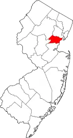
Location of Union County in New Jersey
This is intended to be a complete list of properties and districts listed on the National Register of Historic Places in Union County, New Jersey. The locations of National Register properties and districts (at least for all showing latitude and longitude coordinates below) may be seen in a Google map by clicking on "Map of all coordinates".[1]
- This National Park Service list is complete through NPS recent listings posted January 29, 2021.[2]
| [3] | Name on the Register[4] | Image | Date listed[5] | Location | City or town | Description |
|---|---|---|---|---|---|---|
| 1 | All Souls Church | 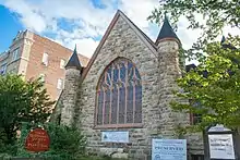 All Souls Church |
December 11, 2009 (#09001078) |
724 Park Ave. 40°36′51″N 74°24′58″W |
Plainfield | |
| 2 | Badgley House and Site | 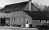 Badgley House and Site |
September 27, 1976 (#76001190) |
North of Mountainside off New Providence Rd., Watchung Reservation 40°40′59″N 74°22′37″W |
Mountainside | Destroyed by fire in 1984 |
| 3 | Baltusrol Golf Club | 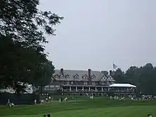 Baltusrol Golf Club |
May 6, 2005 (#05000374) |
201 Shunpike Road 40°42′18″N 74°19′41″W |
Springfield | The courses designed 1918–26 brought architect A. W. Tillinghast to prominence as a course designer; club has been host to many men's and women's majors since then. |
| 4 | Belcher-Ogden Mansion-Price, Benjamin-Price-Brittan Houses District | 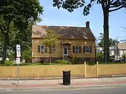 Belcher-Ogden Mansion-Price, Benjamin-Price-Brittan Houses District |
August 28, 1986 (#86001969) |
Corner of E. Jersey and Catherine Sts. 40°39′48″N 74°12′32″W |
Elizabeth | |
| 5 | Belcher-Ogden House | 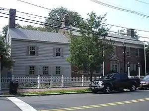 Belcher-Ogden House |
November 2, 1978 (#78001799) |
1046 E. Jersey St. 40°39′47″N 74°12′34″W |
Elizabeth | |
| 6 | Boxwood Hall | 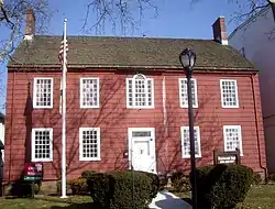 Boxwood Hall |
December 18, 1970 (#70000397) |
1073 E. Jersey St. 40°39′49″N 74°12′37″W |
Elizabeth | |
| 7 | Burial Ground of the Presbyterian Church in the West Fields of Elizabethtown | 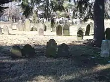 Burial Ground of the Presbyterian Church in the West Fields of Elizabethtown |
October 25, 2007 (#07001108) |
W. side of Mountain Ave. N. of Drift Way opposite 140 Mountain Ave. 40°39′12″N 74°20′57″W |
Westfield | |
| 8 | Caldwell Parsonage |  Caldwell Parsonage |
August 12, 1982 (#82004785) |
909 Caldwell Ave. 40°41′42″N 74°16′43″W |
Union | |
| 9 | Cedar Brook Park |  Cedar Brook Park |
August 28, 2007 (#07000878) |
Roughly bounded Stelle Ave., Arlington Ave., Park Ave., Rose St. and Laramie Rd., Kenyon Ave., Parkside Rd. 40°36′17″N 74°24′31″W |
Plainfield | |
| 10 | Central Railroad of New Jersey | 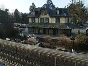 Central Railroad of New Jersey |
July 17, 1980 (#80002521) |
238 North Ave. 40°38′46″N 74°21′43″W |
Fanwood | |
| 11 | Crane-Phillips House |  Crane-Phillips House |
August 14, 1997 (#97000842) |
125 N. Union Ave. 40°39′27″N 74°17′26″W |
Cranford | |
| 12 | Crescent Area Historic District | 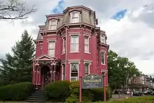 Crescent Area Historic District |
December 12, 1980 (#80002523) |
Roughly bounded by Park, Prospect, and Carnegie Aves., 7th and Richmond Sts. 40°36′59″N 74°24′49″W |
Plainfield | |
| 13 | John De Camp House | 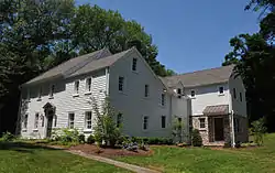 John De Camp House |
December 4, 1973 (#73001136) |
2101 Raritan Rd. 40°37′38″N 74°20′27″W |
Scotch Plains | |
| 14 | Nathaniel Drake House | 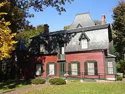 Nathaniel Drake House |
June 19, 1973 (#73001135) |
602 W. Front St. 40°36′49″N 74°25′56″W |
Plainfield | |
| 15 | Droeschers Mill | 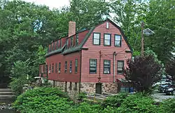 Droeschers Mill |
January 8, 1974 (#74001192) |
347 Lincoln Ave. E. 40°39′01″N 74°18′06″W |
Cranford | |
| 16 | Elizabeth Station | 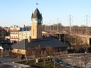 Elizabeth Station |
September 29, 1984 (#84002825) |
Morris Ave., and Broad St. 40°40′01″N 74°13′01″W |
Elizabeth | part of the Operating Passenger Railroad Stations Thematic Resource (TR) |
| 17 | Evergreen Cemetery | 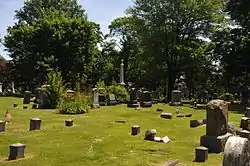 Evergreen Cemetery |
July 9, 1991 (#91000882) |
1137 N. Broad St. 40°41′32″N 74°12′39″W |
Hillside and Elizabeth | |
| 18 | Fanwood Park Historic District | 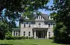 Fanwood Park Historic District |
May 27, 2004 (#04000516) |
North Ave. and North Martine Ave. 40°38′39″N 74°23′21″W |
Fanwood | |
| 19 | Feltville Historic District | 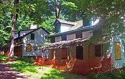 Feltville Historic District |
June 6, 1980 (#80002522) |
South of New Providence 40°40′53″N 74°23′16″W |
New Providence | |
| 20 | Firehouse No. 4 | 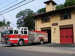 Firehouse No. 4 |
March 11, 1993 (#93000133) |
1015 South Ave. 40°37′42″N 74°24′14″W |
Plainfield | |
| 21 | Elizabeth and Gershom Frazee House | 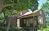 Elizabeth and Gershom Frazee House |
December 7, 2009 (#09000971) |
1451 Raritan Road 40°37′00″N 74°22′02″W |
Scotch Plains | |
| 22 | First Congregation of the Presbyterian Church at Springfield | 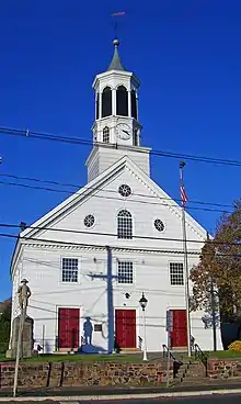 First Congregation of the Presbyterian Church at Springfield |
May 7, 1990 (#90000668) |
201 Morris Ave. and 11-41 Church Mall 40°42′41″N 74°18′39″W |
Springfield | |
| 23 | First Presbyterian Church of Elizabeth | 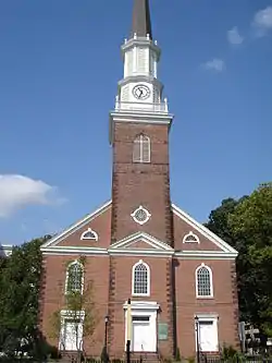 First Presbyterian Church of Elizabeth |
May 6, 1977 (#77000914) |
14-44 Broad St. 40°39′45″N 74°12′56″W |
Elizabeth | |
| 24 | First Presbyterian Congregation of Connecticut Farms | 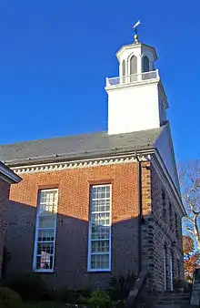 First Presbyterian Congregation of Connecticut Farms |
April 3, 1970 (#70000398) |
Stuyvesant Ave. at Chestnut St. 40°41′36″N 74°16′26″W |
Union | |
| 25 | Charles N. Fowler House | 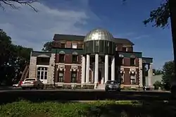 Charles N. Fowler House |
March 13, 1986 (#86000389) |
518 Salem Ave. 40°40′35″N 74°12′53″W |
Elizabeth | |
| 26 | Grace Episcopal Church | 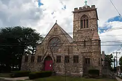 Grace Episcopal Church |
May 10, 2002 (#02000106) |
600 Cleveland Ave. 40°37′05″N 74°25′02″W |
Plainfield | |
| 27 | Green Brook Park | 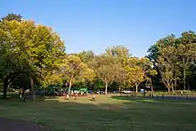 Green Brook Park |
May 14, 2004 (#04000437) |
All parkland from Clinton Ave. to west of West End Ave., and the junction of Lawrence and Parkview Ave., Fisk and Townsend Pls. 40°36′38″N 74°26′39″W |
Plainfield | |
| 28 | Deacon Andrew Hetfield House | 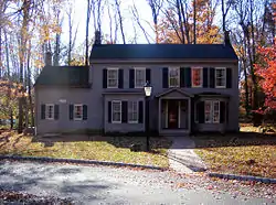 Deacon Andrew Hetfield House |
July 27, 1989 (#89001004) |
Constitution Plaza 40°40′19″N 74°21′29″W |
Mountainside | |
| 29 | Hillside Avenue Historic District | 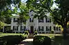 Hillside Avenue Historic District |
June 1, 1982 (#82003307) |
Hillside Ave. from Watchung Ave. to Martine Ave. 40°36′55″N 74°24′18″W |
Plainfield | |
| 30 | Homestead Farm at Oak Ridge | 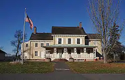 Homestead Farm at Oak Ridge |
October 25, 1995 (#95001185) |
Junction of Oak Ridge Rd. and Feather Bed Ln., Clark and Edison Townships 40°36′28″N 74°20′56″W |
Clark | |
| 31 | Hutchings Homestead | 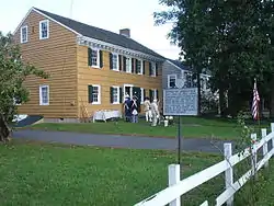 Hutchings Homestead |
September 16, 1977 (#77000915) |
126 Morris Ave. 40°42′37″N 74°18′26″W |
Springfield | |
| 32 | Littel-Lord Farmstead | 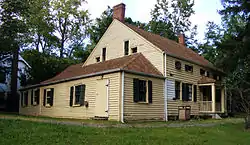 Littel-Lord Farmstead |
March 7, 1979 (#79001528) |
23 and 31 Horseshoe Rd. 40°40′05″N 74°25′41″W |
Berkeley Heights | |
| 33 | William Livingston House | 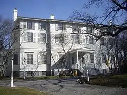 William Livingston House |
November 28, 1972 (#72000807) |
Morris and North Aves. 40°40′40″N 74°13′41″W |
Union | Liberty Hall, Kean University |
| 34 | Merchants' and Drovers' Tavern | 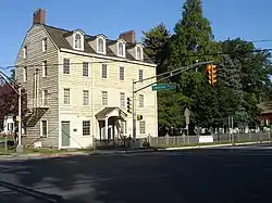 Merchants' and Drovers' Tavern |
November 21, 1978 (#78001801) |
1632 St. Georges Ave. 40°36′59″N 74°17′09″W |
Rahway | |
| 35 | Mid-Town Historic District | 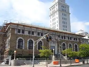 Mid-Town Historic District |
October 5, 1995 (#95001143) |
Bounded by Broad, N. Broad, Dickinson, E. Grand, E. Jersey Sts., Commerce Place, Elizabeth Ave. and Martin L. King Plaza 40°39′56″N 74°12′52″W |
Elizabeth | image shows Elizabeth Public Library and Union County Courthouse |
| 36 | Miller-Cory House |  Miller-Cory House |
November 3, 1972 (#72000808) |
614 Mountain Ave. 40°39′45″N 74°21′02″W |
Westfield | |
| 37 | Murray Hill Station |  Murray Hill Station |
June 22, 1984 (#84002826) |
The Circle 40°41′41″N 74°24′13″W |
Murray Hill | part of the Operating Passenger Railroad Stations TR |
| 38 | Netherwood Station |  Netherwood Station |
June 22, 1984 (#84002830) |
Between North and South Aves. 40°37′45″N 74°24′13″W |
Plainfield | part of the Operating Passenger Railroad Stations TR |
| 39 | Oswald J. Nitschke House |  Oswald J. Nitschke House |
January 17, 2008 (#07001406) |
49 S. 21 St. 40°40′36″N 74°17′28″W |
Kenilworth | |
| 40 | North Avenue Commercial Historic District | 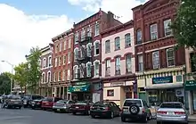 North Avenue Commercial Historic District |
March 29, 1984 (#84002836) |
Park, North, and Watchung Aves. 40°37′07″N 74°25′17″W |
Plainfield | |
| 41 | Old Baptist Parsonage | 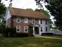 Old Baptist Parsonage |
January 18, 1973 (#73001137) |
547 Park Ave. 40°39′06″N 74°23′59″W |
Scotch Plains | |
| 42 | Plainfield Central Fire Headquarters | 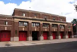 Plainfield Central Fire Headquarters |
March 4, 1993 (#93000131) |
315 Central Ave. 40°36′54″N 74°25′26″W |
Plainfield | |
| 43 | Plainfield Civic District | 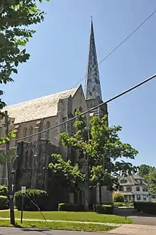 Plainfield Civic District |
June 17, 1993 (#93000533) |
Roughly, Watchung Ave. between E. Fifth and E. Seventh Sts. 40°37′03″N 74°25′03″W |
Plainfield | |
| 44 | Plainfield Station | 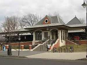 Plainfield Station |
June 22, 1984 (#84002837) |
North Ave. 40°37′06″N 74°25′15″W |
Plainfield | part of the Operating Passenger Railroad Stations TR |
| 45 | Rahway Theatre | 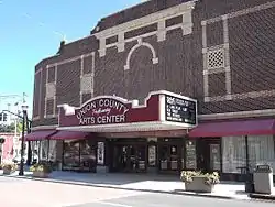 Rahway Theatre |
August 13, 1986 (#86001509) |
1601 Irving St. 40°36′37″N 74°16′39″W |
Rahway | |
| 46 | William Edgar Reeve House | 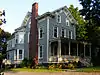 William Edgar Reeve House |
February 1, 2006 (#05001565) |
314 Mountain Ave. 40°39′34″N 74°20′58″W |
Westfield | |
| 47 | Saint Mary's Catholic Church Complex | 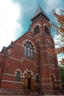 Saint Mary's Catholic Church Complex |
April 11, 1985 (#85000785) |
Liberty and W. 6th Sts. 40°36′39″N 74°25′26″W |
Plainfield | |
| 48 | Sayre Homestead | 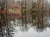 Sayre Homestead |
August 24, 1979 (#79001529) |
Sayre Homestead Lane 40°42′13″N 74°20′50″W |
Springfield | |
| 49 | Scotch Plains Baptist Church, Parsonage, and Cemetery | 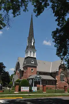 Scotch Plains Baptist Church, Parsonage, and Cemetery |
June 14, 2013 (#13000386) |
333-334 Park Ave., 40°39′09″N 74°23′59″W |
Scotch Plains, New Jersey | |
| 50 | Scotch Plains School | 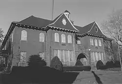 Scotch Plains School |
December 12, 1978 (#78001802) |
Park Ave. 40°38′58″N 74°23′47″W |
Scotch Plains | Apparently demolished. |
| 51 | Seventeenth Century Clark House |  Seventeenth Century Clark House |
November 19, 1974 (#74001193) |
593 Madison Hill Rd. 40°36′49″N 74°18′36″W |
Clark | |
| 52 | Nathaniel Smith House | 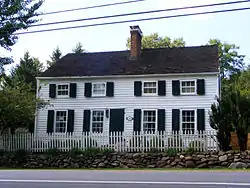 Nathaniel Smith House |
September 28, 1989 (#89001584) |
105 Springfield Ave. 40°41′33″N 74°25′47″W |
Berkeley Heights | |
| 53 | St. John's Parsonage |  St. John's Parsonage |
September 16, 1982 (#82003306) |
633 Pearl St. 40°39′37″N 74°12′45″W |
Elizabeth | |
| 54 | Stage House Inn |  Stage House Inn |
April 15, 1982 (#82003308) |
Park Ave. and Front St. 40°39′03″N 74°23′59″W |
Scotch Plains | |
| 55 | Stoneleigh Park Historic District |  Stoneleigh Park Historic District |
October 28, 1988 (#88002020) |
Roughly bounded by Westfield Ave., Shackamaxon Dr., Rahway and Dorian Rd. 40°38′34″N 74°20′49″W |
Westfield | |
| 56 | George A. Strong House |  George A. Strong House |
August 28, 2012 (#12000570) |
1030 Central Ave. 40°36′18″N 74°25′01″W |
Plainfield | now the duCret School of Art |
| 57 | Summit Downtown Historic District | 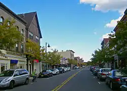 Summit Downtown Historic District |
June 30, 2011 (#10001116) |
Roughly bounded by Springfield Ave, the Village Green, Summit Ave, and Waldron Ave. 40°43′04″N 74°21′27″W |
Summit | Civic and commercial core of early railroad suburb |
| 58 | Summit Playhouse | 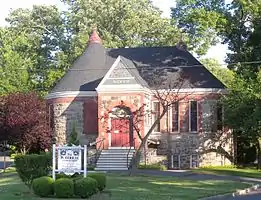 Summit Playhouse |
December 30, 2009 (#09001177) |
10 New England Ave. 40°42′54″N 74°21′55″W |
Summit | |
| 59 | The Clearing |  The Clearing |
April 9, 1993 (#93000233) |
165 Hobart Ave. 40°43′36″N 74°20′53″W |
Summit | Now known as Reeves-Reed Arboretum |
| 60 | James Townley House | 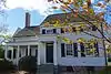 James Townley House |
May 14, 1979 (#79001530) |
Morris Ave. and Green Lane 40°40′54″N 74°14′07″W |
Union | On the campus of Kean University |
| 61 | Twin Maples | 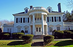 Twin Maples |
August 29, 1997 (#97000977) |
8 Edgewood Rd. 40°43′02″N 74°21′00″W |
Summit | |
| 62 | Union County Park Commission Administration Buildings | 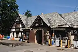 Union County Park Commission Administration Buildings |
November 25, 1985 (#85002976) |
Acme and Canton Sts. 40°39′31″N 74°14′17″W |
Elizabeth | |
| 63 | Van Wyck Brooks Historic District | 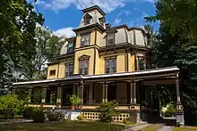 Van Wyck Brooks Historic District |
December 10, 1985 (#85003337) |
Roughly bounded by Plainfield Ave., W. Eighth St., Park Ave., W. Ninth St. and Madison Ave., and Randolph Rd. 40°36′35″N 74°25′06″W |
Plainfield | |
| 64 | Wallace Chapel AME Zion Church | 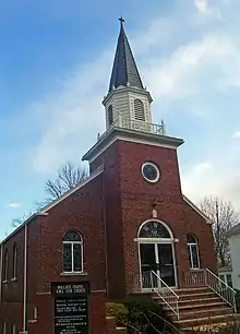 Wallace Chapel AME Zion Church |
August 28, 2007 (#07000877) |
138-142 Broad St. 40°42′49″N 74°20′38″W |
Summit | |
| 65 | Waring T. Orville House | %253B_Plainfield%252C_NJ.jpg.webp) Waring T. Orville House |
May 14, 1979 (#79003252) |
900 Park Ave. 40°36′46″N 74°24′53″W |
Plainfield | |
| 66 | Westfield Fire Headquarters | 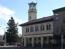 Westfield Fire Headquarters |
December 8, 1980 (#80002524) |
405 North Ave., W. 40°39′00″N 74°20′56″W |
Westfield | |
| 67 | Whyman House |  Whyman House |
April 10, 1986 (#86000705) |
705 Newark Ave. 40°40′49″N 74°12′29″W |
Elizabeth | |
| 68 | Woodruff House |  Woodruff House |
December 11, 1978 (#78001800) |
111-113 Conant St. 40°41′14″N 74°13′12″W |
Hillside | |
| 69 | Young Women's Christian Association of Plainfield and North Plainfield |  Young Women's Christian Association of Plainfield and North Plainfield |
March 12, 1998 (#98000232) |
232 W. Front St. 40°37′15″N 74°25′16″W |
Plainfield |
References
| Wikimedia Commons has media related to National Register of Historic Places in Union County, New Jersey. |
- The latitude and longitude information provided in this table was derived originally from the National Register Information System, which has been found to be fairly accurate for about 99% of listings. Some locations in this table may have been corrected to current GPS standards.
- "National Register of Historic Places: Weekly List Actions". National Park Service, United States Department of the Interior. Retrieved on January 29, 2021.
- Numbers represent an alphabetical ordering by significant words. Various colorings, defined here, differentiate National Historic Landmarks and historic districts from other NRHP buildings, structures, sites or objects.
- "National Register Information System". National Register of Historic Places. National Park Service. April 24, 2008.
- The eight-digit number below each date is the number assigned to each location in the National Register Information System database, which can be viewed by clicking the number.
| Topics | 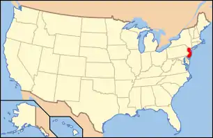 | ||
|---|---|---|---|
| Lists by county | |||
| Lists by city |
| ||
| Other lists | |||
| |||
Municipalities and communities of Union County, New Jersey, United States | ||
|---|---|---|
| Cities | Map of New Jersey highlighting Union County | |
| Boroughs | ||
| Town | ||
| Townships | ||
| Unincorporated communities | ||
| ||
This article is issued from Wikipedia. The text is licensed under Creative Commons - Attribution - Sharealike. Additional terms may apply for the media files.