National Register of Historic Places listings in Cape May County, New Jersey
List of the National Register of Historic Places listings in Cape May County, New Jersey.
| Atlantic - Bergen - Burlington - Camden - Cape May - Cumberland - Essex - Gloucester - Hudson - Hunterdon - Mercer - Middlesex - Monmouth - Morris - Ocean - Passaic - Salem - Somerset - Sussex - Union - Warren |
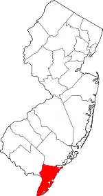
Location of Cape May County in New Jersey
This is intended to be a complete list of properties and districts listed on the National Register of Historic Places in Cape May County, New Jersey. The locations of National Register properties and districts (at least for all showing latitude and longitude coordinates below) may be seen in a Google map by clicking on "Map of all coordinates".[1]
- This National Park Service list is complete through NPS recent listings posted January 29, 2021.[2]
| [3] | Name on the Register[4] | Image | Date listed[5] | Location | City or town | Description |
|---|---|---|---|---|---|---|
| 1 | Avalon Life Saving Station | 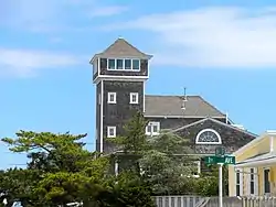 Avalon Life Saving Station |
March 2, 1979 (#79001480) |
76 W. 15th St. 39°06′14″N 74°42′46″W |
Avalon | Built 1894 |
| 2 | J. Thompson Baker House | 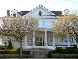 J. Thompson Baker House |
May 31, 1996 (#96000551) |
3008 Atlantic Ave. 38°59′N 74°49′W |
Wildwood | Built 1909 |
| 3 | Battery 223 | 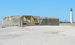 Battery 223 |
June 25, 2008 (#08000555) |
Beach at Cape May State Park 38°55′53″N 74°57′20″W |
Lower Township | Built 1943 |
| 4 | Thomas Beesley Jr. House | 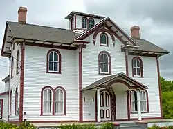 Thomas Beesley Jr. House |
February 12, 1998 (#98000098) |
605 NJ 9 N 39°05′55″N 74°48′50″W |
Middle Township | |
| 5 | Thomas Beesley Sr. House | 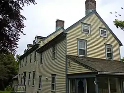 Thomas Beesley Sr. House |
December 17, 1992 (#92001682) |
12 Beesley's Pl. Beesley's Point 39°16′47″N 74°37′46″W |
Upper Township | Built 1816 |
| 6 | Brandywine Shoal Light Station | 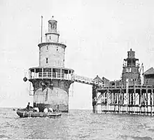 Brandywine Shoal Light Station |
January 8, 2007 (#06000943) |
In lower Delaware Bay, about 8.8 mi. WNW of Cape May Point 38°59′10″N 75°06′47″W |
Cape May Point | Built 1828 (1st light) Built 1850 (2nd light) Built 1914 (3rd light) |
| 7 | Calvary Baptist Church | 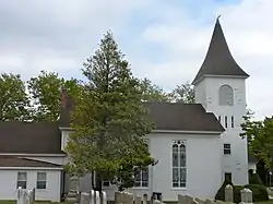 Calvary Baptist Church |
November 25, 1980 (#80002477) |
SW of Ocean View at Seaville Rd. and NJ 9 39°10′14″N 74°44′26″W |
Dennis Township | Built 1855 |
| 8 | Cape May Historic District | 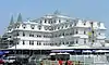 Cape May Historic District |
December 29, 1970 (#70000383) |
Cape May 38°56′24″N 74°54′46″W |
Cape May | Built 1850 600 buildings |
| 9 | Cape May Lighthouse | 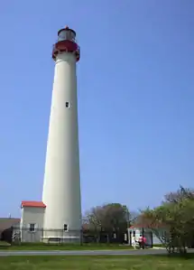 Cape May Lighthouse |
November 12, 1973 (#73001090) |
Cape May Point State Park Lighthouse Ave. 38°55′58″N 74°57′39″W |
Lower Township | Built 1859 |
| 10 | Caribbean Motel | 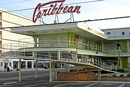 Caribbean Motel |
August 24, 2005 (#05000915) |
5600 Ocean Ave. 38°58′45″N 74°49′32″W |
Wildwood Crest | Built 1958 |
| 11 | Chateau Bleu Motel | 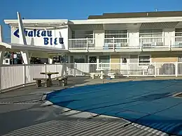 Chateau Bleu Motel |
March 25, 2004 (#04000221) |
911 Surf Ave. 39°00′05″N 74°47′42″W |
North Wildwood | Built 1962 |
| 12 | Owen Coachman House | 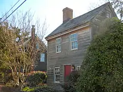 Owen Coachman House |
September 9, 2005 (#05000964) |
1019 Batts Ln. 38°57′44″N 74°55′46″W |
Lower Township | Built 1846 |
| 13 | Cold Spring Grange Hall | 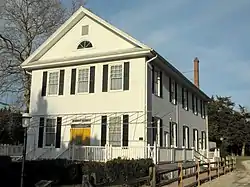 Cold Spring Grange Hall |
March 30, 1998 (#98000234) |
720 Seahore Rd. 38°58′39″N 74°54′48″W |
Lower Township | Built 1912 |
| 14 | Cold Spring Presbyterian Church | 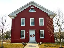 Cold Spring Presbyterian Church |
June 14, 1991 (#91000785) |
780 Seashore Rd. 38°58′35″N 74°54′59″W |
Lower Township | Built 1823 |
| 15 | John Corson, Jr. House Site | 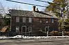 John Corson, Jr. House Site |
February 12, 2015 (#06000686) |
1542 S. Shore Rd. 39°13′46″N 74°41′09″W |
Upper Township | |
| 16 | Dennisville Historic District | 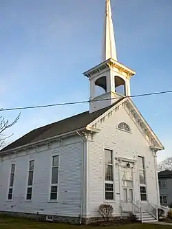 Dennisville Historic District |
November 24, 1987 (#87000848) |
Petersburg Rd., Main St., Church Rd., Hall Ave., Fidler and Academy Rds., and NH 47; also roughly bounded by Gatzmer Ave., RR. tracks, NJ 47, and N. side of Petersburg Rd. and NJ 47 Dennisville 39°11′34″N 74°49′16″W |
Dennis Township | |
| 17 | Joseph Falkinburg House | 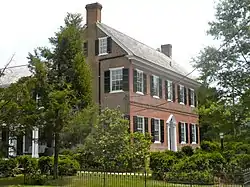 Joseph Falkinburg House |
October 3, 1994 (#94001153) |
922 Delsea Dr. South Dennis 39°10′22″N 74°49′15″W |
Dennis Township | |
| 18 | Fire Control Tower No. 23 | 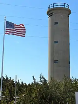 Fire Control Tower No. 23 |
November 17, 2003 (#03000655) |
Sunset Boulevard 38°56′36″N 74°58′03″W |
Lower Township | |
| 19 | Fishing Creek Schoolhouse | 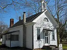 Fishing Creek Schoolhouse |
March 6, 1980 (#80002478) |
2102 Bayshore Rd. 39°00′51″N 74°56′20″W |
Villas | |
| 20 | The Flanders Hotel | 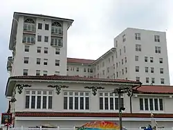 The Flanders Hotel |
November 20, 2009 (#09000939) |
719 E. 11th St. 39°16′29″N 74°34′36″W |
Ocean City | |
| 21 | Judge Nathaniel Foster House | 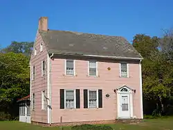 Judge Nathaniel Foster House |
August 25, 2014 (#14000516) |
1649 Bayshore Dr. 39°01′13″N 74°56′07″W |
Lower Township | |
| 22 | John Wesley Gandy House | 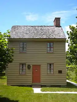 John Wesley Gandy House |
November 12, 1999 (#99001309) |
26 Tyler Rd. Greenfield 39°14′02″N 74°42′24″W |
Upper Township | |
| 23 | Goshen School | 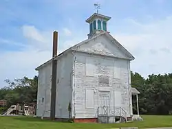 Goshen School |
May 12, 2014 (#14000202) |
314 N. Delsea Dr. (Middle Township) 39°08′14″N 74°51′15″W |
Goshen | |
| 24 | Hangar No. 1-United States Naval Air Station Wildwood | 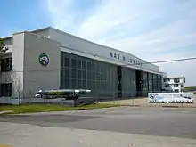 Hangar No. 1-United States Naval Air Station Wildwood |
August 21, 1997 (#97000935) |
Jct. of Forrestal and Langley Rds. Cape May Airport 39°00′18″N 74°54′37″W |
Lower Township | |
| 25 | Hereford Lighthouse | 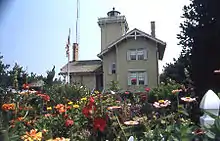 Hereford Lighthouse |
September 20, 1977 (#77000859) |
Central Ave. 39°00′24″N 74°47′32″W |
North Wildwood | Built 1874 |
| 26 | George Hildreth House | 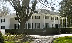 George Hildreth House |
July 28, 1999 (#99000905) |
731 Seashore Rd. 38°58′42″N 74°54′44″W |
Lower Township | |
| 27 | John Holmes House | 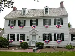 John Holmes House |
June 12, 1979 (#79001481) |
U.S. 9 39°05′46″N 74°48′48″W |
Cape May Court House | |
| 28 | Thomas Leaming House | 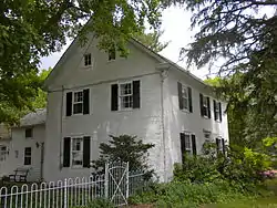 Thomas Leaming House |
August 1, 1997 (#97000801) |
1845 US 9 N 39°08′30″N 74°46′01″W |
Middle Township | |
| 29 | Henry Ludlam House | 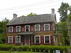 Henry Ludlam House |
August 12, 1993 (#93000826) |
1336 NJ 47 Dennisville 39°11′43″N 74°50′31″W |
Dennis Township | |
| 30 | Thomas Ludlam Jr. House | 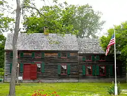 Thomas Ludlam Jr. House |
November 26, 2004 (#04001261) |
707 NJ47 39°10′09″N 74°49′31″W |
Dennis Township | |
| 31 | Marine National Bank | 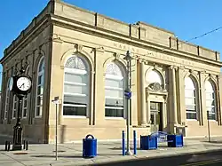 Marine National Bank |
December 20, 2000 (#00001494) |
3301 Pacific Ave. 38°59′24″N 74°48′47″W |
Wildwood | |
| 32 | Marshallville Historic District | 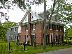 Marshallville Historic District |
November 28, 1989 (#89002013) |
Roughly Marshallville Rd. at Co. Rt. 557 39°17′54″N 74°46′42″W |
Upper Township | |
| 33 | Naval Air Station Wildwood Historic District | 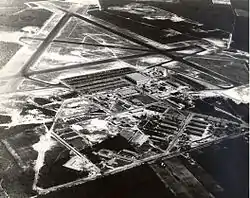 Naval Air Station Wildwood Historic District |
July 28, 2015 (#13000945) |
Roughly bounded by Forrestal & Monterre Rds., runways & taxiways to N. & E. 39°00′24″N 74°54′23″W |
Wildwood vicinity | Former site of Naval Air Station Wildwood, now Cape May Airport |
| 34 | New Asbury Methodist Episcopal Meeting House | 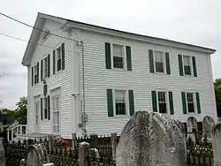 New Asbury Methodist Episcopal Meeting House |
September 17, 1980 (#80002476) |
Shore Rd. 39°08′25″N 74°46′10″W |
Cape May Court House | |
| 35 | Ocean City 34th Street Station | 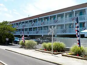 Ocean City 34th Street Station |
June 22, 1984 (#84002613) |
34th St. 39°15′06″N 74°36′49″W |
Ocean City | Demolished.[6] |
| 36 | Ocean City City Hall | 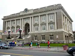 Ocean City City Hall |
June 13, 1997 (#97000565) |
Jct. of 9th St. and Asbury Ave. 39°16′43″N 74°34′34″W |
Ocean City | |
| 37 | Ocean City Life-Saving Station | 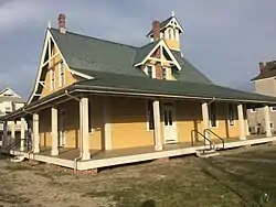 Ocean City Life-Saving Station |
June 14, 2013 (#13000385) |
801 4th St. 39°16′55″N 74°33′56″W |
Ocean City | Built in 1886. |
| 38 | Ocean City Residential Historic District | 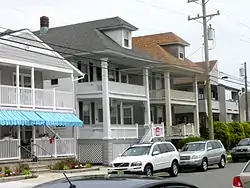 Ocean City Residential Historic District |
March 20, 2003 (#03000129) |
Roughly bounded by 3rd and 8th Sts. and Central and Ocean Aves., 39°16′52″N 74°34′14″W |
Ocean City | |
| 39 | Ocean City Tenth Street Station |  Ocean City Tenth Street Station |
June 22, 1984 (#84002610) |
10th Street and Haven Avenue 39°16′44″N 74°34′43″W |
Ocean City | |
| 40 | Octagonal Poultry House |  Octagonal Poultry House |
March 14, 2008 (#08000177) |
720 US 9 (Lower Township) 38°58′46″N 74°54′45″W |
Cold Spring | |
| 41 | Old Cape May County Courthouse Building | 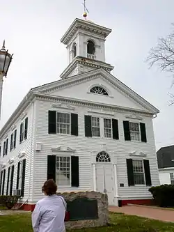 Old Cape May County Courthouse Building |
December 22, 1981 (#81000389) |
N. Main St. 39°05′02″N 74°49′26″W |
Cape May Court House | |
| 42 | Jonathan Pyne House | 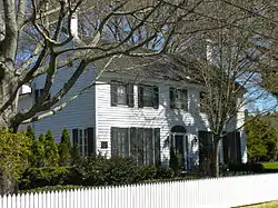 Jonathan Pyne House |
February 14, 1997 (#97000061) |
609 Sea Grove Ave. 38°56′18″N 74°57′35″W |
Lower Township | |
| 43 | Reeves–Iszard–Godfey House | 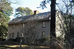 Reeves–Iszard–Godfey House |
March 9, 2005 (#05000127) |
3097 Shore Rd. 39°11′49″N 74°42′42″W |
Upper Township | |
| 44 | Rio Grande Station | 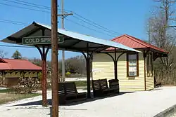 Rio Grande Station |
February 13, 2007 (#07000047) |
720 NJ 9 38°58′31″N 74°54′41″W |
Lower Township | |
| 45 | Rufwud Cottage | 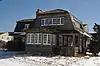 Rufwud Cottage |
December 2, 2014 (#14000979) |
394 93rd St. 39°03′28″N 74°45′40″W |
Stone Harbor Borough | |
| 46 | Saint Peter's-By-The-Sea Episcopal Church | 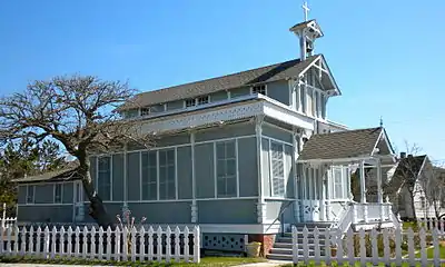 Saint Peter's-By-The-Sea Episcopal Church |
August 3, 1995 (#95000978) |
Jct. of Ocean Ave. and Lake Dr. 38°56′03″N 74°58′00″W |
Cape May Point | |
| 47 | South Tuckahoe Historic District | 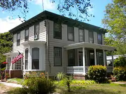 South Tuckahoe Historic District |
March 7, 1997 (#97000103) |
Roughly, along NJ 557 and NJ 50 from the Tuckahoe River to Kendall Ln., Upper Township 39°17′20″N 74°45′10″W |
Tuckahoe | |
| 48 | TBM-3E "Avenger" Torpedo Bomber Warplane | 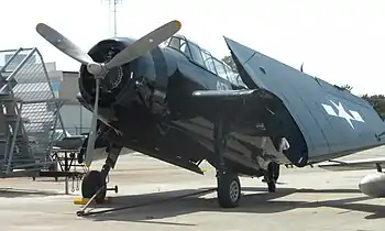 TBM-3E "Avenger" Torpedo Bomber Warplane |
February 11, 2003 (#03000019) |
500 Forrestal Rd. Cape May Airport 39°00′17″N 74°54′36″W |
Lower Township | |
| 49 | William S. Townsend House | 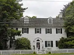 William S. Townsend House |
April 5, 1984 (#84002618) |
96 Delsea Dr. Dennisville 39°11′35″N 74°49′56″W |
Dennis Township | |
| 50 | Tuckahoe Station | 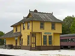 Tuckahoe Station |
June 22, 1984 (#84002626) |
Railroad Ave. and Mill Rd. 39°17′28″N 74°45′39″W |
Tuckahoe | |
| 51 | U.S. Life-Saving Station No. 35 | 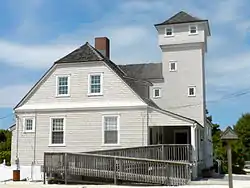 U.S. Life-Saving Station No. 35 |
November 8, 2008 (#08000970) |
11617 2nd Ave. 39°02′22″N 74°46′08″W |
Stone Harbor | |
| 52 | Whilldin–Miller House | 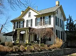 Whilldin–Miller House |
February 12, 2003 (#03000012) |
416 S. Broadway 38°56′04″N 74°55′53″W |
West Cape May | |
| 53 | Woodbine Brotherhood Synagogue | 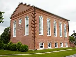 Woodbine Brotherhood Synagogue |
September 17, 1980 (#80002479) |
612 Washington Ave. 39°14′21″N 74°49′08″W |
Woodbine |
References
- The latitude and longitude information provided in this table was derived originally from the National Register Information System, which has been found to be fairly accurate for about 99% of listings. Some locations in this table may have been corrected to current GPS standards.
- "National Register of Historic Places: Weekly List Actions". National Park Service, United States Department of the Interior. Retrieved on January 29, 2021.
- Numbers represent an alphabetical ordering by significant words. Various colorings, defined here, differentiate National Historic Landmarks and historic districts from other NRHP buildings, structures, sites or objects.
- "National Register Information System". National Register of Historic Places. National Park Service. April 24, 2008.
- The eight-digit number below each date is the number assigned to each location in the National Register Information System database, which can be viewed by clicking the number.
- New Jersey and National Registers of Historic Places, Cape May County Archived 2011-06-28 at the Wayback Machine p. 6
| Topics |  | ||
|---|---|---|---|
| Lists by county | |||
| Lists by city |
| ||
| Other lists | |||
| |||
Municipalities and communities of Cape May County, New Jersey, United States | ||
|---|---|---|
| Cities | Map of New Jersey highlighting Cape May County | |
| Boroughs | ||
| Townships | ||
| CDPs | ||
| Other unincorporated communities | ||
| ||
| Wikimedia Commons has media related to National Register of Historic Places in Cape May County, New Jersey. |
This article is issued from Wikipedia. The text is licensed under Creative Commons - Attribution - Sharealike. Additional terms may apply for the media files.