National Register of Historic Places listings in Ridgewood, New Jersey
The table below includes 14 sites listed on the National Register of Historic Places in the village of Ridgewood in Bergen County, New Jersey. Latitude and longitude coordinates of the sites listed on this page may be displayed in a map or exported in several formats by clicking on one of the links in the box below the map to the right.[1]

Map of Bergen County, New Jersey, highlighting Ridgewood
| Atlantic - Bergen - Burlington - Camden - Cape May - Cumberland - Essex - Gloucester - Hudson - Hunterdon - Mercer - Middlesex - Monmouth - Morris - Ocean - Passaic - Salem - Somerset - Sussex - Union - Warren |
National Register listings elsewhere in Bergen County may be found in separate articles.
- This National Park Service list is complete through NPS recent listings posted January 29, 2021.[2]
Current listings
| [3] | Name on the Register[4] | Image | Date listed[5] | Location | Description |
|---|---|---|---|---|---|
| 1 | Ackerman House | 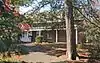 Ackerman House |
January 10, 1983 (#83001450) |
222 Doremus Ave. 40°58′23″N 74°07′37″W |
|
| 2 | Ackerman House | 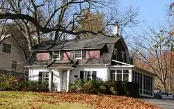 Ackerman House |
January 10, 1983 (#83001451) |
252 Lincoln Ave. 40°58′29″N 74°08′05″W |
|
| 3 | David Ackerman House | 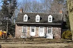 David Ackerman House |
January 10, 1983 (#83001448) |
415 E. Saddle River 40°59′06″N 74°05′20″W |
|
| 4 | Ackerman-Van Emburgh House | 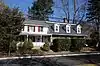 Ackerman-Van Emburgh House |
January 10, 1983 (#83001456) |
789 E. Glen Ave. 40°59′03″N 74°05′19″W |
|
| 5 | Archibald-Vroom House | 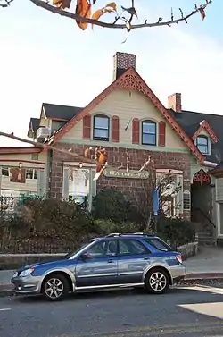 Archibald-Vroom House |
July 24, 1984 (#84002596) |
160 E. Ridgewood Ave. 40°58′43″N 74°06′58″W |
|
| 6 | Beech Street School | 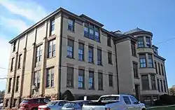 Beech Street School |
March 12, 1998 (#98000233) |
49 Cottage Place 40°58′47″N 74°06′53″W |
|
| 7 | Paramus Reformed Church Historic District | 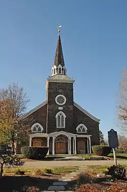 Paramus Reformed Church Historic District |
February 25, 1975 (#75001121) |
Bounded by Franklin Tpke., NJ 17, Saddle River, S side of cemetery, and Glen Ave. 40°59′09″N 74°05′39″W |
|
| 8 | Rathbone-Zabriskie House | 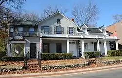 Rathbone-Zabriskie House |
January 10, 1983 (#83001545) |
570 N. Maple Ave. 40°59′43″N 74°06′41″W |
|
| 9 | Ridgewood Station |  Ridgewood Station |
June 22, 1984 (#84002582) |
Garber Sq. 40°58′51″N 74°07′16″W |
|
| 10 | James Rose House | 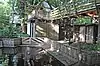 James Rose House |
July 11, 2019 (#97000936) |
506 E. Ridgewood Ave. 40°58′38″N 74°06′31″W |
|
| 11 | Van Dien House | 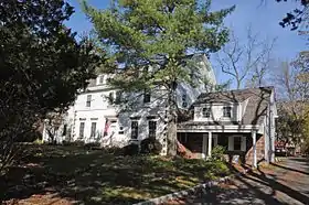 Van Dien House |
January 10, 1983 (#83001567) |
627 Grove St. 40°57′59″N 74°06′03″W |
|
| 12 | Vanderbeck House | 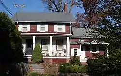 Vanderbeck House |
January 10, 1983 (#83001564) |
249 Prospect St. 40°58′25″N 74°07′01″W |
|
| 13 | Westervelt-Cameron House | 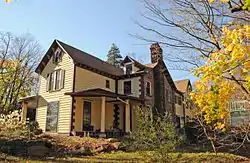 Westervelt-Cameron House |
January 10, 1983 (#83001581) |
26 E. Glen Ave. 40°59′21″N 74°06′54″W |
|
| 14 | John A. L. Zabriskie House | 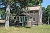 John A. L. Zabriskie House |
November 22, 2019 (#100004648) |
460 W. Saddle River Rd. 40°59′19″N 74°05′34″W |
References
| Wikimedia Commons has media related to National Register of Historic Places in Bergen County, New Jersey. |
- The latitude and longitude information provided in this table was derived originally from the National Register Information System, which has been found to be fairly accurate for about 99% of listings. Some locations in this table may have been corrected to current GPS standards.
- "National Register of Historic Places: Weekly List Actions". National Park Service, United States Department of the Interior. Retrieved on January 29, 2021.
- Numbers represent an alphabetical ordering by significant words. Various colorings, defined here, differentiate National Historic Landmarks and historic districts from other NRHP buildings, structures, sites or objects.
- "National Register Information System". National Register of Historic Places. National Park Service. July 9, 2010.
- The eight-digit number below each date is the number assigned to each location in the National Register Information System database, which can be viewed by clicking the number.
| Topics | 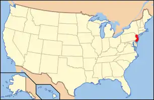 | ||
|---|---|---|---|
| Lists by county | |||
| Lists by city |
| ||
| Other lists | |||
| |||
Municipalities and communities of Bergen County, New Jersey, United States | ||
|---|---|---|
| Cities | 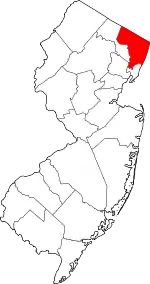 Map of New Jersey highlighting Bergen County | |
| Boroughs |
| |
| Townships | ||
| Villages | ||
| Unincorporated communities | ||
| ||
This article is issued from Wikipedia. The text is licensed under Creative Commons - Attribution - Sharealike. Additional terms may apply for the media files.