National Register of Historic Places listings in Bergen County, New Jersey
The table below includes sites listed on the National Register of Historic Places in Bergen County, New Jersey except those in Closter, Franklin Lakes, Ridgewood, Saddle River and Wyckoff, which are listed separately (links to these other lists are provided below). Latitude and longitude coordinates of the sites listed on this page may be displayed in a map or exported in several formats by clicking on one of the links in the box below the map of New Jersey to the right.[1]
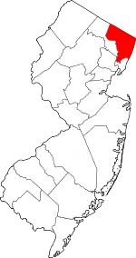
Location of Bergen County in New Jersey
There are 266 properties and districts in the county that are listed on the National Register, including 4 National Historic Landmarks. One site once listed on the Register has been removed.
| Atlantic – Bergen – Burlington – Camden – Cape May – Cumberland – Essex – Gloucester – Hudson – Hunterdon – Mercer – Middlesex – Monmouth – Morris – Ocean – Passaic – Salem – Somerset – Sussex – Union – Warren |
- This National Park Service list is complete through NPS recent listings posted January 29, 2021.[2]
Current listings
Communities listed separately
Other communities in Bergen County
| [3] | Name on the Register[4] | Image | Date listed[5] | Location | City or town | Description |
|---|---|---|---|---|---|---|
| 1 | Ackerman-Demarest House |  Ackerman-Demarest House |
January 10, 1983 (#83001454) |
745 E. Saddle River Rd. 40°59′41″N 74°05′27″W |
Ho-Ho-Kus | |
| 2 | Ackerman-Hopper House |  Ackerman-Hopper House |
January 9, 1983 (#83001455) |
652 Ackerman Ave. 40°57′37″N 74°06′59″W |
Glen Rock | |
| 3 | Ackerman-Zabriskie-Steuben House |  Ackerman-Zabriskie-Steuben House |
January 10, 1983 (#83001457) |
1209 Main St. 40°54′46″N 74°01′55″W |
River Edge | |
| 4 | John G. Ackerson House | 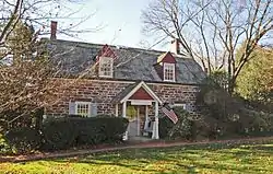 John G. Ackerson House |
January 10, 1983 (#83001458) |
142 Pascack Rd. 41°02′14″N 74°02′27″W |
Park Ridge | |
| 5 | Alcoa Edgewater Works | 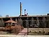 Alcoa Edgewater Works |
August 10, 1978 (#78001735) |
700 River Rd. 40°49′12″N 73°58′46″W |
Edgewater | Demolished.[6] |
| 6 | Anderson Outkitchen | 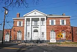 Anderson Outkitchen |
August 8, 1985 (#85002591) |
18 E. Camden St. 40°53′15″N 74°02′25″W |
Hackensack | |
| 7 | Fridolin Arnault House | 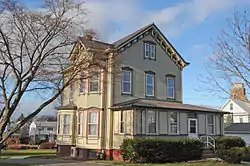 Fridolin Arnault House |
December 23, 2009 (#09001153) |
111 First St. 40°50′44″N 74°05′13″W |
Wood-Ridge | |
| 8 | David Baldwin House | 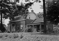 David Baldwin House |
January 10, 1983 (#83001459) |
60 Lake Ave. 40°58′56″N 74°08′16″W |
Midland Park | |
| 9 | Derick Banta House | 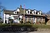 Derick Banta House |
January 9, 1983 (#83001461) |
180 Washington Ave. 40°56′30″N 73°59′39″W |
Dumont | |
| 10 | John Banta House | 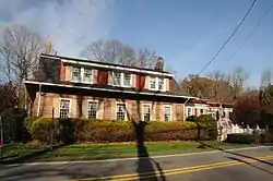 John Banta House |
January 9, 1983 (#83001462) |
211 Pascack Rd. 41°00′29″N 74°03′23″W |
Hillsdale | |
| 11 | Banta-Coe House | 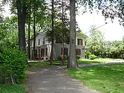 Banta-Coe House |
January 10, 1983 (#83001460) |
884 Lone Pine Lane 40°53′40″N 74°01′57″W |
Teaneck | |
| 12 | John Bartholf House |  John Bartholf House |
January 9, 1983 (#83001463) |
1122 Ramapo Valley Rd. 41°03′22″N 74°12′52″W |
Mahwah | |
| 13 | Beauclaire-Vreeland House |  Beauclaire-Vreeland House |
January 9, 1983 (#83001464) |
88 E. Clinton Ave. 40°55′25″N 73°59′37″W |
Bergenfield | |
| 14 | John G. Benson House |  John G. Benson House |
January 9, 1983 (#83001465) |
60 Grand Ave. 40°53′27″N 73°58′30″W |
Englewood | |
| 15 | G. V. H. Berdan House |  G. V. H. Berdan House |
January 9, 1983 (#83001466) |
1219 River Rd. 40°55′53″N 74°07′56″W |
Fair Lawn | |
| 16 | Richard J. Berdan House |  Richard J. Berdan House |
January 9, 1983 (#83001467) |
24-07 Fair Lawn Ave. 40°56′23″N 74°07′11″W |
Fair Lawn | |
| 17 | Bergen County Court House Complex | 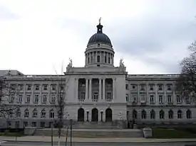 Bergen County Court House Complex |
January 11, 1983 (#83001468) |
Court, Main and Essex Sts. 40°52′41″N 74°02′38″W |
Hackensack | |
| 18 | BINGHAMTON (ferryboat) | 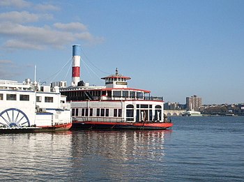 BINGHAMTON (ferryboat) |
July 9, 1982 (#82003262) |
725 River Rd. 40°49′10″N 73°58′33″W |
Edgewater | |
| 19 | Blackledge-Gair House | 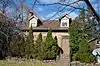 Blackledge-Gair House |
January 9, 1983 (#83001469) |
111 Madison Ave. 40°56′31″N 73°58′04″W |
Cresskill | |
| 20 | Blackledge-Kearney | 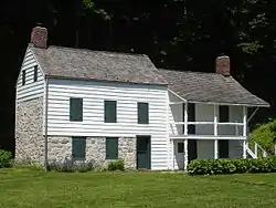 Blackledge-Kearney |
July 24, 1984 (#84002537) |
Alpine Landing 40°56′49″N 73°55′29″W |
Alpine | |
| 21 | Capt. Thomas Blanch House |  Capt. Thomas Blanch House |
January 10, 1983 (#83001470) |
130 Tappan Rd. 40°59′39″N 73°57′55″W |
Norwood | Destroyed by fire in 1997.[7] |
| 22 | Blanch-Haring House |  Blanch-Haring House |
January 9, 1983 (#83001471) |
341 Lafayette Rd. 40°59′27″N 73°58′33″W |
Harrington Park | |
| 23 | Blauvelt House |  Blauvelt House |
January 9, 1983 (#83001473) |
622 Lafayette Rd. 41°00′00″N 73°58′29″W |
Harrington Park | |
| 24 | Blauvelt House |  Blauvelt House |
January 10, 1983 (#83001474) |
54 Tappan Rd. 40°59′33″N 73°57′59″W |
Norwood | |
| 25 | Blauvelt-Demarest House | 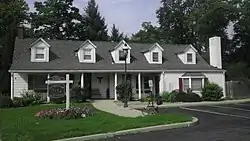 Blauvelt-Demarest House |
January 9, 1983 (#83001472) |
230 Broadway 41°00′25″N 74°02′28″W |
Hillsdale | |
| 26 | Bogert House | 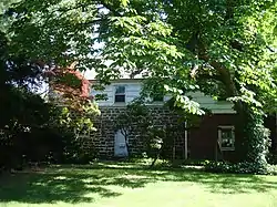 Bogert House |
January 9, 1983 (#83001475) |
4 Lynn Court 40°53′00″N 74°01′58″W |
Bogota | |
| 27 | Bogert House | 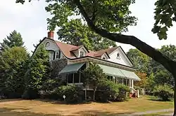 Bogert House |
January 9, 1983 (#83001476) |
324 County Rd. 40°57′43″N 73°57′39″W |
Demarest | |
| 28 | Isaac Bogert House | 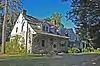 Isaac Bogert House |
January 10, 1983 (#83001477) |
640 Campgaw Rd. 41°02′18″N 74°11′16″W |
Mahwah | |
| 29 | John Jacob Bogert House |  John Jacob Bogert House |
November 26, 2004 (#04001259) |
163 Bogert's Mill Rd. 40°59′05″N 73°59′33″W |
Harrington Park | |
| 30 | Brinkerhoff House | 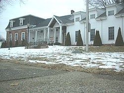 Brinkerhoff House |
July 24, 1984 (#84002541) |
231 Hackensack Ave. 40°50′52″N 74°04′56″W |
Wood-Ridge | |
| 31 | Brinkerhoff-Demarest House | 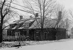 Brinkerhoff-Demarest House |
January 10, 1983 (#83001478) |
493 Teaneck Rd. 40°52′34″N 74°00′43″W |
Teaneck | |
| 32 | Cadmus House |  Cadmus House |
July 24, 1984 (#84002544) |
264 Glen Rd. 41°02′08″N 74°03′58″W |
Woodcliff Lake | |
| 33 | Cadmus-Folly House | 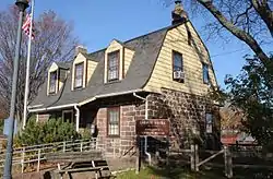 Cadmus-Folly House |
January 10, 1983 (#83001479) |
19–21 Fair Lawn Ave. 40°56′19″N 74°07′24″W |
Fair Lawn | |
| 34 | Campbell-Christie House | 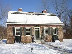 Campbell-Christie House |
January 10, 1983 (#83001481) |
1201 Main St. 40°54′47″N 74°01′58″W |
River Edge | |
| 35 | Christie-Parsels House | 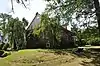 Christie-Parsels House |
January 10, 1983 (#83001482) |
195 Jefferson Ave. 40°55′55″N 73°58′19″W |
Tenafly | |
| 36 | Church of the Holy Communion | 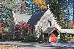 Church of the Holy Communion |
June 23, 1988 (#88000928) |
Summit Ave. 40°59′44″N 73°57′39″W |
Norwood | |
| 37 | Church of the Madonna | 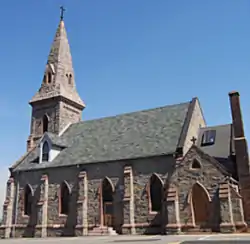 Church of the Madonna |
April 8, 1976 (#76001145) |
Hoefley's Lane 40°51′37″N 73°58′44″W |
Fort Lee | |
| 38 | Civil War Drill Hall and Armory |  Civil War Drill Hall and Armory |
October 19, 1978 (#78001737) |
130 Grand Ave. 40°51′22″N 73°59′53″W |
Leonia | |
| 39 | Cole-Allaire House |  Cole-Allaire House |
January 10, 1983 (#83001483) |
112 Prospect St. 40°51′45″N 73°59′38″W |
Leonia | |
| 40 | Concklin-Sneden House |  Concklin-Sneden House |
January 10, 1983 (#83001484) |
37 Rockleigh Rd. 41°00′11″N 73°55′38″W |
Rockleigh | Built about 1796 by Jacob Concklin, Jr. |
| 41 | Thunise & Richard Cooper House | 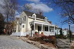 Thunise & Richard Cooper House |
September 12, 1985 (#85002182) |
608–610 Brookside Ave. 40°56′55″N 74°01′53″W |
Oradell | |
| 42 | Tunis R. Cooper House | 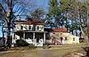 Tunis R. Cooper House |
September 6, 1995 (#95001046) |
83 Cooper St. 40°55′50″N 74°00′09″W |
Bergenfield | |
| 43 | Crim-Tice House | 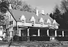 Crim-Tice House |
January 10, 1983 (#83001485) |
16 County Rd. 41°02′22″N 74°04′33″W |
Woodcliff Lake | Apparently demolished. |
| 44 | Crocker-McMillin Mansion-Immaculate Conception Seminary | 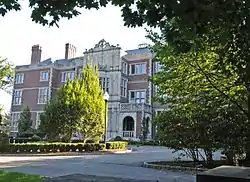 Crocker-McMillin Mansion-Immaculate Conception Seminary |
May 23, 1997 (#96001562) |
Ramapo Valley Rd., jct. of Campgaw Rd., Mahwah Township 41°04′20″N 74°11′26″W |
Ramsey | |
| 45 | Darlington Schoolhouse | 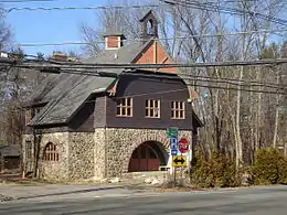 Darlington Schoolhouse |
March 14, 2008 (#08000175) |
600 Ramapo Valley Rd. 41°04′46″N 74°11′04″W |
Mahwah | |
| 46 | Isaac Debaun House | 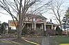 Isaac Debaun House |
January 10, 1983 (#83001487) |
124 Rivervale Rd. 41°01′37″N 74°01′40″W |
Park Ridge | |
| 47 | Debaun-Demarest House |  Debaun-Demarest House |
January 10, 1983 (#83001486) |
56 Spring Valley Rd. 40°56′21″N 74°01′44″W |
River Edge | |
| 48 | Demarest House |  Demarest House |
January 10, 1983 (#83001491) |
213 Ramapo Valley Rd. 41°01′04″N 74°15′01″W |
Oakland | |
| 49 | Demarest House | 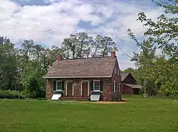 Demarest House |
January 10, 1983 (#83001492) |
Main St. 40°54′47″N 74°01′54″W |
River Edge | |
| 50 | Demarest House | 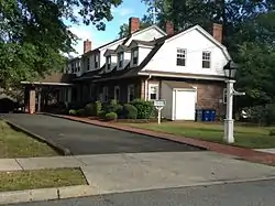 Demarest House |
January 10, 1983 (#83001496) |
268 Grove St. 40°57′00″N 74°01′35″W |
Oradell | |
| 51 | Demarest Railroad Depot | 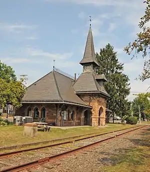 Demarest Railroad Depot |
July 7, 2004 (#04000671) |
38 Park St. 40°57′31″N 73°57′48″W |
Demarest | |
| 52 | Cornelius Demarest House | 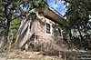 Cornelius Demarest House |
January 10, 1983 (#83001495) |
12 Rochelle Ave. 40°53′43″N 74°04′43″W |
Rochelle Park | |
| 53 | Daniel Demarest House |  Daniel Demarest House |
January 9, 1983 (#83001499) |
404 Washington Ave. 40°56′53″N 73°59′27″W |
Dumont | |
| 54 | Jacobus Demarest House | 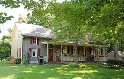 Jacobus Demarest House |
January 10, 1983 (#83001493) |
252 Ramapo Valley Rd. 41°01′08″N 74°14′53″W |
Oakland | |
| 55 | John R. Demarest House |  John R. Demarest House |
January 9, 1983 (#83001497) |
35 County Rd. 40°56′49″N 73°57′16″W |
Demarest | |
| 56 | Samuel R. Demarest House | 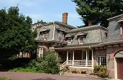 Samuel R. Demarest House |
July 24, 1984 (#84002552) |
212 County Rd. 40°57′20″N 73°57′44″W |
Demarest | |
| 57 | Thomas Demarest House | 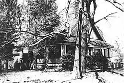 Thomas Demarest House |
January 9, 1983 (#83001498) |
370 Grand Ave. 40°53′08″N 73°58′41″W |
Englewood | Demolished. |
| 58 | Demarest-Bloomer House | 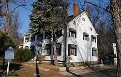 Demarest-Bloomer House |
November 7, 1985 (#85002775) |
147 River Edge Ave. 40°56′06″N 74°01′41″W |
New Milford | |
| 59 | Demarest-Atwood House | 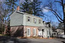 Demarest-Atwood House |
July 24, 1984 (#84002548) |
84 Jefferson Ave. 40°56′14″N 73°58′13″W |
Cresskill | |
| 60 | Demarest-Hopper House | 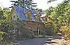 Demarest-Hopper House |
January 10, 1983 (#83001490) |
21 Breakneck Rd. 41°00′03″N 74°14′46″W |
Oakland | |
| 61 | Demarest-Lyle House | 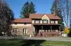 Demarest-Lyle House |
January 10, 1983 (#83001494) |
91 W. Clinton Ave. 40°55′30″N 73°58′13″W |
Tenafly | |
| 62 | Demott-Westervelt House | 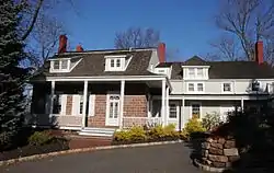 Demott-Westervelt House |
January 9, 1983 (#83001500) |
290 Grand Ave. 40°53′00″N 73°58′40″W |
Englewood | Duplicate listing for Peter Westervelt House and Barn. |
| 63 | Jacobus DesMarest House | 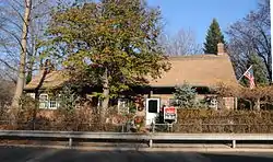 Jacobus DesMarest House |
February 17, 1978 (#78001739) |
618 River Rd. 40°56′04″N 74°01′34″W |
New Milford | |
| 64 | Doremus House | 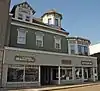 Doremus House |
July 24, 1984 (#84002561) |
73 Main St. 40°52′50″N 74°02′40″W |
Hackensack | |
| 65 | Draw Bridge at New Bridge | 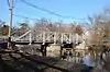 Draw Bridge at New Bridge |
July 5, 1989 (#89000775) |
Main St. and Old New Bridge Rd. over Hackensack River 40°54′51″N 74°01′48″W |
River Edge, New Milford and Teaneck | |
| 66 | Garret J. Durie House | 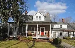 Garret J. Durie House |
January 9, 1983 (#83001502) |
371 Schraalenburgh Rd. 40°58′00″N 73°59′00″W |
Haworth | |
| 67 | Garret Durie House | 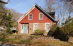 Garret Durie House |
January 9, 1983 (#83001501) |
156 Ell Rd. 41°00′03″N 74°03′25″W |
Hillsdale | |
| 68 | John P. Durie House | 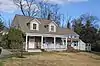 John P. Durie House |
January 9, 1983 (#83001503) |
265 Schraalenburgh Rd. 40°57′49″N 73°59′01″W |
Haworth | |
| 69 | Dutch Reformed Church at Romopock |  Dutch Reformed Church at Romopock |
September 5, 1985 (#85002000) |
Island Rd. at W. Ramapo Ave. 41°05′41″N 74°09′09″W |
Mahwah | |
| 70 | Dutch Reformed Church in the English Neighborhood |  Dutch Reformed Church in the English Neighborhood |
September 18, 1998 (#98001181) |
1040 Edgewater Ave. 40°50′03″N 74°00′46″W |
Ridgefield | |
| 71 | Eckerson House |  Eckerson House |
January 10, 1983 (#83001504) |
200 Chestnut Ridge Rd. 41°04′14″N 74°04′05″W |
Montvale | |
| 72 | Edgewater Borough Hall |  Edgewater Borough Hall |
January 16, 2008 (#07001401) |
916 River Rd. 40°49′38″N 73°58′26″W |
Edgewater | |
| 73 | Edgewater Public Library | 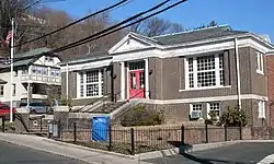 Edgewater Public Library |
December 23, 2009 (#09001154) |
49 Hudson Ave. 40°49′47″N 73°58′28″W |
Edgewater | |
| 74 | Erie Railroad Signal Tower, Waldwick Yard | 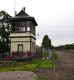 Erie Railroad Signal Tower, Waldwick Yard |
December 23, 1987 (#87000847) |
NE end of Bohnert Pl., W side of RR Tracks 41°00′55″N 74°07′29″W |
Waldwick | |
| 75 | Ferdon House | 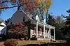 Ferdon House |
January 10, 1983 (#83001505) |
366 14th St. 40°59′18″N 73°56′32″W |
Norwood | |
| 76 | Ford Motor Company Edgewater Assembly Plant | Ford Motor Company Edgewater Assembly Plant |
September 15, 1983 (#83001507) |
309 River Rd. 40°48′33″N 73°59′09″W |
Edgewater | Demolished in 2006.[6] |
| 77 | Forshee-Van Orden House | 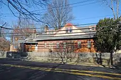 Forshee-Van Orden House |
July 24, 1984 (#84002563) |
109 Summit Ave. 41°03′34″N 74°03′27″W |
Montvale | |
| 78 | Peter Garretson House | 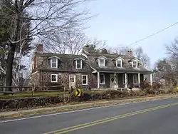 Peter Garretson House |
November 19, 1974 (#74001153) |
4-02 River Rd. 40°55′26″N 74°07′50″W |
Fair Lawn | |
| 79 | Garret Garrison House | 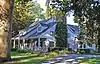 Garret Garrison House |
January 10, 1983 (#83001508) |
980 Ramapo Valley Rd. 41°03′51″N 74°12′36″W |
Mahwah | |
| 80 | Gethsemane Cemetery | 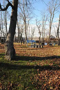 Gethsemane Cemetery |
April 20, 1994 (#94000330) |
360–370 Liberty St. 40°51′20″N 74°02′29″W |
Little Ferry | |
| 81 | Hardenburgh Avenue Bridge | 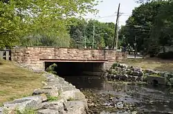 Hardenburgh Avenue Bridge |
March 12, 2001 (#01000237) |
Hardenburgh Avenue over the Tenakill Brook 40°57′24″N 73°57′48″W |
Demarest | |
| 82 | Abraham A. Haring House |  Abraham A. Haring House |
January 10, 1983 (#83001510) |
Piermont Rd. 40°59′50″N 73°55′56″W |
Rockleigh | |
| 83 | Frederick Haring House | 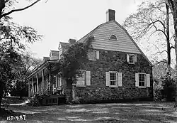 Frederick Haring House |
January 10, 1983 (#83001513) |
Old Tappan and De Wolf Rds. 41°01′04″N 73°58′44″W |
Old Tappan | |
| 84 | Gerrit Haring House | 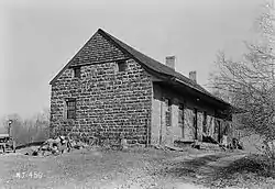 Gerrit Haring House |
January 10, 1983 (#83001514) |
224 Old Tappan Rd. 41°00′47″N 73°59′12″W |
Old Tappan | |
| 85 | Nicholas Haring House | 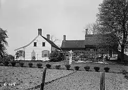 Nicholas Haring House |
January 10, 1983 (#83001515) |
Piermont Rd. 40°59′44″N 73°55′58″W |
Rockleigh | |
| 86 | Teunis Haring House |  Teunis Haring House |
April 20, 1979 (#79001473) |
70 Old Tappan Rd. 41°01′14″N 73°58′05″W |
Old Tappan | |
| 87 | Haring-Blauvelt House |  Haring-Blauvelt House |
January 10, 1983 (#83001511) |
454 Tappan Rd. 41°00′47″N 73°57′07″W |
Northvale | |
| 88 | Haring-Blauvelt-Demarest House |  Haring-Blauvelt-Demarest House |
January 10, 1983 (#83001509) |
525 Rivervale Rd. 41°00′57″N 74°00′39″W |
River Vale | |
| 89 | Haring-Corning House |  Haring-Corning House |
August 8, 1985 (#85002589) |
Rockleigh Rd. 40°59′58″N 73°55′48″W |
Rockleigh | |
| 90 | Haring-DeWolf House |  Haring-DeWolf House |
January 10, 1983 (#83001512) |
95 De Wolf Rd. 41°01′28″N 73°58′42″W |
Old Tappan | |
| 91 | Haring-Vervalen House |  Haring-Vervalen House |
January 10, 1983 (#83001517) |
200 Tappan Rd. 40°59′48″N 73°57′46″W |
Norwood | Destroyed replaced in 2013 |
| 92 | Hennion House |  Hennion House |
January 10, 1983 (#83001518) |
54 Pleasant Ave. 41°02′53″N 74°06′35″W |
Upper Saddle River | |
| 93 | The Hermitage |  The Hermitage |
August 29, 1970 (#70000379) |
335 N. Franklin Tpke. 41°00′24″N 74°07′10″W |
Ho-Ho-Kus | |
| 94 | Hillsdale Station | 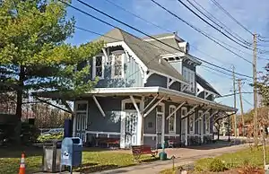 Hillsdale Station |
June 22, 1984 (#84002566) |
Broadway and Hillsdale Ave. 41°00′09″N 74°02′28″W |
Hillsdale | |
| 95 | William Holdrum House |  William Holdrum House |
January 10, 1983 (#83001519) |
606 Prospect St. 41°01′22″N 74°00′39″W |
River Vale | |
| 96 | Holdrum-Van Houten House |  Holdrum-Van Houten House |
January 9, 1983 (#83001520) |
43 Spring Valley Rd. 41°03′09″N 74°03′05″W |
Montvale | |
| 97 | Hopper Gristmill Site |  Hopper Gristmill Site |
March 3, 1983 (#83001524) |
N. Ramapo Valley Rd. at Ramapo River[8] 41°06′00″N 74°09′31″W |
Mahwah | |
| 98 | Hopper House | 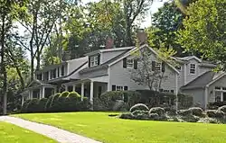 Hopper House |
January 10, 1983 (#83001525) |
72 Hopper Farm Rd. 41°04′22″N 74°05′24″W |
Upper Saddle River | |
| 99 | Andrew H. Hopper House | 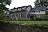 Andrew H. Hopper House |
January 9, 1983 (#83001521) |
762 Prospect St. 40°57′23″N 74°06′38″W |
Glen Rock | |
| 100 | Garret Hopper House | 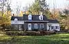 Garret Hopper House |
January 9, 1983 (#83001522) |
470 Prospect St. 40°57′57″N 74°06′51″W |
Glen Rock | |
| 101 | Hendrick Hopper House | 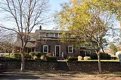 Hendrick Hopper House |
January 9, 1983 (#83001526) |
724 Ackerman Ave. 40°57′32″N 74°06′51″W |
Glen Rock | |
| 102 | John Hopper House |  John Hopper House |
January 9, 1983 (#83001527) |
231 Polifly Rd. 40°52′30″N 74°03′41″W |
Hackensack | Built in 1818.[9] |
| 103 | Hopper-Goetschius House |  Hopper-Goetschius House |
January 10, 1983 (#83001523) |
363 E. Saddle River Rd. 41°03′31″N 74°05′34″W |
Upper Saddle River | |
| 104 | Hopper-Van Horn House |  Hopper-Van Horn House |
April 11, 1973 (#73001079) |
398 Ramapo Valley Rd. 41°05′19″N 74°10′22″W |
Mahwah | |
| 105 | Peter Huyler House |  Peter Huyler House |
January 9, 1983 (#83001528) |
50 County Rd. 40°56′10″N 73°57′23″W |
Cresskill | |
| 106 | Iviswold | 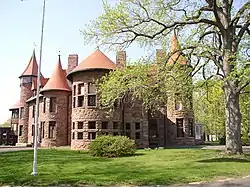 Iviswold |
November 4, 2004 (#04001213) |
223 Montross Ave. 40°49′51″N 74°06′42″W |
Rutherford | |
| 107 | Kip Homestead |  Kip Homestead |
January 10, 1983 (#83001529) |
12 Meadow Rd. 40°49′30″N 74°06′02″W |
Rutherford | |
| 108 | Lozier House and Van Riper Mill |  Lozier House and Van Riper Mill |
October 10, 1975 (#75001119) |
34 Goffle Rd. and 11 Paterson Ave. 40°59′03″N 74°08′28″W |
Midland Park | |
| 109 | Garret Lydecker House |  Garret Lydecker House |
January 9, 1983 (#83001530) |
228 Grand Ave. 40°53′08″N 73°58′39″W |
Englewood | |
| 110 | Maywood Railroad Station |  Maywood Railroad Station |
May 29, 2003 (#03000487) |
271 Maywood Ave. 40°53′46″N 74°03′58″W |
Maywood | |
| 111 | John Meyerhoff House |  John Meyerhoff House |
January 9, 1983 (#83001532) |
279 County Rd. 40°57′37″N 73°57′45″W |
Demarest | |
| 112 | Midland School |  Midland School |
April 7, 1978 (#78001740) |
239 W. Midland Ave. 40°57′38″N 74°05′25″W |
Paramus | |
| 113 | Myers-Masker House |  Myers-Masker House |
January 9, 1983 (#83001533) |
179 Park Ave. 41°00′03″N 74°08′53″W |
Midland Park | |
| 114 | Naugle House |  Naugle House |
January 9, 1983 (#83001536) |
42–49 Dunkerhook Rd. 40°56′44″N 74°05′58″W |
Fair Lawn | |
| 115 | New Milford Plant of the Hackensack Water Company |  New Milford Plant of the Hackensack Water Company |
August 22, 2001 (#01000891) |
New Milford Ave. 40°56′49″N 74°01′30″W |
Oradell | |
| 116 | New North Reformed Low Dutch Church | 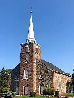 New North Reformed Low Dutch Church |
April 15, 1982 (#82003263) |
E. Saddle River Road at Old Stone Church Road 41°04′14″N 74°05′12″W |
Upper Saddle River | Known as The Old Stone Church |
| 117 | New York, Susquehanna & Western Railroad ALCO Type S-2 Locomotive | 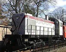 New York, Susquehanna & Western Railroad ALCO Type S-2 Locomotive |
March 19, 2010 (#09001072) |
Maywood Station Museum, 271 Maywood Ave. 40°53′47″N 74°03′55″W |
Maywood | |
| 118 | North Church | 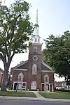 North Church |
May 26, 1983 (#83001538) |
120 Washington Ave. and 191 Washington Ave. 40°56′24″N 73°59′43″W |
Dumont | Also known as Schraalenburgh North Church |
| 119 | Oradell Station |  Oradell Station |
June 22, 1984 (#84002575) |
400 Maple Ave. 40°57′13″N 74°01′50″W |
Oradell | |
| 120 | Richard Outwater House | 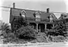 Richard Outwater House |
January 9, 1983 (#83001539) |
231 Hackensack St. 40°49′43″N 74°05′54″W |
East Rutherford | |
| 121 | Palisades Interstate Parkway | 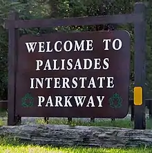 Palisades Interstate Parkway |
August 2, 1999 (#99000940) |
Palisade Interstate Parkway 40°51′29″N 73°57′40″W |
Fort Lee | |
| 122 | Palisades Interstate Park |  Palisades Interstate Park |
October 15, 1966 (#66000890) |
W bank of the Hudson River 40°57′19″N 73°55′54″W |
Fort Lee and vicinity | |
| 123 | Park Ridge Station | 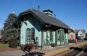 Park Ridge Station |
June 22, 1984 (#84002577) |
Hawthorne and Park Ave. 41°01′58″N 74°02′11″W |
Park Ridge | |
| 124 | Paulison-Christie House | 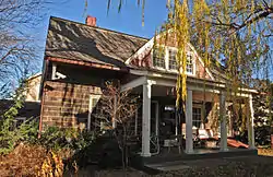 Paulison-Christie House |
January 10, 1983 (#83001541) |
8 Homestead Pl. 40°51′10″N 74°01′39″W |
Ridgefield Park | |
| 125 | Peter D. Perry House | 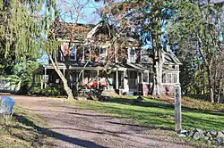 Peter D. Perry House |
January 10, 1983 (#83001542) |
107 Rivervale Rd. 41°01′42″N 74°01′41″W |
Park Ridge | |
| 126 | Peter P. Post House |  Peter P. Post House |
January 10, 1983 (#83001543) |
259 Pascack Rd. 41°01′03″N 74°02′53″W |
Woodcliff Lake | |
| 127 | Presbyterian Church of Norwood |  Presbyterian Church of Norwood |
February 1, 2006 (#05001567) |
701 Broadway 41°00′00″N 73°57′39″W |
Norwood | |
| 128 | Radburn |  Radburn |
April 16, 1975 (#75001118) |
Irregular pattern between Radburn Rd. and Erie RR. tracks 40°56′28″N 74°07′07″W |
Fair Lawn | |
| 129 | Radburn-Fair Lawn Station |  Radburn-Fair Lawn Station |
June 22, 1984 (#84002580) |
Pollitt Dr. 40°56′22″N 74°07′19″W |
Fair Lawn | |
| 130 | Reformed Dutch Church and Green |  Reformed Dutch Church and Green |
June 9, 1983 (#83001546) |
42 Court St. 40°52′45″N 74°02′34″W |
Hackensack | |
| 131 | Ridgewood Country Club | 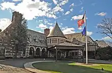 Ridgewood Country Club |
May 29, 2015 (#14000222) |
96 W. Midland Ave. 40°56′49″N 74°04′41″W |
Paramus | |
| 132 | River Road School | 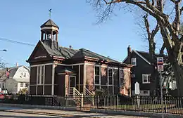 River Road School |
November 11, 1977 (#77000844) |
400 Riverside Ave. 40°48′52″N 74°08′04″W |
Lyndhurst | |
| 133 | Rockleigh Historic District | 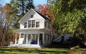 Rockleigh Historic District |
June 29, 1977 (#77000845) |
E of Norwood on Willow Ave., Rockleigh and Piermont Rds. 41°00′11″N 73°55′42″W |
Rockleigh | |
| 134 | Romeyn-Oldis-Brinkerhoff House | 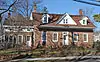 Romeyn-Oldis-Brinkerhoff House |
January 10, 1983 (#83001548) |
279 Maywood Ave. 40°53′48″N 74°03′57″W |
Maywood | |
| 135 | Romine-Van Voorhis House |  Romine-Van Voorhis House |
January 10, 1983 (#83001547) |
306 Maywood Ave. 40°53′51″N 74°03′54″W |
Maywood | |
| 136 | Rutherford Station |  Rutherford Station |
June 22, 1984 (#84002584) |
Station Sq. 40°49′42″N 74°06′06″W |
Rutherford | |
| 137 | Woman's Club of Rutherford Clubhouse |  Woman's Club of Rutherford Clubhouse |
April 10, 2017 (#100000852) |
201 Fairview Ave. 40°49′55″N 74°06′41″W |
Rutherford | |
| 138 | St. Paul's Episcopal Church |  St. Paul's Episcopal Church |
May 5, 2014 (#14000189) |
113 Engle St. 40°53′47″N 73°58′13″W |
Englewood | |
| 139 | Seven Chimneys | 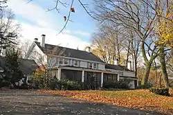 Seven Chimneys |
August 12, 1971 (#71000494) |
25 Chimney Ridge Ct. 40°58′56″N 74°03′55″W |
Washington Township | Also known as the Nicholas Zabriskie House[4] |
| 140 | Albert Smith House | 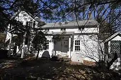 Albert Smith House |
January 10, 1983 (#83004870) |
289 Wyckoff Ave. 41°00′43″N 74°08′42″W |
Waldwick | |
| 141 | John Smith House | 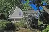 John Smith House |
January 10, 1983 (#83001549) |
290 Forest Rd. 41°01′47″N 74°09′24″W |
Mahwah | |
| 142 | South Church Manse | 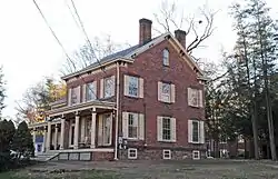 South Church Manse |
August 24, 1979 (#79001470) |
138 W. Church St. 40°55′44″N 74°00′10″W |
Bergenfield | |
| 143 | South Schraalenburgh Church | 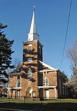 South Schraalenburgh Church |
December 6, 1975 (#75001116) |
Prospect Ave. and W. Church St. 40°55′46″N 74°00′13″W |
Bergenfield | |
| 144 | Elizabeth Cady Stanton House | 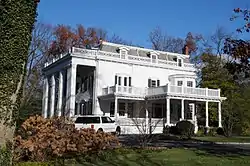 Elizabeth Cady Stanton House |
May 15, 1975 (#75001122) |
135 Highwood Ave. 40°55′33″N 73°57′16″W |
Tenafly | |
| 145 | Steuben Estate Complex | 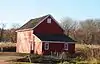 Steuben Estate Complex |
December 9, 1980 (#80004403) |
New Bridge Rd., Main St. and Hackensack River 40°54′49″N 74°01′55″W |
River Edge | |
| 146 | Steuben House | 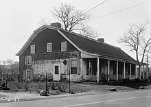 Steuben House |
December 18, 1970 (#70000381) |
Old New Bridge Rd., at the Hackensack River 40°54′49″N 74°01′51″W |
River Edge | Built in 1752.[10] |
| 147 | Joseph Taylor House |  Joseph Taylor House |
January 14, 2015 (#14000464) |
475 Franklin Tpk. 40°59′29″N 74°05′57″W |
Allendale | |
| 148 | Tenafly Station |  Tenafly Station |
January 25, 1979 (#79001476) |
Off Hillside Ave. 40°55′29″N 73°57′54″W |
Tenafly | |
| 149 | Terhune House |  Terhune House |
February 28, 1996 (#82005390) |
470 Paramus Rd. 40°57′28″N 74°05′35″W |
Paramus | |
| 150 | Terhune-Gardner-Lindenmeyr House |  Terhune-Gardner-Lindenmeyr House |
February 7, 1972 (#72000769) |
218 Paramus Rd. 40°56′27″N 74°05′33″W |
Paramus | |
| 151 | Terhune-Hopper House | 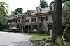 Terhune-Hopper House |
January 10, 1983 (#83001554) |
825 E. Saddle River Rd. 40°59′51″N 74°05′30″W |
Ho-Ho-Kus | |
| 152 | Terhune-Hopper House | 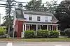 Terhune-Hopper House |
January 10, 1983 (#83001553) |
349 W. Saddle River Rd. 41°03′30″N 74°05′56″W |
Upper Saddle River | |
| 153 | Terhune-Ranlett House | 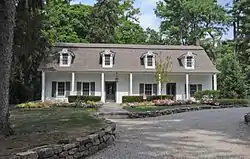 Terhune-Ranlett House |
January 10, 1983 (#83001555) |
933 E. Saddle River Rd. 41°00′05″N 74°05′36″W |
Ho-Ho-Kus | |
| 154 | Theodore Roosevelt Monument | 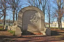 Theodore Roosevelt Monument |
September 20, 2006 (#06000870) |
Roosevelt Common, Riveredge Rd. 40°55′42″N 73°58′07″W |
Tenafly | |
| 155 | U.S.S. LING | U.S.S. LING |
October 19, 1978 (#78001736) |
Hackensack River at 150 River St. 40°52′47″N 74°02′26″W |
Hackensack | |
| 156 | Upper Closter-Alpine Historic District | 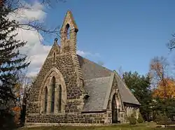 Upper Closter-Alpine Historic District |
May 8, 1985 (#85001013) |
Roughly bounded by Forest St., Old Dock Rd., School House Ln., Church St. and Closter Dock Rd. 40°56′57″N 73°55′37″W |
Alpine | |
| 157 | Edward W. Vaill House | 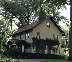 Edward W. Vaill House |
January 18, 1990 (#89001595) |
863 Midland Rd. 40°57′27″N 74°02′30″W |
Oradell | |
| 158 | Van Allen House | 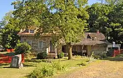 Van Allen House |
July 24, 1973 (#73001080) |
Corner of U.S. 202 and Franklin Ave. 41°01′47″N 74°14′11″W |
Oakland | |
| 159 | Van Buskirk-Oakley House |  Van Buskirk-Oakley House |
July 3, 1979 (#79001474) |
467 Kinderkamack Rd. 40°57′23″N 74°01′55″W |
Oradell | |
| 160 | Harmon Van Dien House | 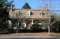 Harmon Van Dien House |
January 10, 1983 (#83001561) |
449 Paramus Rd. 40°57′23″N 74°05′40″W |
Paramus | |
| 161 | Abraham Van Gelder House | 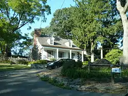 Abraham Van Gelder House |
January 10, 1983 (#83001569) |
86 W. Crescent Ave. 41°02′40″N 74°09′59″W |
Mahwah | |
| 162 | David Van Gelder House | 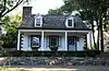 David Van Gelder House |
January 10, 1983 (#83001570) |
37 W. Crescent Ave. 41°02′37″N 74°09′53″W |
Ramsey | |
| 163 | Van Horn-Newcomb House | 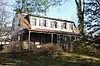 Van Horn-Newcomb House |
July 24, 1984 (#84002590) |
303 Tenafly Rd. 40°54′16″N 73°58′31″W |
Englewood | |
| 164 | Van Houten-Hillman House | 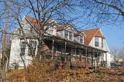 Van Houten-Hillman House |
January 9, 1983 (#83001575) |
891 River Rd. 40°53′26″N 74°07′40″W |
Elmwood Park | |
| 165 | Jacob W. Van Winkle House | 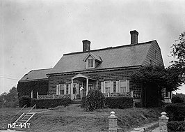 Jacob W. Van Winkle House |
January 10, 1983 (#83001588) |
316 Riverside Ave. 40°48′59″N 74°07′57″W |
Lyndhurst | |
| 166 | Van Winkle-Fox House | 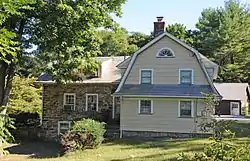 Van Winkle-Fox House |
January 10, 1983 (#83001578) |
669 Ramapo Valley Rd. 41°02′28″N 74°13′45″W |
Oakland | |
| 167 | Van Zile House | 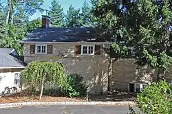 Van Zile House |
January 10, 1983 (#83001579) |
714 Godwin Ave. 41°00′03″N 74°09′20″W |
Midland Park | |
| 168 | Adam Vandelinda House | 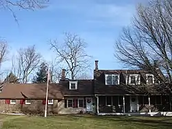 Adam Vandelinda House |
January 10, 1983 (#83001562) |
586 Teaneck Rd. 40°52′43″N 74°00′42″W |
Teaneck | |
| 169 | James Vandelinda House |  James Vandelinda House |
January 10, 1983 (#83001563) |
566 Teaneck Rd. 40°52′38″N 74°00′43″W |
Teaneck | |
| 170 | Vanderbeck House |  Vanderbeck House |
January 10, 1983 (#83001565) |
69 Vanderbeck Ave. 41°02′02″N 74°09′17″W |
Mahwah | |
| 171 | Jacob Vanderbeck, Jr., House |  Jacob Vanderbeck, Jr., House |
January 9, 1983 (#83001566) |
41-25 Dunderhook Rd. 40°56′46″N 74°06′02″W |
Fair Lawn | |
| 172 | Vanderbeek House |  Vanderbeek House |
July 24, 1984 (#84002589) |
6 Arigot Court 41°00′20″N 74°04′22″W |
Hillsdale | |
| 173 | Vreeland House |  Vreeland House |
November 17, 1978 (#78001738) |
125 Lakeview Ave. 40°52′26″N 73°59′06″W |
Leonia | |
| 174 | Waldwick Railroad Station |  Waldwick Railroad Station |
February 23, 1978 (#78001742) |
Hewson Ave. and Prospect St. 41°00′44″N 74°07′26″W |
Waldwick | Original 1887 depot to be restored for use as local museum |
| 175 | Westervelt House |  Westervelt House |
August 15, 1983 (#83001586) |
81 Westervelt Ave. 40°55′17″N 73°58′08″W |
Tenafly | |
| 176 | Benjamin P. Westervelt House |  Benjamin P. Westervelt House |
January 9, 1983 (#83001583) |
235 County Rd. 40°56′33″N 73°57′27″W |
Cresskill | |
| 177 | Caspar Westervelt House |  Caspar Westervelt House |
January 10, 1983 (#83001584) |
20 Sherwood Rd. 40°52′09″N 74°00′54″W |
Teaneck | |
| 178 | John Westervelt House |  John Westervelt House |
January 9, 1983 (#83001585) |
29 The Parkway 40°59′11″N 73°58′33″W |
Harrington Park | |
| 179 | Peter Westervelt House and Barn |  Peter Westervelt House and Barn |
March 19, 1975 (#75001117) |
290 Grand Ave. 40°53′01″N 73°58′38″W |
Englewood | Duplicate listing of Demott-Westervelt House. |
| 180 | Westervelt-Ackerson House |  Westervelt-Ackerson House |
July 20, 1977 (#77000846) |
538 Island Rd. 41°04′25″N 74°08′39″W |
Ramsey | |
| 181 | Westervelt-Lydecker House |  Westervelt-Lydecker House |
January 10, 1983 (#83001582) |
Weirmus and Old Mill Rds. 41°01′18″N 74°03′57″W |
Woodcliff Lake | |
| 182 | Westwood Railroad Station | 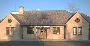 Westwood Railroad Station |
January 28, 2020 (#100003609) |
Broadway & Westwood Ave. 40°59′27″N 74°01′58″E |
Westwood | 1870 stone building |
| 183 | White Tenant House |  White Tenant House |
January 10, 1983 (#83001587) |
16 White's Lane 41°00′23″N 74°07′38″W |
Waldwick | Demolished.[11] |
| 184 | William Carlos Williams House |  William Carlos Williams House |
June 4, 1973 (#73001082) |
9 Ridge Rd. 40°50′00″N 74°06′30″W |
Rutherford | |
| 185 | William A. Wittmer Lustron House |  William A. Wittmer Lustron House |
July 25, 2000 (#00000797) |
19 Dubois Ave. 40°56′50″N 73°55′44″W |
Alpine | |
| 186 | World War I Monument |  World War I Monument |
April 24, 2013 (#13000201) |
Intersection of Park Avenue, Chestnut Street and Passaic Avenue and Lincoln Ave., Rutherford Borough 40°49′34″N 74°06′26″W |
Rutherford | |
| 187 | Wortendyke Barn | 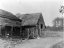 Wortendyke Barn |
May 7, 1973 (#73001081) |
13 Pascack Rd. 41°01′43″N 74°02′45″W |
Park Ridge | Now a county museum. |
| 188 | Frederick Wortendyke House | 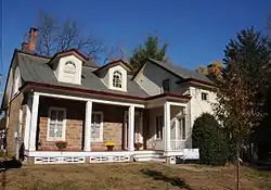 Frederick Wortendyke House |
January 10, 1983 (#83001591) |
168 Pascack Rd. 41°01′16″N 74°02′56″W |
Woodcliff Lake | |
| 189 | Frederick Wortendyke House | 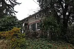 Frederick Wortendyke House |
January 10, 1983 (#83001592) |
12 Pascack Rd. 41°01′43″N 74°02′46″W |
Park Ridge | |
| 190 | Jacob Wortendyke House | 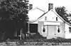 Jacob Wortendyke House |
January 10, 1983 (#83001593) |
445 Chestnut Ridge 41°02′30″N 74°04′28″W |
Woodcliff Lake | Apparently demolished. |
| 191 | Wortendyke-Demund House | Wortendyke-Demund House |
January 10, 1983 (#83001590) |
57 Demund Lane 40°59′45″N 74°08′43″W |
Midland Park | |
| 192 | Jeremiah J. Yeareance House | 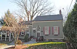 Jeremiah J. Yeareance House |
April 3, 1986 (#86000628) |
410 Riverside Ave. 40°48′51″N 74°08′05″W |
Lyndhurst | |
| 193 | Yereance-Berry House | 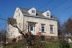 Yereance-Berry House |
January 10, 1983 (#83001594) |
91 Crane Ave. 40°48′56″N 74°06′16″W |
Rutherford | |
| 194 | Zabriskie House | 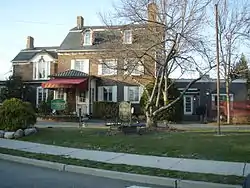 Zabriskie House |
January 10, 1983 (#83001598) |
Franklin Turnpike & Sheridan Ave. 40°59′51″N 74°06′37″W |
Ho-Ho-Kus | |
| 195 | Zabriskie Tenant House | 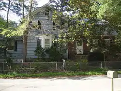 Zabriskie Tenant House |
July 24, 1984 (#84002602) |
273 Dunkerhook Rd. 40°56′53″N 74°05′50″W |
Paramus | Demolished in 2012.[12] |
| 196 | Albert J. Zabriskie Farmhouse | 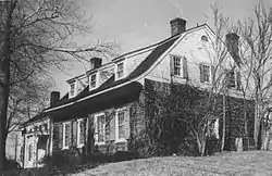 Albert J. Zabriskie Farmhouse |
November 7, 1977 (#77000847) |
7 E. Ridgewood Ave. 40°58′12″N 74°04′39″W |
Paramus | Some listings misreport this location as Ridgewood, NJ. |
| 197 | Garret Zabriskie House |  Garret Zabriskie House |
January 9, 1983 (#83001596) |
317 Massachusetts Ave. 40°57′19″N 73°59′25″W |
Haworth | |
| 198 | Henry Zabriskie House | 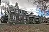 Henry Zabriskie House |
January 9, 1983 (#83001597) |
58 Schraalenburgh Rd. 40°57′25″N 73°59′05″W |
Haworth | |
| 199 | Zabriskie-Christie House | 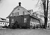 Zabriskie-Christie House |
January 9, 1983 (#83001595) |
2 Colonial Court 40°56′32″N 74°00′27″W |
Dumont | |
| 200 | Zabriskie-Kipp-Cadmus House | 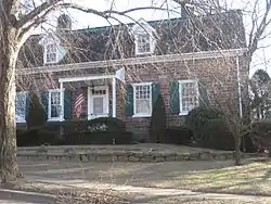 Zabriskie-Kipp-Cadmus House |
December 13, 1978 (#78001741) |
664 River Rd. 40°53′17″N 74°01′55″W |
Teaneck |
Former listings
| [3] | Name on the Register | Image | Date listed | Date removed | Location | City or town | Summary |
|---|---|---|---|---|---|---|---|
| 1 | Anderson Street Station | 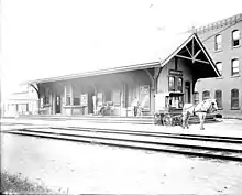 Anderson Street Station |
June 22, 1984 (#84002520) | May 18, 2011 | Anderson St. 40°53′39″N 74°02′40″W |
Hackensack | Destroyed by fire on January 10, 2009.[13] |
References
- The latitude and longitude information provided in this table was derived originally from the National Register Information System, which has been found to be fairly accurate for about 99% of listings. Some locations in this table may have been corrected to current GPS standards.
- "National Register of Historic Places: Weekly List Actions". National Park Service, United States Department of the Interior. Retrieved on January 29, 2021.
- Numbers represent an alphabetical ordering by significant words. Various colorings, defined here, differentiate National Historic Landmarks and historic districts from other NRHP buildings, structures, sites or objects.
- "National Register Information System". National Register of Historic Places. National Park Service. July 9, 2010.
- The eight-digit number below each date is the number assigned to each location in the National Register Information System database, which can be viewed by clicking the number.
- "Archived copy" (PDF). Archived from the original (PDF) on October 30, 2008. Retrieved July 21, 2010.CS1 maint: archived copy as title (link) Accessed June 15, 2010.
- "New Jersey and National Registers of Historic Places" (PDF). NJ DEP – Historic Preservation Office. Archived from the original (PDF) on October 30, 2008. Retrieved July 21, 2010.
- "Hopper Gristmill-Sawmill".
- http://www.hmdb.org/Marker.asp?Marker=6864 Accessed April 14, 2009.
- http://www.bergencountyhistory.org/Pages/steubenhsehistory.html Accessed April 14, 2009.
- "New Jersey and National Registers of Historic Places" (PDF). NJ DEP. Archived from the original (PDF) on October 30, 2008. Retrieved July 16, 2010.
- Ma, Myles (July 30, 2012). "Privately owned historic sites still vulnerable after destruction of Zabriskie Tenant House". The Star-Ledger. Retrieved February 8, 2015.
- Abdou, Nyier (January 10, 2009). "Fire destroys historic Hackensack train station". The Star-Ledger. Retrieved May 29, 2011.
External links
 Media related to National Register of Historic Places in Bergen County, New Jersey at Wikimedia Commons
| Topics |  | ||
|---|---|---|---|
| Lists by county | |||
| Lists by city |
| ||
| Other lists | |||
| |||
Municipalities and communities of Bergen County, New Jersey, United States | ||
|---|---|---|
| Cities | Map of New Jersey highlighting Bergen County | |
| Boroughs |
| |
| Townships | ||
| Villages | ||
| Unincorporated communities | ||
| ||
This article is issued from Wikipedia. The text is licensed under Creative Commons - Attribution - Sharealike. Additional terms may apply for the media files.