National Register of Historic Places listings in Monmouth County, New Jersey
List of the National Register of Historic Places listings in Monmouth County, New Jersey
| Atlantic - Bergen - Burlington - Camden - Cape May - Cumberland - Essex - Gloucester - Hudson - Hunterdon - Mercer - Middlesex - Monmouth - Morris - Ocean - Passaic - Salem - Somerset - Sussex - Union - Warren |
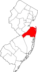
Location of Monmouth County in New Jersey
This is intended to be a complete list of properties and districts listed on the National Register of Historic Places in Monmouth County, New Jersey. The locations of National Register properties and districts (at least for all showing latitude and longitude coordinates below) may be seen in an online map by clicking on "Map of all coordinates".[1]
- This National Park Service list is complete through NPS recent listings posted January 29, 2021.[2]
| [3] | Name on the Register[4] | Image | Date listed[5] | Location | City or town | Description |
|---|---|---|---|---|---|---|
| 1 | PS Alexander Hamilton (steamship) | 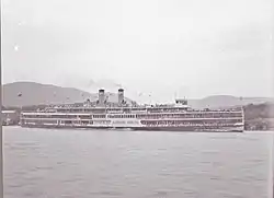 PS Alexander Hamilton (steamship) |
March 25, 1977 (#77000887) |
Off NJ 36 40°25′19″N 74°02′06″W |
Atlantic Highlands | |
| 2 | All Saints' Memorial Church Complex | 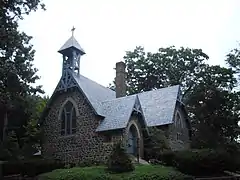 All Saints' Memorial Church Complex |
February 15, 1974 (#74001179) |
Navesink Ave. and Locust Rd. 40°23′53″N 74°01′13″W |
Navesink | |
| 3 | Allaire Village | 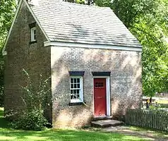 Allaire Village |
January 11, 1974 (#74001174) |
3 miles (4.8 km) southeast of Farmingdale on NJ 524 40°09′31″N 74°07′44″W |
Farmingdale | |
| 4 | Allen House | 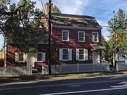 Allen House |
May 8, 1974 (#74001180) |
Broad St. and Sycamore Ave. 40°19′26″N 74°03′44″W |
Shrewsbury | |
| 5 | Allenhurst Railroad Station | .JPG.webp) Allenhurst Railroad Station |
September 17, 1980 (#80002504) |
Main St. 40°14′14″N 74°00′25″W |
Allenhurst | |
| 6 | Allenhurst Residential Historic District | .JPG.webp) Allenhurst Residential Historic District |
June 18, 2010 (#10000353) |
Roughly bounded by the Atlantic Ocean, Main St., Cedar Ave., Hume St., and Elberon Ave. 40°14′10″N 74°00′02″W |
Allenhurst | |
| 7 | Allentown Historic District | .JPG.webp) Allentown Historic District |
June 14, 1982 (#82003284) |
N. and S. Main Sts. 40°10′36″N 74°35′14″W |
Allentown | |
| 8 | Allentown Mill | .JPG.webp) Allentown Mill |
February 14, 1978 (#78001774) |
42 S. Main St. 40°10′34″N 74°35′13″W |
Allentown | |
| 9 | Allgor-Barkalow Homestead | .JPG.webp) Allgor-Barkalow Homestead |
June 21, 1984 (#84002748) |
New Bedford Rd. 40°10′30″N 74°03′52″W |
Wall Township | |
| 10 | Arburtus Cottage |  Arburtus Cottage |
August 18, 2015 (#15000003) |
508 4th Ave. 40°13′25″N 74°00′25″W |
Asbury Park | Owned by Stephen Crane |
| 11 | Asbury Park Commercial Historic District | 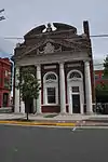 Asbury Park Commercial Historic District |
September 30, 2014 (#14000536) |
Roughly bounded by 500, 600, 700 blocks, of Bond St., Cookman & Mattison Aves. between Lake & Bangs Aves. 40°12′59″N 74°00′43″W |
Asbury Park | |
| 12 | Asbury Park Convention Hall | 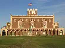 Asbury Park Convention Hall |
March 2, 1979 (#79001512) |
Ocean Ave. 40°13′22″N 73°59′56″W |
Asbury Park | |
| 13 | Audenried Cottage |  Audenried Cottage |
March 8, 1991 (#91000117) |
21 Tuttle Ave. 40°09′31″N 74°01′21″W |
Spring Lake | Now the Normandy Inn; part of the Spring Lake, NJ as a Coastal Resort Multiple Property Submission (MPS) |
| 14 | Bell Laboratories-Holmdel | 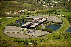 Bell Laboratories-Holmdel |
June 26, 2017 (#16000223) |
101 Crawfords Corner Rd. 40°21′54″N 74°10′02″W |
Holmdel Township | |
| 15 | Bradley Beach Free Public Library |  Bradley Beach Free Public Library |
December 24, 2013 (#13000976) |
511 4th Ave. 40°12′01″N 74°00′58″W |
Bradley Beach | |
| 16 | Bradley Beach Station | 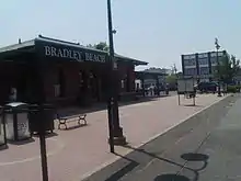 Bradley Beach Station |
June 22, 1984 (#84002749) |
Between LaReine and Brimley Aves. 40°12′13″N 74°01′09″W |
Bradley Beach | part of the Operating Passenger Railroad Stations Thematic Resource (TR) |
| 17 | Brielle Road Bridge over the Glimmer Glass | .JPG.webp) Brielle Road Bridge over the Glimmer Glass |
April 25, 2008 (#08000336) |
Brielle Rd. over The Glimmer Glass 40°06′43″N 74°02′45″W |
Brielle and Manasquan | |
| 18 | Brookdale Farm Historic District | 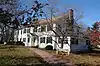 Brookdale Farm Historic District |
November 9, 2020 (#100004105) |
805 Newman Springs Rd. 40°19′59″N 74°08′19″W |
Middletown Township | All or part of Thompson Park |
| 19 | Maj. John Burrowes Mansion | .jpg.webp) Maj. John Burrowes Mansion |
September 29, 1972 (#72000803) |
94 Main St. 40°25′00″N 74°13′46″W |
Matawan | |
| 20 | Camp Evans Historic District | .JPG.webp) Camp Evans Historic District |
March 26, 2002 (#02000274) |
2201 Marconi Rd. (Wall Township) • Boundary increase and decrease (listed August 21, 2012, refnum 12000076): 2201 Marconi Rd. (Wall Township) 40°11′06″N 74°03′28″W |
Wall Township | |
| 21 | The Carlton Theatre |  The Carlton Theatre |
December 18, 2009 (#09001100) |
99 Monmouth St. 40°20′56″N 74°04′13″W |
Red Bank Borough | Also known as Count Basie Theatre |
| 22 | Chauncy Jerome Jr. Shipwreck Site | .JPG.webp) Chauncy Jerome Jr. Shipwreck Site |
March 1, 1996 (#96000205) |
Address Restricted |
Long Branch City | |
| 23 | Christ Church | 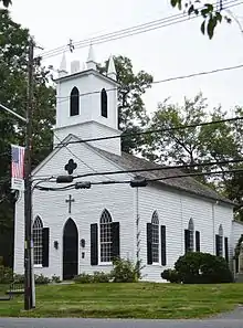 Christ Church |
November 12, 1971 (#71000511) |
92 Kings Highway 40°23′38″N 74°07′05″W |
Middletown Township | |
| 24 | Christ Church (Episcopal), Shrewsbury | 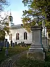 Christ Church (Episcopal), Shrewsbury |
October 25, 1995 (#95001184) |
Jct. of Broad St. and Sycamore Ave. 40°19′25″N 74°03′42″W |
Shrewsbury | |
| 25 | Church of the Presidents | 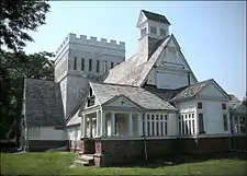 Church of the Presidents |
November 7, 1976 (#76001169) |
1260 Ocean Ave. 40°15′48″N 73°59′27″W |
Long Branch | |
| 26 | Clarksburg Methodist Episcopal Church | .JPG.webp) Clarksburg Methodist Episcopal Church |
February 5, 1999 (#99000084) |
512 Cty Rd. 524 40°11′29″N 74°27′05″W |
Millstone Township | |
| 27 | Clarksburg School | .JPG.webp) Clarksburg School |
November 12, 1999 (#99001316) |
524 Stagecoach Rd. (Millstone Township) 40°11′28″N 74°26′33″W |
Clarksburg | |
| 28 | Dr. Robert W. Cooke Medical Office | 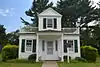 Dr. Robert W. Cooke Medical Office |
January 18, 2011 (#10001145) |
67 McCampbell Rd. 40°20′45″N 74°10′11″W |
Holmdel | New listing; refnum 10001145 |
| 29 | Court Street School | 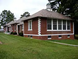 Court Street School |
August 4, 1995 (#95001003) |
Jct. of Court St. and Holmes Terr. 40°15′58″N 74°17′01″W |
Freehold | |
| 30 | Coward-Smith House | .JPG.webp) Coward-Smith House |
July 6, 1989 (#89000804) |
Burlington Path Rd. 40°08′32″N 74°28′28″W |
Upper Freehold | |
| 31 | Coward-Hendrickson House | 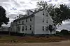 Coward-Hendrickson House |
March 21, 1985 (#85000594) |
Address Restricted |
Cream Ridge | |
| 32 | First Presbyterian Church of Rumson | .JPG.webp) First Presbyterian Church of Rumson |
March 3, 2010 (#09000132) |
4 E. River Rd. 40°22′34″N 74°00′35″W |
Rumson | New listing; refnum 09000132 |
| 33 | Frederic A. Duggan First Aid and Emergency Squad Building | 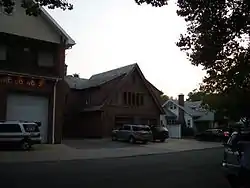 Frederic A. Duggan First Aid and Emergency Squad Building |
September 18, 1998 (#98001177) |
311 Washington Ave. 40°09′19″N 74°01′45″W |
Spring Lake | |
| 34 | Fisk Chapel | .JPG.webp) Fisk Chapel |
October 29, 1975 (#75001146) |
Cedar Ave. 40°21′38″N 74°02′28″W |
Fair Haven | |
| 35 | Fort Hancock and the Sandy Hook Proving Ground Historic District | 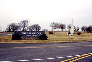 Fort Hancock and the Sandy Hook Proving Ground Historic District |
April 24, 1980 (#80002505) |
NJ 36 40°26′41″N 73°59′44″W |
Sandy Hook | |
| 36 | Fort Hancock U.S. Life Saving Station | 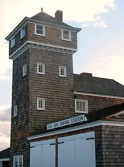 Fort Hancock U.S. Life Saving Station |
November 30, 1981 (#81000080) |
North of Highlands on Sandy Hook 40°25′35″N 73°59′05″W |
Highlands | |
| 37 | Fort Monmouth Historic District | 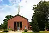 Fort Monmouth Historic District |
March 12, 2014 (#13000764) |
Oceanport Ave. 40°18′50″N 74°02′42″W |
Oceanport | |
| 38 | T. Thomas Fortune House | .jpg.webp) T. Thomas Fortune House |
December 8, 1976 (#76001171) |
94 W. Bergen Pl. 40°20′29″N 74°04′26″W |
Red Bank | |
| 39 | Gregory Primary School | 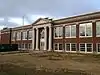 Gregory Primary School |
October 24, 2012 (#12000880) |
157 N. 7th Ave. 40°18′30″N 73°59′47″W |
Long Branch | |
| 40 | Grover House | 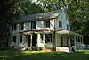 Grover House |
October 10, 2002 (#02001121) |
940 W. Front St. 40°20′41″N 74°06′16″W |
Middletown | |
| 41 | Murry Guggenheim House | Murry Guggenheim House |
March 28, 1978 (#78001778) |
Cedar and Norwood Aves. 40°16′56″N 74°00′12″W |
West Long Branch | Also known as Guggenheim Library, at Monmouth University |
| 42 | Hankinson-Moreau-Covenhoven House | 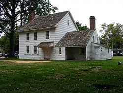 Hankinson-Moreau-Covenhoven House |
May 1, 1974 (#74001175) |
150 W. Main St. 40°15′07″N 74°17′19″W |
Freehold | |
| 43 | Holmdel Dutch Reformed Church | 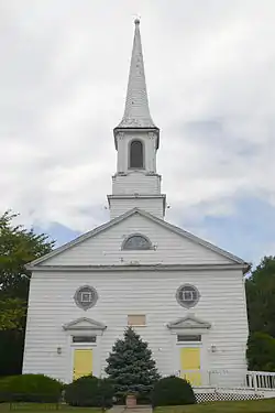 Holmdel Dutch Reformed Church |
October 22, 1980 (#80002506) |
41 Main St. 40°20′43″N 74°11′04″W |
Holmdel | |
| 44 | Holmes-Hendrickson House |  Holmes-Hendrickson House |
April 26, 1978 (#78001776) |
North of Holmdel 40°22′20″N 74°11′09″W |
Holmdel | |
| 45 | Holy Trinity Episcopal Church |  Holy Trinity Episcopal Church |
March 8, 1991 (#91000116) |
Jct. of Monmouth and Third Aves. 40°08′46″N 74°01′52″W |
Spring Lake | part of the Spring Lake, NJ as a Coastal Resort MPS |
| 46 | Horn Antenna |  Horn Antenna |
December 20, 1989 (#89002457) |
Off Garden State Parkway in Crawford Hill Facility 40°23′29″N 74°11′07″W |
Holmdel | |
| 47 | House at 364 Cedar Avenue |  House at 364 Cedar Avenue |
November 1, 1979 (#79001514) |
364 Cedar Avenue 40°16′53″N 74°00′04″W |
Long Branch | Demolished c. 2009 |
| 48 | Imlaystown Historic District |  Imlaystown Historic District |
January 3, 1985 (#85000032) |
Roughly Imlaystown-Davis Station Rd., and Imlaystown-Red Valley Rd. 40°09′50″N 74°30′41″W |
Upper Freehold Township | |
| 49 | Jersey Homesteads Historic District | 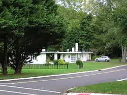 Jersey Homesteads Historic District |
December 5, 1983 (#83004053) |
All that area within the corporate boundaries of the Borough of Roosevelt 40°13′17″N 74°28′26″W |
Roosevelt | |
| 50 | Kovenhoven | 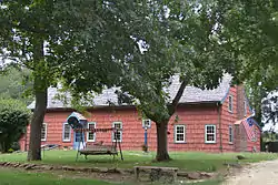 Kovenhoven |
April 26, 1974 (#74001176) |
North of Holmdel off NJ 34 40°21′56″N 74°11′43″W |
Holmdel | |
| 51 | Lauriston | 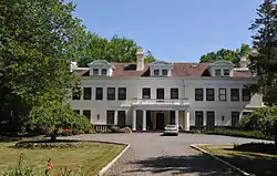 Lauriston |
March 8, 2002 (#02000134) |
Address Restricted |
Rumson | |
| 52 | Little Silver Station |  Little Silver Station |
June 22, 1984 (#84002754) |
Sycamore and Branch Aves. 40°19′35″N 74°02′28″W |
Little Silver | part of the Operating Passenger Railroad Stations TR |
| 53 | Longstreet Farm |  Longstreet Farm |
November 29, 1979 (#79003255) |
North of Holmdel on Longstreet Rd. 40°22′08″N 74°11′02″W |
Holmdel | |
| 54 | MacGregor-Tallman House |  MacGregor-Tallman House |
September 5, 1985 (#85002003) |
407 Monmouth Rd. 40°16′52″N 74°01′09″W |
West Long Branch | |
| 55 | Martin Maloney Cottage |  Martin Maloney Cottage |
October 26, 1992 (#91000115) |
101 Morris Ave. 40°09′05″N 74°01′29″W |
Spring Lake | part of the Spring Lake, NJ as a Coastal Resort MPS |
| 56 | Manasquan Friends Meetinghouse and Burying Ground | .JPG.webp) Manasquan Friends Meetinghouse and Burying Ground |
July 22, 1992 (#91000902) |
NJ 35 at Manasquan Cir., Wall Township 40°07′58″N 74°03′53″W |
Manasquan | |
| 57 | Matawan Station |  Matawan Station |
June 22, 1984 (#84002756) |
Between Main and Atlantic Aves. 40°25′12″N 74°13′27″W |
Matawan | part of the Operating Passenger Railroad Stations TR |
| 58 | McLeod-Rice House |  McLeod-Rice House |
December 3, 2018 (#100003203) |
900 Leonardville Rd. 40°24′44″N 74°03′18″W |
Middletown Township | |
| 59 | Merino Hill House and Farm |  Merino Hill House and Farm |
February 11, 1988 (#87002561) |
Allentown-Clarksburg Rd., CR 524 40°11′08″N 74°30′06″W |
Wrightsville | |
| 60 | Middletown Village Historic District | 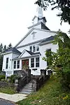 Middletown Village Historic District |
May 3, 1974 (#74001177) |
Irregular pattern on both sides of Kings Highway, south and west of NJ 35 40°23′38″N 74°06′48″W |
Middletown Township | Includes Christ Church |
| 61 | Monmouth Battlefield | 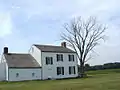 Monmouth Battlefield |
October 15, 1966 (#66000467) |
Northwest of Freehold on NJ 522, west of Rte. 9 40°16′23″N 74°18′50″W |
Freehold | |
| 62 | Monmouth Boat Club |  Monmouth Boat Club |
August 16, 1994 (#94000857) |
Union St. east of Boat Club Ct. 40°21′12″N 74°04′01″W |
Red Bank | |
| 63 | Navesink Historic District |  Navesink Historic District |
September 5, 1975 (#75001148) |
Roughly triangular area including both sides of Monmouth and Locust Avenues to the junction with Hillside and Grand Avenues 40°24′00″N 74°02′08″W |
Navesink | |
| 64 | Navesink Light Station |  Navesink Light Station |
February 17, 2006 (#06000237) |
100 Government-Lighthouse Rd. 40°23′46″N 73°59′09″W |
Highlands | |
| 65 | Navesink Military Reservation Historic District |  Navesink Military Reservation Historic District |
October 13, 2015 (#15000011) |
Grand Tour Road and Portland Road, Hartshorne Woods Park 40°23′26″N 73°59′20″W |
Middletown Township | |
| 66 | North Long Branch School-Primary No. 3 |  North Long Branch School-Primary No. 3 |
July 28, 1999 (#99000906) |
469 Church St. 40°19′15″N 73°58′44″W |
Long Branch | |
| 67 | North Shrewsbury Ice Boat and Yacht Club | .jpg.webp) North Shrewsbury Ice Boat and Yacht Club |
October 31, 2019 (#08000179) |
9 Union St. 40°21′10″N 74°04′00″W |
Red Bank | |
| 68 | Ocean Grove Camp Meeting Association District |  Ocean Grove Camp Meeting Association District |
April 12, 1976 (#76001170) |
Bounded by Fletcher Lake, NJ 71, Lake Wesley, and the Ocean 40°12′34″N 74°00′47″W |
Ocean Grove | |
| 69 | Old Kentuck |  Old Kentuck |
November 6, 1973 (#73001118) |
Northwest of Holmdel off NJ 34 on Pleasant Valley Rd. 40°21′56″N 74°13′14″W |
Holmdel | |
| 70 | Old Mill at Tinton Falls |  Old Mill at Tinton Falls |
April 24, 1973 (#73001119) |
1205 Sycamore Ave. 40°18′16″N 74°06′03″W |
Tinton Falls | |
| 71 | Old Scots Burying Ground | .JPG.webp) Old Scots Burying Ground |
August 15, 2001 (#01000841) |
Gordon's Corner Rd. 40°20′23″N 74°15′35″W |
Marlboro | |
| 72 | Palace Amusements |  Palace Amusements |
November 22, 2000 (#00001406) |
201-207 Lake Ave. 40°13′04″N 74°00′13″W |
Asbury Park | Demolished in 2004 |
| 73 | Parker Homestead | .JPG.webp) Parker Homestead |
December 28, 2011 (#11000966) |
235 Rumson Rd. 40°20′36″N 74°02′26″W |
Little Silver | |
| 74 | Players Boat Club | 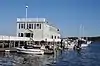 Players Boat Club |
June 17, 2019 (#100004058) |
925 River Rd. 40°22′07″N 74°01′48″W |
Fair Haven | |
| 75 | Probasco-Dittner Farmstead | 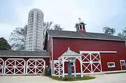 Probasco-Dittner Farmstead |
February 1, 2006 (#05001564) |
61 Bucks Mill Rd. 40°17′15″N 74°12′14″W |
Colts Neck | |
| 76 | Portland Place | 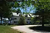 Portland Place |
December 12, 2012 (#12001033) |
220 Hartshorne Rd. 40°23′25″N 74°00′21″W |
Middletown Township | |
| 77 | Anthony Reckless Estate | .JPG.webp) Anthony Reckless Estate |
June 3, 1982 (#82003286) |
164 Broad St. 40°20′47″N 74°03′58″W |
Red Bank | |
| 78 | Red Bank Passenger Station | 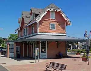 Red Bank Passenger Station |
May 28, 1976 (#76001172) |
Ridge and Monmouth Sts. 40°20′52″N 74°04′30″W |
Red Bank | |
| 79 | River Street School | 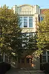 River Street School |
April 14, 1995 (#95000410) |
60 River St. 40°20′35″N 74°04′36″W |
Red Bank | |
| 80 | Romer Shoal Light Station | 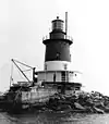 Romer Shoal Light Station |
January 24, 2007 (#06001304) |
In Lower New York Bay, 3.8 miles (6.1 km) north of Sandy Hook 40°30′46″N 74°00′50″W |
Highlands Borough | part of the Light Stations of the United States MPS |
| 81 | Salter's Mill | .JPG.webp) Salter's Mill |
September 29, 1980 (#80002507) |
Imlaystown-Davis Station Rd. 40°09′54″N 74°30′51″W |
Imlaystown | |
| 82 | Sandy Hook Archeological Site | .JPG.webp) Sandy Hook Archeological Site |
June 26, 1998 (#98000704) |
Gateway National Recreation Area, Address Restricted |
Highlands | |
| 83 | Sandy Hook Light | 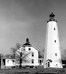 Sandy Hook Light |
October 15, 1966 (#66000468) |
Fort Hancock Military Reservation 40°27′42″N 74°00′09″W |
Sandy Hook | |
| 84 | Seabright Lawn Tennis and Cricket Club | 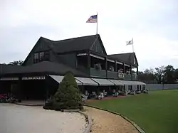 Seabright Lawn Tennis and Cricket Club |
July 9, 1991 (#91000883) |
Jct. of Rumson Rd. and Tennis Court Ln. 40°21′59″N 73°59′01″W |
Rumson | |
| 85 | Seabrook-Wilson House |  Seabrook-Wilson House |
October 29, 1974 (#74001178) |
119 Port Monmouth Rd. 40°26′21″N 74°05′35″W |
Middletown | |
| 86 | Shadow Lawn | 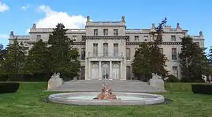 Shadow Lawn |
March 28, 1978 (#78001780) |
Cedar and Norwood Aves. 40°16′46″N 74°00′19″W |
West Long Branch | Also known as Woodrow Wilson Hall, at Monmouth University |
| 87 | Shrewsbury Historic District | 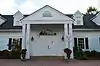 Shrewsbury Historic District |
July 17, 1978 (#78001779) |
Broad and Sycamore Sts. 40°19′23″N 74°03′49″W |
Shrewsbury | |
| 88 | Shrewsbury Township Hall | 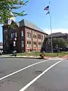 Shrewsbury Township Hall |
December 8, 1980 (#80002508) |
51 Monmouth St. 40°20′57″N 74°04′06″W |
Red Bank | |
| 89 | Squan Beach Life-Saving Station #9 | .JPG.webp) Squan Beach Life-Saving Station #9 |
March 5, 2008 (#08000135) |
Ocean & 2nd Aves. 40°07′03″N 74°02′02″W |
Manasquan | |
| 90 | St. George's-by-the-River Episcopal Church | .JPG.webp) St. George's-by-the-River Episcopal Church |
February 13, 2007 (#07000045) |
7 Lincoln Ave. 40°21′48″N 73°58′43″W |
Rumson | |
| 91 | St. James Memorial Church of Eatontown | 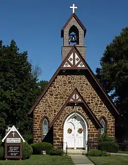 St. James Memorial Church of Eatontown |
February 17, 1978 (#78001775) |
69 Broad St. 40°18′22″N 74°03′26″W |
Eatontown | |
| 92 | St. John's Episcopal Church | .JPG.webp) St. John's Episcopal Church |
December 27, 1990 (#90001374) |
Little Silver Point Rd. 40°20′02″N 74°01′58″W |
Little Silver | |
| 93 | St. Peter's Episcopal Church | 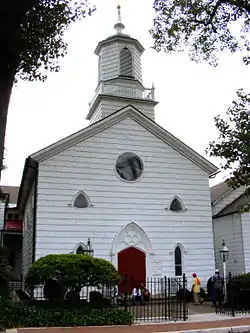 St. Peter's Episcopal Church |
March 19, 1998 (#98000256) |
31 Throckmorton St. 40°15′34″N 74°16′34″W |
Freehold Borough | |
| 94 | Steinbach-Cookman Building | .JPG.webp) Steinbach-Cookman Building |
July 8, 1982 (#82003285) |
Cookman Ave. 40°12′59″N 74°00′37″W |
Asbury Park | |
| 95 | George Taylor House | 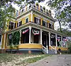 George Taylor House |
April 29, 1994 (#94000392) |
74 Broadway 40°16′03″N 74°16′02″W |
Freehold Borough | |
| 96 | Tinton Falls Historic District |  Tinton Falls Historic District |
November 10, 1977 (#77000888) |
Irregular pattern along Tinton and Sycamore Avenues 40°18′18″N 74°05′57″W |
Tinton Falls | |
| 97 | Twin Lights | Twin Lights |
December 2, 1970 (#70000389) |
South of NJ 36 on a promontory between the Navesink River and Sandy Hook Bay 40°23′48″N 73°59′11″W |
Highlands | |
| 98 | The Towers |  The Towers |
August 20, 2012 (#12000529) |
27 Prospect Circle 40°24′44″N 74°02′01″W |
Atlantic Highlands | |
| 99 | Trinity Church | .jpg.webp) Trinity Church |
August 6, 2014 (#14000465) |
503 Asbury Ave. 40°13′11″N 74°00′29″W |
Asbury Park | |
| 100 | Union Schoolhouse | 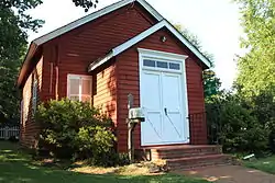 Union Schoolhouse |
June 23, 1976 (#76001173) |
West of Red Bank on Middletown-Lincroft Rd. 40°21′57″N 74°07′14″W |
Middletown | |
| 101 | Upper Freehold Baptist Meeting | .JPG.webp) Upper Freehold Baptist Meeting |
April 21, 1975 (#75001147) |
East of Imlaystown on Red Valley Rd. 40°10′08″N 74°28′28″W |
Imlaystown | |
| 102 | Upper Meeting House of the Baptist Church of Middletown | 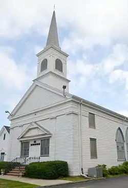 Upper Meeting House of the Baptist Church of Middletown |
December 7, 1990 (#87002573) |
40 Main St. 40°20′41″N 74°11′11″W |
Holmdel | |
| 103 | Village Inn | 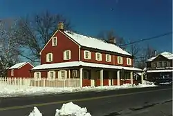 Village Inn |
November 13, 1972 (#72000802) |
Water and Main Sts. 40°17′50″N 74°21′34″W |
Englishtown | |
| 104 | Walker-Combs-Hartshorne Farmstead | 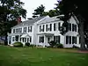 Walker-Combs-Hartshorne Farmstead |
October 4, 1990 (#90001474) |
189 Wemrock Rd. 40°14′51″N 74°18′22″W |
Freehold | |
| 105 | Walnford |  Walnford |
June 29, 1976 (#76001167) |
South of Allentown off CR 539 40°08′03″N 74°33′32″W |
Allentown | |
| 106 | Wardell House |  Wardell House |
July 24, 1974 (#74001181) |
419 Sycamore Ave. 40°19′22″N 74°03′46″W |
Shrewsbury | |
| 107 | Water Witch Club Casino |  Water Witch Club Casino |
August 13, 1990 (#90001219) |
Jct. of E. Twin Rd. and W. Twin Rd. 40°24′00″N 73°59′39″W |
Highlands | |
| 108 | Water Witch Club Historic District |  Water Witch Club Historic District |
March 12, 2004 (#04000147) |
Roughly bounded by NJ 36, Water Witch Dr., Sea View Terrace, Park Way, Windlass Path and Serpentine Dr. 40°24′02″N 73°59′49″W |
Middletown Township | |
| 109 | Robert White House | .JPG.webp) Robert White House |
March 7, 2012 (#12000077) |
20 South St. 40°20′45″N 74°03′43″W |
Red Bank | |
| 110 | Winsor Building | .JPG.webp) Winsor Building |
September 13, 1979 (#79001513) |
400-420 Main St. and 715-131 Bangs Ave 40°13′02″N 74°00′42″W |
Asbury Park | |
| 111 | George Wurts Summer Home | .JPG.webp) George Wurts Summer Home |
December 28, 1989 (#89002162) |
306 Eighth Ave. 40°13′41″N 74°00′07″W |
Asbury Park |
Former listings
| [3] | Name on the Register | Image | Date listed | Date removed | Location | City or town | Summary |
|---|---|---|---|---|---|---|---|
| 1 | Anderson House | May 17, 1972 (#72001498) | 1976 | East of Manalapan on NJ 33 |
Manalapan Township | ||
| 2 | Elberon Railroad Station | June 9, 1978 (#78001777) | October 30, 1990 | Lincoln Ave. |
Long Branch City | Destroyed by fire | |
| 3 | Mayfair Theatre | 1974 (#74002229) | 1975 | Lake Ave. and St. James Pl. |
Asbury Park | Demolished in November 1974.[6] | |
| 4 | North American Phalanx | _-_North_American_Phalanx%252C_Country_Route_537%252C_Phalanx%252C_Monmouth_County%252C_NJ_HABS_NJ%252C13-PHAL%252C1-5.tif.jpg.webp) North American Phalanx |
1972 (#72001499) | 1974 | Phalanx Rd. |
Colts Neck Township | Destroyed by fire November 15, 1972 |
References
| Wikimedia Commons has media related to National Register of Historic Places in Monmouth County, New Jersey. |
- The latitude and longitude information provided in this table was derived originally from the National Register Information System, which has been found to be fairly accurate for about 99% of listings. Some locations in this table may have been corrected to current GPS standards.
- "National Register of Historic Places: Weekly List Actions". National Park Service, United States Department of the Interior. Retrieved on January 29, 2021.
- Numbers represent an alphabetical ordering by significant words. Various colorings, defined here, differentiate National Historic Landmarks and historic districts from other NRHP buildings, structures, sites or objects.
- "National Register Information System". National Register of Historic Places. National Park Service. April 24, 2008.
- The eight-digit number below each date is the number assigned to each location in the National Register Information System database, which can be viewed by clicking the number.
| Topics | 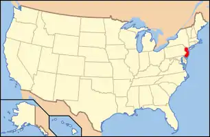 | ||
|---|---|---|---|
| Lists by county | |||
| Lists by city |
| ||
| Other lists | |||
| |||
This article is issued from Wikipedia. The text is licensed under Creative Commons - Attribution - Sharealike. Additional terms may apply for the media files.