National Register of Historic Places listings in Gloucester County, New Jersey
List of the National Register of Historic Places listings in Gloucester County, New Jersey
| Atlantic – Bergen – Burlington – Camden – Cape May – Cumberland – Essex – Gloucester – Hudson – Hunterdon – Mercer – Middlesex – Monmouth – Morris – Ocean – Passaic – Salem – Somerset – Sussex – Union – Warren |
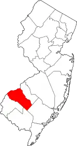
Location of Gloucester County in New Jersey
This is intended to be a complete list of properties and districts listed on the National Register of Historic Places in Gloucester County, New Jersey. The locations of National Register properties and districts (at least for all showing latitude and longitude coordinates below) may be seen in an online map by clicking on "Map of all coordinates".[1]
- This National Park Service list is complete through NPS recent listings posted January 29, 2021.[2]
| [3] | Name on the Register[4] | Image | Date listed[5] | Location | City or town | Description |
|---|---|---|---|---|---|---|
| 1 | Barnsboro Hotel |  Barnsboro Hotel |
January 25, 1973 (#73001095) |
Jct. of Pitman and Sewell Rds. 39°45′42″N 75°09′37″W |
Mantua Township | |
| 2 | Butler Farm | 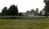 Butler Farm |
December 1, 1978 (#78001763) |
E of Swedesboro 39°44′09″N 75°16′17″W |
Swedesboro | |
| 3 | Carpenter Street School | 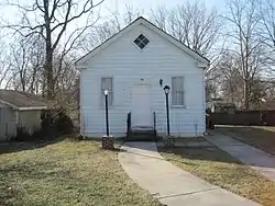 Carpenter Street School |
August 21, 1997 (#97000934) |
53–55 Carpenter St. 39°49′54″N 75°09′16″W |
Woodbury | |
| 4 | Jesse Chew House | .JPG.webp) Jesse Chew House |
October 18, 1972 (#72000797) |
611 Mantua Blvd. 39°46′25″N 75°08′58″W |
Sewell | |
| 5 | Benjamin Clark House | 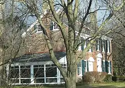 Benjamin Clark House |
January 25, 1973 (#73001099) |
Glassboro Rd. 39°47′07″N 75°08′15″W |
Wenonah | |
| 6 | Downer Methodist Episcopal Church | 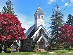 Downer Methodist Episcopal Church |
October 14, 2010 (#10000835) |
2226 Fries Mill Rd. 39°41′34″N 75°03′08″W |
Monroe Township | |
| 7 | Free Library and Reading Room–Williamstown Memorial Library | 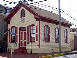 Free Library and Reading Room–Williamstown Memorial Library |
October 1, 1987 (#87001761) |
405 S. Main St. 39°40′57″N 74°59′27″W |
Williamstown | |
| 8 | G. G. Green's Block | 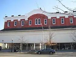 G. G. Green's Block |
July 25, 2001 (#01000769) |
108 S. Broad St. 39°50′11″N 75°09′16″W |
Woodbury | |
| 9 | Hall Street School | 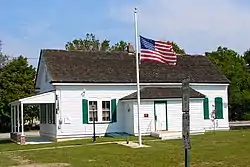 Hall Street School |
September 27, 2006 (#06000879) |
30 Hall St. 39°41′03″N 74°59′31″W |
Monroe Township | |
| 10 | Hunter–Lawrence–Jessup House | 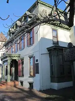 Hunter–Lawrence–Jessup House |
October 18, 1972 (#72000798) |
58 N. Broad St. 39°50′22″N 75°09′07″W |
Woodbury | |
| 11 | Ladd's Castle | 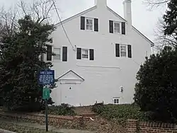 Ladd's Castle |
October 31, 1972 (#72000794) |
1337 Lafayette Ave. 39°51′28″N 75°08′37″W |
Colonial Manor | |
| 12 | Memorial Presbyterian Church | 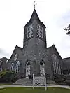 Memorial Presbyterian Church |
August 7, 2013 (#13000585) |
202 E. Mantua Ave. 39°47′28″N 75°08′48″W |
Wenonah | |
| 13 | Moravian Church | 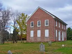 Moravian Church |
April 3, 1973 (#73001097) |
Swedesboro–Sharptown Rd. 39°42′05″N 75°19′58″W |
Woolwich Township | |
| 14 | George Jr. and Sarah Morgan House | 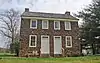 George Jr. and Sarah Morgan House |
April 8, 2019 (#100003593) |
208 Egg Harbor Rd. 39°46′38″N 75°05′40″W |
Washington Township | |
| 15 | Mount Zion African Methodist Episcopal Church and Mount Zion Cemetery | 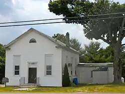 Mount Zion African Methodist Episcopal Church and Mount Zion Cemetery |
July 25, 2001 (#01000768) |
172 Garwin Rd. 39°45′54″N 75°17′50″W |
Woolwich | |
| 16 | Mullica Hill Historic District | 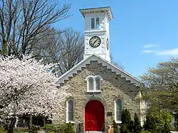 Mullica Hill Historic District |
April 25, 1991 (#91000483) |
Roughly, Main St. from Mullica Hill–Bridgeport Rd. to jct. of Commissioner's Rd. and Bridgeton Pike, Harrison Township 39°44′10″N 75°13′31″W |
Mullica Hill | |
| 17 | C. A. Nothnagle Log House | 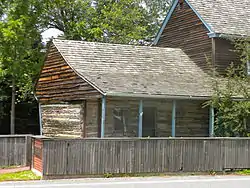 C. A. Nothnagle Log House |
April 23, 1976 (#76001153) |
Swedesboro–Paulsboro Rd. 39°49′05″N 75°15′59″W |
Gibbstown | |
| 18 | Bodo Otto House |  Bodo Otto House |
December 12, 1976 (#76001154) |
SR 551 and Quaker Rd. 39°47′18″N 75°14′25″W |
Mickleton | |
| 19 | Pitman Grove | 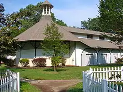 Pitman Grove |
August 19, 1977 (#77000870) |
Bounded by Holly, East, Laurel, and West Aves. (both sides) 39°43′50″N 75°07′58″W |
Pitman | |
| 20 | Red Bank Battlefield |  Red Bank Battlefield |
October 31, 1972 (#72000796) |
E bank of Delaware River and W end of Hessian Ave. 39°52′13″N 75°11′25″W |
National Park | |
| 21 | Richardson Avenue School | 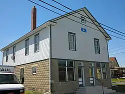 Richardson Avenue School |
June 18, 1998 (#98000703) |
Richardson Ave. 39°44′51″N 75°18′49″W |
Swedesboro | |
| 22 | Richwood Methodist Church | 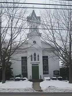 Richwood Methodist Church |
January 19, 1979 (#79001490) |
Elmer Rd. 39°43′18″N 75°10′01″W |
Harrison Township | |
| 23 | John C. Rulon House | 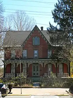 John C. Rulon House |
November 22, 2000 (#00001404) |
1428 Kings Highway 39°44′52″N 75°18′36″W |
Swedesboro | |
| 24 | Salisbury Farm | March 7, 1979 (#79001489) |
Address Restricted |
Bridgeport | ||
| 25 | St. Peter's Episcopal Church | .JPG.webp) St. Peter's Episcopal Church |
August 10, 1977 (#77000869) |
King's Hwy. 39°47′58″N 75°13′28″W |
Clarksboro | |
| 26 | St. Thomas Episcopal Church | 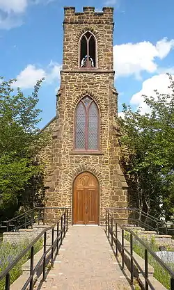 St. Thomas Episcopal Church |
March 3, 1975 (#75001137) |
SE corner Main and Focer Sts. 39°42′28″N 75°06′37″W |
Glassboro | |
| 27 | Gov. Charles C. Stratton House | 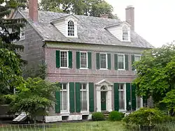 Gov. Charles C. Stratton House |
January 29, 1973 (#73001101) |
0.5 mi. E of Swedesboro on King's Hwy. 39°45′07″N 75°18′10″W |
Woolwich Township | |
| 28 | Thompson House | .JPG.webp) Thompson House |
July 13, 1988 (#88000996) |
103 Penn St. 39°50′00″N 75°09′34″W |
Woodbury | Burned down on January 14, 2012 |
| 29 | Tinicum Island Rear Range Light Station | 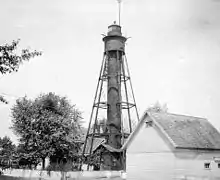 Tinicum Island Rear Range Light Station |
September 15, 2005 (#05001053) |
250 ft. S o jct. of Beacon Ave. and Second St. 39°50′51″N 75°14′24″W |
Billingsport | |
| 30 | Trinity Church | 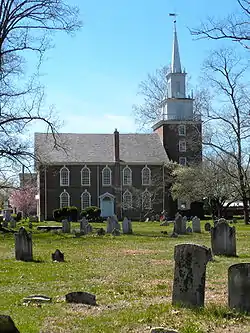 Trinity Church |
January 29, 1973 (#73001098) |
NW corner of Church St. and King's Hwy. 39°45′00″N 75°18′26″W |
Swedesboro | |
| 31 | Upper Greenwich Friends Meetinghouse | 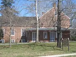 Upper Greenwich Friends Meetinghouse |
February 28, 1997 (#97000062) |
413 Kings Hwy., E. Greenwich Township 39°47′27″N 75°14′16″W |
Mickleton | |
| 32 | West Jersey Rail Road Glassboro Depot | 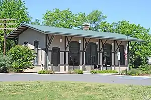 West Jersey Rail Road Glassboro Depot |
April 14, 2020 (#100005179) |
354 Oakwood Ave. 39°42′17″N 75°07′16″W |
Glassboro | |
| 33 | James Whitall Jr. House |  James Whitall Jr. House |
February 6, 1973 (#73001096) |
100 Grove Ave. 39°51′52″N 75°10′49″W |
National Park | |
| 34 | Whitney Mansion |  Whitney Mansion |
December 5, 1972 (#72000795) |
Whitney Ave. 39°42′22″N 75°07′06″W |
Glassboro | |
| 35 | Woodbury Friends' Meetinghouse | .JPG.webp) Woodbury Friends' Meetinghouse |
February 6, 1973 (#73001100) |
120 N. Broad St. 39°50′26″N 75°09′04″W |
Woodbury |
See also
| Wikimedia Commons has media related to National Register of Historic Places in Gloucester County, New Jersey. |
References
- The latitude and longitude information provided in this table was derived originally from the National Register Information System, which has been found to be fairly accurate for about 99% of listings. Some locations in this table may have been corrected to current GPS standards.
- "National Register of Historic Places: Weekly List Actions". National Park Service, United States Department of the Interior. Retrieved on January 29, 2021.
- Numbers represent an alphabetical ordering by significant words. Various colorings, defined here, differentiate National Historic Landmarks and historic districts from other NRHP buildings, structures, sites or objects.
- "National Register Information System". National Register of Historic Places. National Park Service. April 24, 2008.
- The eight-digit number below each date is the number assigned to each location in the National Register Information System database, which can be viewed by clicking the number.
| Topics | 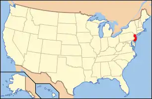 | ||
|---|---|---|---|
| Lists by county | |||
| Lists by city |
| ||
| Other lists | |||
| |||
Municipalities and communities of Gloucester County, New Jersey, United States | ||
|---|---|---|
| City | Map of New Jersey highlighting Gloucester County | |
| Boroughs | ||
| Townships | ||
| CDPs | ||
| Other unincorporated communities |
| |
| ||
This article is issued from Wikipedia. The text is licensed under Creative Commons - Attribution - Sharealike. Additional terms may apply for the media files.