National Register of Historic Places listings in Clark County, Washington
This list presents the full set of buildings, structures, objects, sites, or districts designated on the National Register of Historic Places in Clark County, Washington, and offers brief descriptive information about each of them. The National Register recognizes places of national, state, or local historic significance across the United States.[1] Out of over 90,000 National Register sites nationwide,[2] Washington is home to approximately 1,500,[3] and 44 of those are found partially or wholly in Clark County.
- This National Park Service list is complete through NPS recent listings posted January 29, 2021.[4]
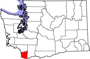
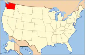
Location of Clark County in Washington
Current listings
| [5] | Name on the Register[6] | Image | Date listed[7] | Location | City or town | Description |
|---|---|---|---|---|---|---|
| 1 | Amboy United Brethren Church |  Amboy United Brethren Church |
December 4, 2008 (#08001184) |
21416 NE 399th Street 45°54′37″N 122°27′12″W |
Amboy | |
| 2 | Anderson–Beletski Prune Farm |  Anderson–Beletski Prune Farm |
May 15, 1986 (#86001100) |
13220 Northwest 42nd Court 45°43′01″N 122°42′51″W |
Vancouver | Farm was subdivided and most properties demolished or developed. Only the farm house is still standing in its original location. |
| 3 | Arndt Prune Dryer |  Arndt Prune Dryer |
October 4, 1979 (#79002527) |
2109 Northwest 219th Street 45°46′43″N 122°41′37″W |
Ridgefield | |
| 4 | Basalt Cobblestone Quarries District |  Basalt Cobblestone Quarries District |
December 14, 1981 (#81000587) |
Roghly bounded by Gee Creek, Lake River and BNSF Railway, about 2 miles (3.2 km) northwest of Ridgefield, in Ridgefield National Wildlife Refuge 45°50′25″N 122°45′45″W |
Ridgefield | The 535 acres (217 ha) area comprises 7 basalt quarries. |
| 5 | Cedar Creek Grist Mill | 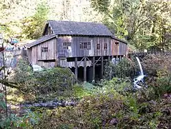 Cedar Creek Grist Mill |
March 26, 1975 (#75001844) |
43907 Northeast Grist Mill Road 45°56′18″N 122°35′00″W |
Woodland | |
| 6 | Chumasero–Smith House |  Chumasero–Smith House |
April 7, 1998 (#98000282) |
310 West 11th Street 45°37′47″N 122°40′28″W |
Vancouver | |
| 7 | Clark County Courthouse | .jpg.webp) Clark County Courthouse |
April 11, 2014 (#14000165) |
1200 Franklin Street 45°37′49″N 122°40′40″W |
Vancouver | |
| 8 | Clark County Poor Farm – Southwestern Washington Experiment Station | .jpg.webp) Clark County Poor Farm – Southwestern Washington Experiment Station |
January 7, 2013 (#12001159) |
1919 Northeast 78th Street 45°40′42″N 122°39′06″W |
Vancouver | Actually hosting the Washington State University Extension of Clark County. |
| 9 | Covington House | 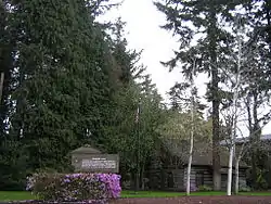 Covington House |
May 5, 1972 (#72001268) |
4201 Main Street 45°39′09″N 122°39′59″W |
Vancouver | |
| 10 | Elks Building | 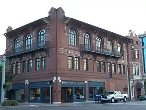 Elks Building |
July 14, 1983 (#83003322) |
916 Main Street 45°37′43″N 122°40′19″W |
Vancouver | |
| 11 | Evergreen Hotel | 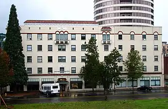 Evergreen Hotel |
January 1, 1979 (#79002529) |
500 Main Street 45°37′31″N 122°40′19″W |
Vancouver | |
| 12 | Farrell Building | 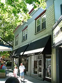 Farrell Building |
March 15, 2006 (#06000135) |
305 Northeast 4th Avenue 45°35′08″N 122°24′18″W |
Camas | |
| 13 | Fort Vancouver National Historic Site | 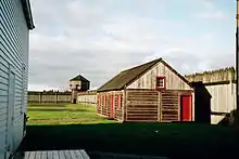 Fort Vancouver National Historic Site |
October 15, 1966 (#66000370) |
Roughly bounded by Lewis and Clark Highway, Interstate 5, East Evergreen Boulevard and East Reserve Street 45°37′27″N 122°39′40″W |
Vancouver | |
| 14 | Glenwood School |  Glenwood School |
June 11, 1992 (#92000697) |
13305 Northeast 87th Avenue 45°43′06″N 122°35′00″W |
Glenwood | Included in the Rural Public Schools of Washington State MPS. |
| 15 | Albert and Letha Green House and Barn |  Albert and Letha Green House and Barn |
February 19, 1982 (#82004202) |
25716 NE Lewisville Highway 45°48′33″N 122°32′53″W |
Battle Ground vicinity | |
| 16 | Henry Heisen House | 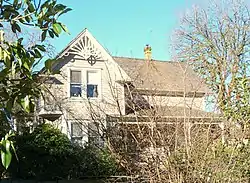 Henry Heisen House |
October 4, 1979 (#79002526) |
27904 NE 174th Avenue 45°49′29″N 122°29′38″W |
Heisson | |
| 17 | Hidden Houses |  Hidden Houses |
November 29, 1978 (#78002737) |
100 and 110 W. 13th Street 45°37′53″N 122°40′16″W |
Vancouver | |
| 18 | House of Providence | .JPG.webp) House of Providence |
December 1, 1978 (#78002738) |
400 E. Evergreen Boulevard 45°37′47″N 122°40′01″W |
Vancouver | |
| 19 | John P. and Mary Kiggins House |  John P. and Mary Kiggins House |
June 30, 1995 (#95000804) |
411 E. Evergreen Boulevard 45°37′47″N 122°40′01″W |
Vancouver | |
| 20 | Kiggins Theater | 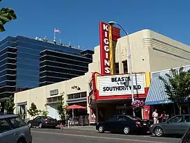 Kiggins Theater |
July 17, 2012 (#12000421) |
1011 Main Street 45°37′45″N 122°40′17″W |
Vancouver | part of the Movie Theaters in Washington State Multiple Property Submission |
| 21 | Lambert School |  Lambert School |
March 16, 1989 (#89000216) |
21814 NW 11th Avenue 45°46′47″N 122°40′55″W |
Ridgefield | Rural Public Schools of Washington State MPS |
| 22 | Judge Columbia Lancaster House | 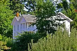 Judge Columbia Lancaster House |
February 20, 1975 (#75001843) |
North of Ridgefield on Lancaster Road 45°51′48″N 122°44′52″W |
Ridgefield | |
| 23 | Lewisville Park |  Lewisville Park |
May 28, 1986 (#86001202) |
26411 NE Lewisville Highway 45°49′02″N 122°32′23″W |
Battle Ground | |
| 24 | Luepke Florist |  Luepke Florist |
May 17, 2016 (#16000293) |
1300 Washington Street 45°37′52″N 122°40′23″W |
Vancouver | |
| 25 | Heye H. and Eva Meyer Farmstead |  Heye H. and Eva Meyer Farmstead |
January 7, 2015 (#14001142) |
13705 NE 50th Avenue 45°43′17″N 122°37′11″W |
Vancouver | |
| 26 | Officers Row, Fort Vancouver Barracks | 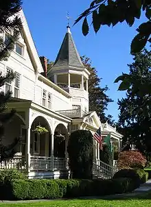 Officers Row, Fort Vancouver Barracks |
November 11, 1974 (#74001948) |
611–1616 E. Evergreen Boulevard 45°37′41″N 122°39′30″W |
Vancouver | |
| 27 | Parkersville Site |  Parkersville Site |
August 11, 1976 (#76001880) |
24 S A St. 45°34′46″N 122°22′55″W |
Washougal | |
| 28 | Pittock House |  Pittock House |
July 3, 1979 (#79003148) |
114 NE Leadbetter Road 45°37′21″N 122°25′42″W |
Camas | |
| 29 | Pomeroy Farm |  Pomeroy Farm |
March 13, 1987 (#87000413) |
20902 NE Lucia Falls Road 45°50′27″N 122°27′30″W |
Yacolt | |
| 30 | John Roffler House | .JPG.webp) John Roffler House |
April 29, 1993 (#93000368) |
1437 NE Everett Street 45°35′27″N 122°24′16″W |
Camas | |
| 31 | Sara Store |  Sara Store |
March 30, 1995 (#95000304) |
17903 NW 41st Avenue 45°45′24″N 122°42′41″W |
Ridgefield | |
| 32 | William Henry Shobert House |  William Henry Shobert House |
October 4, 1979 (#79002528) |
621 Shobert Lane 45°48′40″N 122°44′26″W |
Ridgefield | |
| 33 | Slocum House |  Slocum House |
January 18, 1973 (#73001867) |
605 Esther Street 45°38′07″N 122°40′27″W |
Vancouver | |
| 34 | John Stanger House |  John Stanger House |
May 17, 1990 (#90000785) |
9213 SE Evergreen Highway 45°36′24″N 122°34′42″W |
Vancouver | |
| 35 | U.S. National Bank Building | 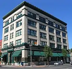 U.S. National Bank Building |
December 29, 1988 (#84004010) |
601 Main Street 45°37′34″N 122°40′13″W |
Vancouver | |
| 36 | U.S. Post Office – Camas Main |  U.S. Post Office – Camas Main |
August 7, 1991 (#91000639) |
440 NE 5th Avenue 45°35′12″N 122°24′18″W |
Camas | |
| 37 | U.S. Post Office – Vancouver Main |  U.S. Post Office – Vancouver Main |
May 30, 1991 (#91000659) |
1211 Daniels Street 45°37′51″N 122°40′24″W |
Vancouver | |
| 38 | Vancouver National Historic Reserve Historic District | 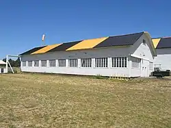 Vancouver National Historic Reserve Historic District |
January 5, 2007 (#06001216) |
Roughly bounded by an alley north of Officers Row, East Reserve Street, Columbia River, and Interstate 5 45°37′35″N 122°39′19″W |
Vancouver | |
| 39 | Vancouver Public Library | 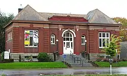 Vancouver Public Library |
August 3, 1982 (#82004204) |
1511 Main Street 45°38′00″N 122°40′12″W |
Vancouver | Carnegie Libraries of Washington TR |
| 40 | Vancouver Telephone Building | 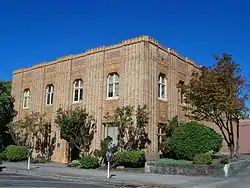 Vancouver Telephone Building |
November 6, 1986 (#86003092) |
112 W. 11th Street 45°37′48″N 122°40′16″W |
Vancouver | |
| 41 | Vancouver–Portland Bridge | 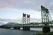 Vancouver–Portland Bridge |
July 16, 1982 (#82004205) |
Spanning the Columbia River on Interstate 5 northbound[8] 45°37′04″N 122°40′30″W |
Vancouver | Historic Bridges and Tunnels in Washington TR |
| 42 | Venersborg School |  Venersborg School |
March 16, 1989 (#89000215) |
Junction of NE 209th Street and NE 242nd Avenue 45°46′23″N 122°25′25″W |
Battle Ground vicinity | Rural Public Schools of Washington State MPS |
| 43 | Washington School for the Blind |  Washington School for the Blind |
May 14, 1993 (#93000370) |
2214 E. 13th Street 45°38′24″N 122°38′46″W |
Vancouver | |
| 44 | Yale Bridge | .jpg.webp) Yale Bridge |
July 16, 1982 (#82004206) |
Spanning the Lewis River on State Route 503 (see also Cowlitz County) 45°57′40″N 122°22′18″W |
Yale | Historic Bridges and Tunnels in Washington TR |
Former listings
| [5] | Name on the Register | Image | Date listed | Date removed | Location | City or town | Summary |
|---|---|---|---|---|---|---|---|
| 1 | Ridgefield American Women's League Chapter House | June 2, 1982 (#82004203) | July 16, 1990 | 406 N. 1st Street |
Yale |
See also
References
- Andrus, Patrick W.; Shrimpton, Rebecca H.; et al. (2002), How to Apply the National Register Criteria for Evaluation, National Register Bulletin, National Park Service, U.S. Department of the Interior, retrieved June 20, 2014.
- National Park Service, National Register of Historic Places Program: Research, retrieved January 28, 2015.
- Department of Archaeology and Historic Preservation, Washington Information System for Architectural and Archaeological Records Data (WISAARD), retrieved February 14, 2015.
- "National Register of Historic Places: Weekly List Actions". National Park Service, United States Department of the Interior. Retrieved on January 29, 2021.
- Numbers represent an alphabetical ordering by significant words. Various colorings, defined here, differentiate National Historic Landmarks and historic districts from other NRHP buildings, structures, sites or objects.
- "National Register Information System". National Register of Historic Places. National Park Service. April 24, 2008.
- The eight-digit number below each date is the number assigned to each location in the National Register Information System database, which can be viewed by clicking the number.
- Oregon Parks and Recreation Department, Oregon Historic Sites Database: Portland-Vancouver Highway Bridge, archived from the original on March 3, 2016, retrieved October 16, 2016.
External links
- Washington Department of Archaeology and Historic Preservation, Historic Register program
- National Park Service, National Register of Historic Places site
 Media related to National Register of Historic Places in Clark County, Washington at Wikimedia Commons
| Lists by county |
|  |
|---|---|---|
| Other lists |
| |
| Topics | |
|---|---|
| Lists by state |
|
| Lists by insular areas | |
| Lists by associated state | |
| Other areas | |
| Related | |
| |
Municipalities and communities of Clark County, Washington, United States | ||
|---|---|---|
| Cities | Map of Washington highlighting Clark County | |
| Town | ||
| CDPs | ||
| Other unincorporated communities | ||
| Footnotes | ‡This populated place also has portions in an adjacent county or counties | |
| ||
This article is issued from Wikipedia. The text is licensed under Creative Commons - Attribution - Sharealike. Additional terms may apply for the media files.