National Register of Historic Places listings in Whitman County, Washington
This list presents the full set of buildings, structures, objects, sites, or districts designated on the National Register of Historic Places in Whitman County, Washington, and offers brief descriptive information about each of them. The National Register recognizes places of national, state, or local historic significance across the United States.[1] Out of over 90,000 National Register sites nationwide,[2] Washington is home to approximately 1,500,[3] and 35 of those are found in Whitman County.
- This National Park Service list is complete through NPS recent listings posted January 29, 2021.[4]
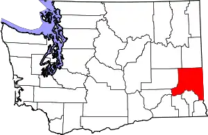
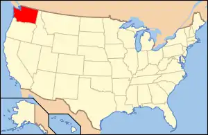
Location of Whitman County in Washington
Current listings
| [5] | Name on the Register | Image | Date listed[6] | Location | City or town | Description |
|---|---|---|---|---|---|---|
| 1 | J. C. Barron Flour Mill | 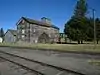 J. C. Barron Flour Mill |
February 8, 1978 (#78002788) |
1st and Jackson Sts. 47°07′49″N 117°14′27″W |
Oakesdale | |
| 2 | Canyon Grain Bin and Chutes | 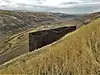 Canyon Grain Bin and Chutes |
September 22, 1988 (#88001539) |
E of County Rd. 7030, 2 mi (3.2 km). NE of jct. County Rds. 7030 and 7010 46°37′46″N 118°03′12″W |
Hay | |
| 3 | Central Service Station | 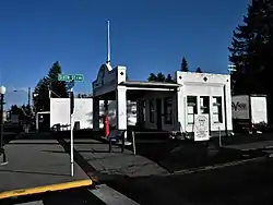 Central Service Station |
April 24, 2007 (#07000365) |
534 Whitman St. 47°14′10″N 117°22′07″W |
Rosalia | |
| 4 | College Hill Historic District | 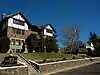 College Hill Historic District |
November 3, 2006 (#06000701) |
Roughly bounded by Stadium Way, B St., Howard St., and Indiana St. 46°44′19″N 117°10′13″W |
Pullman | |
| 5 | Collins House and Granary | 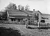 Collins House and Granary |
July 30, 1974 (#74001993) |
SE of Uniontown off U.S. 195 46°28′26″N 117°03′00″W |
Uniontown | Also known as the O. M. Collins House. |
| 6 | Cordova Theater | 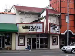 Cordova Theater |
March 18, 2004 (#04000200) |
135 N. Grand Ave. 46°43′57″N 117°10′54″W |
Pullman | |
| 7 | F Street Bridge | 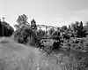 F Street Bridge |
July 16, 1982 (#82004308) |
Spans Palouse River 46°54′36″N 117°04′07″W |
Palouse | Historic Bridges and Tunnels in Washington TR |
| 8 | Florence Ferguson House | 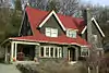 Florence Ferguson House |
April 19, 2011 (#10000996) |
504 North Mill Street 46°53′02″N 117°21′48″W |
Colfax | |
| 9 | Edwin H. Hanford House | 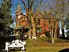 Edwin H. Hanford House |
May 15, 1986 (#86001068) |
North of WA 217 47°07′33″N 117°13′25″W |
Oakesdale | |
| 10 | Gustave Heilsberg Farm |  Gustave Heilsberg Farm |
September 22, 1988 (#88001534) |
Rt. 2 46°48′23″N 117°29′14″W |
Colfax | |
| 11 | Henley Site | September 19, 1977 (#77001369) |
Address Restricted |
Hay | ||
| 12 | Holy Trinity Episcopal Church | 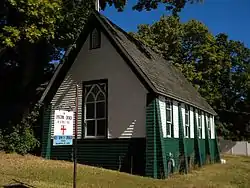 Holy Trinity Episcopal Church |
March 30, 2005 (#05000249) |
105 E. Alder St. 46°54′50″N 117°04′37″W |
Palouse | |
| 13 | Interior Grain Tramway |  Interior Grain Tramway |
September 22, 1988 (#88001538) |
Snake River Canyon, 2 mi (3.2 km). N of Wawawai 46°39′43″N 117°22′38″W |
Pullman | |
| 14 | T. A. Leonard Barn |  T. A. Leonard Barn |
May 2, 1986 (#86000963) |
S side of Old Moscow Hwy. 46°42′16″N 117°07′23″W |
Pullman | |
| 15 | Manning-Rye Covered Bridge | 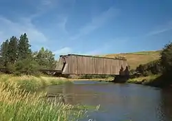 Manning-Rye Covered Bridge |
July 16, 1982 (#82004307) |
Spans Palouse River 46°55′42″N 117°24′55″W |
Colfax | Open top covered bridge converted from a railway bridge. Also known as the Harpole Bridge. Historic Bridges and Tunnels in Washington TR; Destroyed by range fire September 7-8, 2020. |
| 16 | Masonic Hall |  Masonic Hall |
February 12, 1987 (#87000057) |
Corner of Main and Second Sts. 47°05′25″N 117°02′40″W |
Farmington | |
| 17 | R. C. McCroskey House | .jpg.webp) R. C. McCroskey House |
November 21, 1974 (#74001992) |
4th and Manring Sts. 47°00′46″N 117°08′32″W |
Garfield | Residence of R. C. McCroskey |
| 18 | McGregor Ranch | 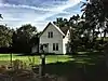 McGregor Ranch |
September 22, 1988 (#88001535) |
6 mi (9.7 km). S of Hooper 46°42′53″N 118°04′27″W |
Hooper | |
| 19 | Northern Pacific Railway Depot - Pullman |  Northern Pacific Railway Depot - Pullman |
August 26, 2019 (#100004328) |
330 N. Grand Ave. 46°43′53″N 117°10′45″W |
Pullman | |
| 20 | Oakesdale City Hall | 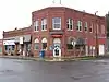 Oakesdale City Hall |
April 29, 1993 (#93000360) |
E. 101 Steptoe 47°07′42″N 117°14′29″W |
Oakesdale | |
| 21 | Palouse Main Street Historic District | 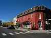 Palouse Main Street Historic District |
May 8, 1986 (#86001026) |
Main St. between K and Mary Sts. 46°54′36″N 117°04′31″W |
Palouse | |
| 22 | James A. Perkins House | 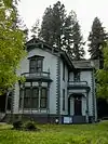 James A. Perkins House |
December 11, 1972 (#72001283) |
N. 623 Perkins St. 46°53′15″N 117°22′00″W |
Colfax | |
| 23 | Pullman High School |  Pullman High School |
August 6, 1998 (#98001017) |
115 NW State St. 46°43′52″N 117°10′56″W |
Pullman | Now the Gladish Community & Cultural Center. |
| 24 | Rosalia Railroad Bridge | 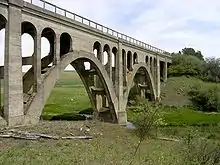 Rosalia Railroad Bridge |
July 16, 1982 (#82004310) |
WA 271 47°13′15″N 117°21′24″W |
Rosalia | Historic Bridges and Tunnels in Washington TR |
| 25 | St. Boniface Church, Convent and Rectory | 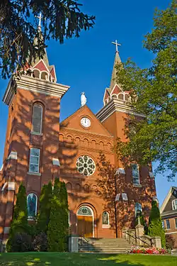 St. Boniface Church, Convent and Rectory |
December 9, 1994 (#94001433) |
206 St. Boniface St. 46°32′25″N 117°05′27″W |
Uniontown | |
| 26 | Star Route and Palouse Street Brick Road |  Star Route and Palouse Street Brick Road |
April 15, 2014 (#14000168) |
Part of NE Maple and Palouse streets 46°43′50″N 117°10′41″W |
Pullman | |
| 27 | Max Steinke Barn | 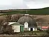 Max Steinke Barn |
September 22, 1988 (#88001536) |
Rt. 1, Box 130 47°06′56″N 117°40′25″W |
St. John | |
| 28 | Steptoe Battlefield Site | 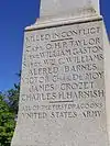 Steptoe Battlefield Site |
May 6, 1976 (#76001924) |
SE of Rosalia 47°13′46″N 117°21′49″W |
Rosalia | |
| 29 | Stevens Hall | 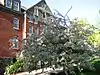 Stevens Hall |
March 26, 1979 (#79002567) |
Campus and Administration Sts. 46°43′54″N 117°09′55″W |
Pullman | |
| 30 | William Swain House |  William Swain House |
July 28, 1994 (#94000801) |
W. 315 Main St. 46°43′51″N 117°11′01″W |
Pullman | |
| 31 | Tekoa Grain Company Elevator & Flathouse | 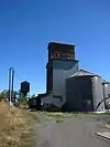 Tekoa Grain Company Elevator & Flathouse |
September 22, 1988 (#88001537) |
4 mi (6.4 km). W of Tekoa 47°13′22″N 117°08′46″W |
Lone Pine | |
| 32 | Albert W. Thompson Hall |  Albert W. Thompson Hall |
March 1, 1973 (#73001894) |
Administration Rd. on Washington State University campus 46°43′53″N 117°09′57″W |
Pullman | |
| 33 | United Presbyterian Church | 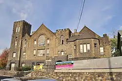 United Presbyterian Church |
December 7, 1989 (#89002095) |
430 Maple St. 46°43′54″N 117°10′32″W |
Pullman | |
| 34 | U.S. Post Office – Colfax Main | 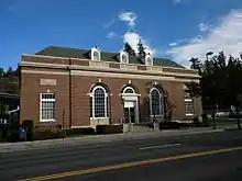 U.S. Post Office – Colfax Main |
May 30, 1991 (#91000643) |
211 S. Main St. 46°52′45″N 117°21′52″W |
Colfax | |
| 35 | U.S. Post Office – Pullman | 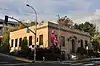 U.S. Post Office – Pullman |
August 21, 2003 (#03000810) |
SE 245 Paradise St. 46°43′44″N 117°10′46″W |
Pullman |
Former listings
| [5] | Name on the Register | Image | Date listed | Date removed | Location | City or town | Summary |
|---|---|---|---|---|---|---|---|
| 1 | Elberton Historic District | 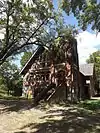 Elberton Historic District |
May 26, 1977 (#77001368) | July 16, 1990 | Off WA 272 at Palouse River |
Elberton | |
| 2 | McClure Bridge | .jpg.webp) McClure Bridge |
July 16, 1982 (#82004309) | July 16, 1990 | Spans Palouse River |
Palouse |
See also
- National Register of Historic Places listings in Washington state
- Listings in neighboring counties: Adams, Asotin, Benewah, Columbia, Franklin, Garfield, Latah, Lincoln, Nez Perce, Spokane
- Historic preservation
- History of Washington (state)
- Index of Washington-related articles
References
- Andrus, Patrick W.; Shrimpton, Rebecca H.; et al. (2002), How to Apply the National Register Criteria for Evaluation, National Register Bulletin, National Park Service, U.S. Department of the Interior, retrieved June 20, 2014.
- National Park Service, National Register of Historic Places Program: Research, retrieved January 28, 2015.
- Department of Archaeology and Historic Preservation, Washington Information System for Architectural and Archaeological Records Data (WISAARD), retrieved February 14, 2015.
- "National Register of Historic Places: Weekly List Actions". National Park Service, United States Department of the Interior. Retrieved on January 29, 2021.
- Numbers represent an alphabetical ordering by significant words. Various colorings, defined here, differentiate National Historic Landmarks and historic districts from other NRHP buildings, structures, sites or objects.
- The eight-digit number below each date is the number assigned to each location in the National Register Information System database, which can be viewed by clicking the number.
External links
- Washington Department of Archaeology and Historic Preservation, Historic Register program
- National Park Service, National Register of Historic Places site
 Media related to National Register of Historic Places in Whitman County, Washington at Wikimedia Commons
| Lists by county |
|  |
|---|---|---|
| Other lists |
| |
| Topics | |
|---|---|
| Lists by state |
|
| Lists by insular areas | |
| Lists by associated state | |
| Other areas | |
| Related | |
| |
Municipalities and communities of Whitman County, Washington, United States | ||
|---|---|---|
| Cities | Map of Washington highlighting Whitman County | |
| Towns | ||
| CDP | ||
| Other unincorporated communities | ||
| Ghost towns | ||
| ||
This article is issued from Wikipedia. The text is licensed under Creative Commons - Attribution - Sharealike. Additional terms may apply for the media files.