National Register of Historic Places listings in Yakima County, Washington
This is a list of the National Register of Historic Places listings in Yakima County, Washington.
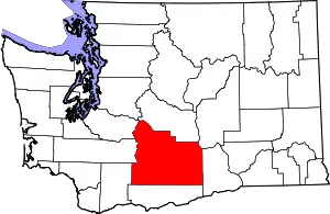
Location of Yakima County in Washington
This is intended to be a complete list of the properties and districts on the National Register of Historic Places in Yakima County, Washington, United States. Latitude and longitude coordinates are provided for many National Register properties and districts; these locations may be seen together in a Google map.[1]
There are 69 properties and districts listed on the National Register in the county. Another property was once listed but has been removed.
- This National Park Service list is complete through NPS recent listings posted January 29, 2021.[2]
Current listings
| [3] | Name on the Register | Image | Date listed[4] | Location | City or town | Description |
|---|---|---|---|---|---|---|
| 1 | E. William Brackett House | 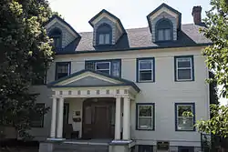 E. William Brackett House |
October 25, 1990 (#90001605) |
2606 Tieton Dr. 46°35′34″N 120°32′35″W |
Yakima | |
| 2 | Brooker-Taylor House |  Brooker-Taylor House |
February 18, 1987 (#87000061) |
203 S. Naches Ave. 46°36′03″N 120°29′49″W |
Yakima | |
| 3 | Buckeye Ranch House |  Buckeye Ranch House |
November 2, 1990 (#90001735) |
10881 WA 410 46°47′55″N 120°53′19″W |
Naches | |
| 4 | Bumping Lake Cabin No. 16 |  Bumping Lake Cabin No. 16 |
January 23, 2013 (#12001223) |
1920 Bumping Lake Road 46°51′27″N 121°19′02″W |
Naches vicinity | |
| 5 | Bumping Lake Resort |  Bumping Lake Resort |
August 28, 2013 (#13000211) |
781 Bumping Lake Rd. 46°52′36″N 121°18′10″W |
Naches vicinity | |
| 6 | Capitol Theatre | 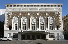 Capitol Theatre |
April 11, 1973 (#73001895) |
19 S. 3rd St. 46°36′09″N 120°30′08″W |
Yakima | |
| 7 | Carbonneau Mansion |  Carbonneau Mansion |
December 12, 1976 (#76001927) |
620 S. 48th Ave. 46°35′29″N 120°34′22″W |
Yakima | |
| 8 | Rupert Card House |  Rupert Card House |
February 18, 1987 (#87000063) |
1105 W. A St. 46°35′59″N 120°31′27″W |
Yakima | |
| 9 | Elizabeth Loudon Carmichael House |  Elizabeth Loudon Carmichael House |
May 1, 1991 (#91000538) |
108 W. Pine St. 46°33′06″N 120°28′34″W |
Union Gap | |
| 10 | Carmichael-Loudon House |  Carmichael-Loudon House |
February 18, 1987 (#87000065) |
2 Chicago Ave. 46°35′51″N 120°31′36″W |
Yakima | |
| 11 | Cornell Farmstead |  Cornell Farmstead |
February 17, 1987 (#87000055) |
Pleasant Rd. and Old Prosser Rd. 46°14′35″N 119°53′41″W |
Grandview | |
| 12 | Harrison Dills House |  Harrison Dills House |
February 18, 1987 (#87000066) |
4 N. Sixteenth Ave. 46°35′51″N 120°31′47″W |
Yakima | |
| 13 | Donald House |  Donald House |
December 12, 1976 (#76001928) |
304 N. 2nd St. 46°36′24″N 120°30′21″W |
Yakima | |
| 14 | Donald-Wapato Bridge |  Donald-Wapato Bridge |
May 24, 1995 (#95000629) |
Donald Rd. over the Yakima R. 46°27′58″N 120°23′51″W |
Wapato | Bridges of Washington State MPS |
| 15 | Edgar Rock Lodge | 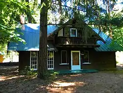 Edgar Rock Lodge |
August 1, 1996 (#96000843) |
380 Old Naches Rd. 46°55′16″N 121°03′03″W |
Naches | |
| 16 | First Baptist Church |  First Baptist Church |
April 5, 2016 (#16000147) |
515 East Yakima Ave. 46°36′15″N 120°29′56″W |
Yakima | |
| 17 | Fort Simcoe State Park | 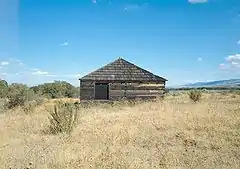 Fort Simcoe State Park |
June 27, 1974 (#74001994) |
Southwest of Yakima on WA 220 46°20′34″N 120°50′08″W |
Yakima | |
| 18 | O. J. Gendron Ranch |  O. J. Gendron Ranch |
September 21, 2005 (#05001062) |
6702 Bell Rd. 46°33′34″N 120°24′57″W |
Moxee City | |
| 19 | H. M. Gilbert House |  H. M. Gilbert House |
August 23, 1985 (#85001812) |
2109 W. Yakima Ave. 46°35′51″N 120°32′11″W |
Yakima | |
| 20 | James Gleed Barn |  James Gleed Barn |
May 10, 1990 (#90000672) |
1960 Old Naches Hwy. 46°39′42″N 120°36′13″W |
Naches | |
| 21 | Daniel Goodman House |  Daniel Goodman House |
October 2, 1992 (#92001286) |
701 S. 3rd Ave. 46°35′28″N 120°30′28″W |
Yakima | |
| 22 | Gotchen Creek Ranger Station |  Gotchen Creek Ranger Station |
April 25, 2007 (#07000369) |
Forest Service Road 8225.060 46°05′23″N 121°29′04″W |
Gifford Pinchot National Forest | |
| 23 | Grandview Herald Building |  Grandview Herald Building |
February 17, 1987 (#87000056) |
107 Division St. 46°15′21″N 119°54′01″W |
Grandview | |
| 24 | Grandview High School | 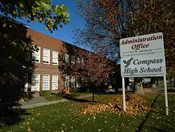 Grandview High School |
February 17, 1987 (#87000058) |
913 W. Second St. 46°15′18″N 119°54′54″W |
Grandview | |
| 25 | Grandview Road-Yellowstone Trail |  Grandview Road-Yellowstone Trail |
December 11, 1995 (#95001446) |
Grandview Pavement Rd. between Mabton-Sunnyside Rd. and Apple Way 46°15′01″N 119°59′50″W |
Grandview | |
| 26 | Grandview State Bank |  Grandview State Bank |
February 17, 1987 (#87000060) |
100 W. Second St. 46°15′17″N 119°54′04″W |
Grandview | |
| 27 | Grave of the Legendary Giantess |  Grave of the Legendary Giantess |
December 14, 1978 (#78002789) |
Address Restricted |
Toppenish | Not an actual grave, but a rock formation some think looks to have the outline of a woman. |
| 28 | James Greene House |  James Greene House |
May 6, 1987 (#87000059) |
203 N. Ninth St. 46°36′32″N 120°29′37″W |
Yakima | |
| 29 | A. E. Howard House |  A. E. Howard House |
February 18, 1987 (#87000067) |
602 N. First St. 46°36′36″N 120°30′32″W |
Yakima | |
| 30 | Howay-Dykstra House |  Howay-Dykstra House |
February 17, 1987 (#87000062) |
114 Birch St. 46°15′19″N 119°53′53″W |
Grandview | |
| 31 | William N. Irish House |  William N. Irish House |
March 31, 1992 (#92000280) |
210 S. 28th Ave. 46°35′48″N 120°32′43″W |
Yakima | |
| 32 | Kamiakin's Gardens | 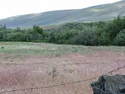 Kamiakin's Gardens |
December 22, 1976 (#76001926) |
West of Union Gap on Lower Ahtanum Rd. 46°31′46″N 120°49′32″W |
Union Gap | |
| 33 | James Knuppenburg House |  James Knuppenburg House |
February 18, 1987 (#87000070) |
111 S. Ninth St. 46°36′10″N 120°29′30″W |
Yakima | |
| 34 | LaFramboise Farmstead |  LaFramboise Farmstead |
February 28, 1985 (#85000400) |
5204 Mieras Rd. 46°34′37″N 120°25′44″W |
Yakima | |
| 35 | A. E. Larson Building | 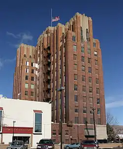 A. E. Larson Building |
September 11, 1984 (#84003647) |
6 S. 2nd St. 46°36′08″N 120°30′13″W |
Yakima | |
| 36 | Larson-Hellieson House |  Larson-Hellieson House |
May 6, 1987 (#87000073) |
208 N. Naches Ave. 46°36′25″N 120°30′03″W |
Yakima | |
| 37 | William Lindsey House |  William Lindsey House |
February 18, 1987 (#87000075) |
301 N. Eighth St. 46°36′32″N 120°29′44″W |
Yakima | |
| 38 | Lund Building |  Lund Building |
October 13, 1983 (#83004276) |
5 N. Front St. 46°36′08″N 120°30′23″W |
Yakima | |
| 39 | Mabton High School |  Mabton High School |
November 21, 1985 (#85002917) |
High School Rd. 46°12′44″N 119°59′25″W |
Mabton | |
| 40 | Masonic Temple |  Masonic Temple |
February 16, 1996 (#96000051) |
321 E. Yakima Ave. 46°36′13″N 120°30′02″W |
Yakima | Also known as the Great Western Building. |
| 41 | Mattoon Cabin |  Mattoon Cabin |
October 28, 1977 (#77001371) |
South of Sawyer on U.S. 12 46°27′07″N 120°21′23″W |
Sawyer | |
| 42 | Alexander McAllister House |  Alexander McAllister House |
October 25, 1990 (#90001603) |
402 W. White St. 46°32′59″N 120°28′47″W |
Union Gap | |
| 43 | John J. Miller House |  John J. Miller House |
February 18, 1987 (#87000078) |
9 S. Tenth Ave. 46°35′52″N 120°31′16″W |
Yakima | |
| 44 | Francis Mineau House |  Francis Mineau House |
February 18, 1987 (#87000079) |
216 N. Seventh St. 46°36′28″N 120°29′51″W |
Yakima | |
| 45 | Edward B. Moore House |  Edward B. Moore House |
February 18, 1987 (#87000081) |
222 N. Second St. 46°35′49″N 120°30′20″W |
Yakima | |
| 46 | Morse House |  Morse House |
February 17, 1987 (#87000064) |
404 E. Main St. 46°15′22″N 119°53′46″W |
Grandview | |
| 47 | Old North Yakima Historic District |  Old North Yakima Historic District |
May 2, 1986 (#86000960) |
Roughly bounded by E. A St., S. First St., E. Yakima Ave., and the Northern Pacific RR tracks 46°36′10″N 120°30′24″W |
Yakima | |
| 48 | Winfield Perrin House |  Winfield Perrin House |
February 18, 1987 (#87000083) |
12 S. Eleventh Ave. 46°35′52″N 120°32′57″W |
Yakima | |
| 49 | H. W. Potter House |  H. W. Potter House |
February 18, 1987 (#87000084) |
305 S. Fourth St. 46°35′56″N 120°29′52″W |
Yakima | |
| 50 | Powell House |  Powell House |
February 18, 1987 (#87000085) |
207 S. Ninth St. 46°36′07″N 120°29′30″W |
Yakima | |
| 51 | James Richey House |  James Richey House |
May 6, 1987 (#87000087) |
206 N. Naches Ave. 46°36′23″N 120°30′01″W |
Yakima | |
| 52 | Rosedell |  Rosedell |
July 12, 1990 (#90001074) |
1811 W. Yakima Ave. 46°35′52″N 120°31′57″W |
Yakima | |
| 53 | W. P. Sawyer House And Orchard | November 23, 1977 (#77001370) |
U.S. 12 46°27′14″N 120°21′22″W |
Sawyer | ||
| 54 | James Sharp House |  James Sharp House |
February 18, 1987 (#87000088) |
111 N. Ninth St. 46°36′26″N 120°29′36″W |
Yakima | |
| 55 | St. Joseph's Mission |  St. Joseph's Mission |
December 22, 1976 (#76001925) |
East of Tampico on Tampico Rd. 46°31′54″N 120°45′30″W |
Tampico | |
| 56 | Reuben Sweet House | 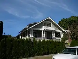 Reuben Sweet House |
February 18, 1987 (#87000089) |
6 Chicago Ave. 46°35′52″N 120°31′36″W |
Yakima | |
| 57 | Teapot Dome Service Station | 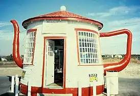 Teapot Dome Service Station |
August 29, 1985 (#85001943) |
Old State HW 12 46°23′16″N 120°14′02″W |
Zillah | |
| 58 | Toppenish-Zillah Bridge |  Toppenish-Zillah Bridge |
May 24, 1995 (#95000630) |
Over the Yakima R., between Toppenish and Zillah 46°23′59″N 120°16′49″W |
Toppenish | Bridges of Washington State MPS |
| 59 | U.S. Post Office and Courthouse |  U.S. Post Office and Courthouse |
November 27, 1979 (#79002568) |
25 S. 3rd St 46°36′07″N 120°30′08″W |
Yakima | |
| 60 | Union Pacific Freight Building |  Union Pacific Freight Building |
September 8, 1988 (#88001519) |
104 W. Yakima Ave. 46°36′04″N 120°30′32″W |
Yakima | |
| 61 | US Post Office-Sunnyside Main |  US Post Office-Sunnyside Main |
May 30, 1991 (#91000656) |
713 E. Edison Ave. 46°19′25″N 120°00′36″W |
Sunnyside | |
| 62 | US Post Office-Toppenish Main |  US Post Office-Toppenish Main |
August 7, 1991 (#91000658) |
14 Jefferson Ave. 46°22′32″N 120°18′44″W |
Toppenish | |
| 63 | William Watt House |  William Watt House |
February 18, 1987 (#87000091) |
1511 W. Chestnut Ave. 46°35′47″N 120°31′44″W |
Yakima | |
| 64 | Dr. Edmond West House |  Dr. Edmond West House |
February 18, 1987 (#87000092) |
202 S. Sixteenth Ave. 46°35′46″N 120°31′46″W |
Yakima | |
| 65 | Charles Wilcox House |  Charles Wilcox House |
February 18, 1987 (#87000093) |
220 N. Sixteenth Ave. 46°36′05″N 120°31′47″W |
Yakima | |
| 66 | Yakima Indian Agency Building | 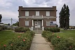 Yakima Indian Agency Building |
May 19, 1988 (#88000605) |
1 S. Elm 46°22′44″N 120°18′55″W |
Toppenish | |
| 67 | Yakima Valley Transportation Company | 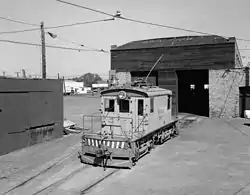 Yakima Valley Transportation Company |
October 8, 1992 (#84004012) |
Third Ave. and Pine St. 46°35′56″N 120°36′09″W |
Yakima | |
| 68 | Fred and Elizabeth Young House |  Fred and Elizabeth Young House |
April 1, 2011 (#11000150) |
804 S. 22nd Ave. 46°35′22″N 120°32′19″W |
Yakima | |
| 69 | Young Women's Christian Association Building |  Young Women's Christian Association Building |
April 29, 1993 (#93000361) |
15 N. Naches Ave. 46°36′18″N 120°29′57″W |
Yakima |
Former listings
| [3] | Name on the Register | Image | Date listed | Date removed | Location | City or town | Summary |
|---|---|---|---|---|---|---|---|
| 1 | C. M. Holtzinger Fruit Company Building | September 8, 1988 (#88001517) | July 16, 1990 | N. Second Ave. and W. Yakima Ave. 46°36′18″N 120°29′57″W |
Yakima |
See also
| Wikimedia Commons has media related to National Register of Historic Places in Yakima County, Washington. |
References
- The latitude and longitude information provided in this table was derived originally from the National Register Information System, which has been found to be fairly accurate for about 99% of listings. Some locations in this table may have been corrected to current GPS standards.
- "National Register of Historic Places: Weekly List Actions". National Park Service, United States Department of the Interior. Retrieved on January 29, 2021.
- Numbers represent an alphabetical ordering by significant words. Various colorings, defined here, differentiate National Historic Landmarks and historic districts from other NRHP buildings, structures, sites or objects.
- The eight-digit number below each date is the number assigned to each location in the National Register Information System database, which can be viewed by clicking the number.
This article is issued from Wikipedia. The text is licensed under Creative Commons - Attribution - Sharealike. Additional terms may apply for the media files.

