Nebraska Highway 85
Nebraska Highway 85 is a highway in Nebraska. It is a highway in the Omaha Metro Area. It has a southern terminus at Nebraska Highway 370 in Papillion. Its northern terminus is at U.S. Highway 275 and Nebraska Highway 92 on the border of Omaha and Ralston. It is a four-lane highway for its entire length. Most people in the Omaha area think of the highway as part of 84th Street.
| ||||
|---|---|---|---|---|
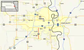 Nebraska Highway 85 highlighted in red | ||||
| Route information | ||||
| Maintained by NDOT | ||||
| Length | 5.01 mi[1] (8.06 km) | |||
| Existed | 1960[2]–present | |||
| Major junctions | ||||
| South end | ||||
| North end | ||||
| Location | ||||
| Counties | Sarpy, Douglas | |||
| Highway system | ||||
| ||||

Route description

Nebraska Highway 85 begins at an intersection with Nebraska Highway 370 in Papillion. It is divided at NE 370 and at its intersection with Cedardale Road, and is undivided briefly between NE 370 and Cedardale Road and north of Cedardale Road as it passes through downtown Papillion. In Papillion itself, the street is named Washington Street. At 6th Street in Papillion, NE 85 becomes a divided highway, which is becomes for the rest of its route. After passing Giles Road, it enters LaVista, and after passing Harrison Street, it enters Ralston. After its intersection with Madison Street, NE 85 forms the west border of Ralston for most of the rest of the way, with Omaha on the other side of that border. Its southern route may go down to Platteview Road. The most southern neighborhoods are Shadow Lake and Barrington (also called Southampton) and Schramn. At US 275 and NE 92, which is L Street, the highway ends.[1][3]
Major intersections
| County | Location | mi[1] | km | Destinations | Notes |
|---|---|---|---|---|---|
| Sarpy | Papillion | 0.00 | 0.00 | Southern terminus; road continues as Washington Street | |
| Douglas | Ralston–Omaha line | 5.01 | 8.06 | L Street (US 275 / N-92) | Northern terminus; road continues as 84th Street |
| 1.000 mi = 1.609 km; 1.000 km = 0.621 mi | |||||
References
- "Nebraska Highway Reference Log Book" (PDF). Nebraska Department of Roads. 2015. p. 237. Retrieved January 7, 2017.
- Nebraska Roads: NE 81-100
- Google (2010-11-01). "overview of Nebraska Highway 85" (Map). Google Maps. Google. Retrieved 2010-11-01.
External links
| Wikimedia Commons has media related to Nebraska Highway 85. |