Sussex Parish, New Brunswick
Sussex is a civil parish in Kings County, New Brunswick, Canada.[2]
Sussex | |
|---|---|
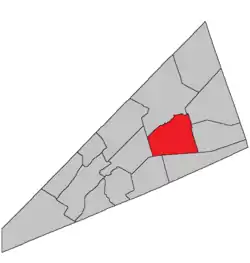 Location within Kings County, New Brunswick. | |
| Coordinates: 45.84°N 64.59°W | |
| Country | |
| Province | |
| County | Kings County |
| Erected | 1786 |
| Area | |
| • Land | 244.02 km2 (94.22 sq mi) |
| Population (2016)[1] | |
| • Total | 2,516 |
| • Density | 10.3/km2 (27/sq mi) |
| • Change 2011-2016 | |
| • Dwellings | 1,050 |
| Time zone | UTC-4 (AST) |
| • Summer (DST) | UTC-3 (ADT) |
For governance purposes it is divided between the town of Sussex,[3] the village of Sussex Corner,[3] and the local service district of the parish of Sussex[4] (which further includes the special service area of Apohaqui), all of which are members of Regional Service Commission 8 (RSC8).[5]
Origin of name
Ganong to have "probably" been in honour of the Duke of Sussex,[6] but the title was not created for him until 1801. The name may instead have come from Sussex County, New Jersey or Sussex, England.
History
Sussex was erected in 1786 as one of the original parishes of the county,[7] stretching from Kennebecasis Bay to the eastern line of the county, which then was north of St. Martins.
In 1787 a large area was added to Sussex when the county's eastern boundary was moved significantly eastward to run due north and south from the portage between the Petitcodiac and Kennebecasis Rivers.[8]
In the 1795 reorganisation of the county the western part of Sussex formed the bulk of Hampton Parish.[9] By this time Sussex included Cardwell, Havelock, Studholm, and Waterford Parishes.
In 1837 the eastern boundary of the county was altered, adding area to the southeastern corner of Sussex and removing it from the northeastern corner.[10]
In 1840 Studholm was erected as its own parish,[11] including Havelock.
In 1874 Cardwell and Waterford became parishes.[12]
In 1875 the boundary with Hammond Parish was altered.[13]
Delineation
Sussex Parish is defined in the Territorial Division Act[2] as being bounded:
- West and south by a line running south from the mouth of Halfway Brook to the Old Westmorland Road;[lower-alpha 1] thence easterly in a direct line to a point distant seventy chains on a course north by the magnet of the year one thousand eight hundred and fifteen, from the northeastern angle of lot number one, granted to Samuel DeForest; thence by a line running in a direct course to the northeastern angle of lot fifty-five, granted to William Thompson, on the north side of Shepody Road, until it intersects the eastern side line of lot number thirty, granted to Henry Douglas, or its prolongation; east by the eastern side line of the said grant to Henry Douglas and its northerly prolongation until it strikes Trout Creek; thence up stream to the southwestern angle of lot number seven, granted to Simon Armstrong; thence north, following the western side line of last-mentioned grant and its northerly prolongation to the Kennebecasis River and north by the centre of the Kennebecasis River.
Communities
Parish population total does not include incorporated municipalities (in bold).
|
|
|
Demographics
Access Routes
Highways and numbered routes that run through the parish, including external routes that start or finish at the parish limits:[17]
See also
Notes
- The old Westmorland Road no longer appears on provincial highway maps.[14]
References
- "Census Profile, 2016 Census Sussex, Parish [Census subdivision], New Brunswick". Statistics Canada. Retrieved September 18, 2019.
- "Chapter T-3 Territorial Division Act". Government of New Brunswick. Retrieved 13 November 2020.
- "New Brunswick Regulation 85-6 under the Municipalities Act (O.C. 85-45)". Government of New Brunswick. Retrieved 19 July 2020.
- "New Brunswick Regulation 84-168 under the Municipalities Act (O.C. 84-582)". Government of New Brunswick. Retrieved 19 July 2020.
- "Communities in each of the 12 Regional Service Commissions (RSC) / Les communautés dans chacune des 12 Commissions de services régionaux (CSR)" (PDF), Government of New Brunswick, July 2017, retrieved 2 February 2021
- Ganong, William F. (1896). A Monograph of the Place-Nomenclature of the Province of New Brunswick. Royal Society of Canada. p. 274.
- "26 Geo. III Chapter I. An Act for the better ascertaining and confirming the Boundaries of the several Counties within this Province, and for subdividing them into Towns or Parishes.". Acts of the General Assembly of His Majesty's Province of New-Brunswick, passed in the year 1786. Saint John, New Brunswick: Government of New Brunswick. 1786. pp. 3–12.
- "27 Geo. III Chapter VII. An Act in Addition to an Act for the better ascertaining and confirming the Boundaries of the several Counties within this Province, and for Subdividing them into Towns or Parishes.". Acts of the General Assembly, of His Majesty's Province of New-Brunswick, Passed in the Year 1787. Saint John, New Brunswick: Government of New Brunswick. 1787. p. 147.
- "35 Geo. III c. 3 An Act in addition to an Act intitled, 'An Act for the better Ascertaining and Confirming the Boundaries of the several Counties within this Province, and for subdividing them into Towns or Parishes.'". Acts of the General Assembly of His Majesty's Province of New-Brunswick, Passed in the Year 1795. Fredericton: Government of New Brunswick. 1795. pp. 338–340.
- "7 Wm. IV c. 35 An Act to establish a Boundary Line between the Counties of Westmorland and Saint John, and King's and Queen's Counties.". Acts of the General Assembly of His Majesty's Province of New Brunswick, Passed in the Year 1837. Fredericton: Government of New Brunswick. 1837. pp. 91–92.
- "3 Vic. c. 30 An Act for erecting a part of the Parish or Township of Sussex, in King's County, into a separate and distinct Parish or Township.". Acts of the General Assembly of Her Majesty's Province of New Brunswick, Passed in the Year 1840. Fredericton: Government of New Brunswick. 1840. pp. 14–15.
- "37 Vic. c. 42 An Act to erect separate Parishes out of part of the Parish of Sussex, in King's County.". Acts of the General Assembly of Her Majesty's Province of New Brunswick. Passed in the Months of March & April 1874. Fredericton: Government of New Brunswick. 1874. pp. 119–121.
- "38 Vic. c. 114 An Act to establish the division line between the Parish of Hammond and the Parishes of Sussex and Waterford, in King's County.". Acts of the General Assembly of Her Majesty's Province of New Brunswick. Passed in the Month of April 1875. Fredericton: Government of New Brunswick. 1875. pp. 388–389.
- "No. 447" (PDF). 2015 Designated Highway Maps. Government of New Brunswick. Retrieved 30 August 2016.
- Statistics Canada: 2001, 2006 census
- 2011 Statistics Canada Census Profile: Sussex Parish, New Brunswick
- Atlantic Canada Back Road Atlas ISBN 978-1-55368-618-7
Places adjacent to Sussex Parish, New Brunswick | |
|---|---|
| Subdivisions | |
|---|---|
| Cities | |
| Counties | |
| |