Upham Parish, New Brunswick
Upham is a civil parish in Kings County, New Brunswick, Canada.[2]
Upham | |
|---|---|
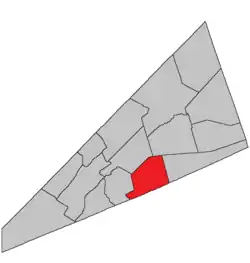 Location within Kings County, New Brunswick. | |
| Coordinates: 45.84°N 64.59°W | |
| Country | |
| Province | |
| County | Kings County |
| Erected | 1835 |
| Area | |
| • Land | 189.22 km2 (73.06 sq mi) |
| Population (2016)[1] | |
| • Total | 1,269 |
| • Density | 6.7/km2 (17/sq mi) |
| • Change 2011-2016 | |
| • Dwellings | 579 |
| Time zone | UTC-4 (AST) |
| • Summer (DST) | UTC-3 (ADT) |
For governance purposes it forms the local service district of the parish of Upham,[3] which is a member of Regional Service Commission 8 (RSC8).[4]
Origin of name
The parish was probably named in honour of Joshua Upham, Loyalist military commander and later judge on the Supreme Court of New Brunswick.[5] Members of the Upham family settled in the area after Joshua's death.[6]
History
Upham was erected in 1835 from Hampton Parish.[7] It included Hammond Parish.
In 1858 Hammond was erected as its own parish.[8]
The parish's boundary was rewritten in 1897,[9] probably causing some change.
Delineation
Upham Parish is defined in the Territorial Division Act[2] as being bounded:
- North by Norton and Sussex Parishes; east by a line commencing at the southeast corner of lot number one, granted to Samuel DeForest, near Cassidy Lake, and running a north and south course from thence; south by the County line, and westerly by a line starting from a point on the County line, where the westerly side line of a three hundred acre lot, granted to Thomas Smith, or its prolongation, meets the said County line, and running northwesterly along the side line of said lot to its most westerly corner; thence a course easterly to the northeasterly angle of a three hundred acre lot granted to Richard E. Armstrong, and thence easterly in a direct line to the northeasterly angle of lot number two, granted to Robert Godfrey; thence northerly by a direct line to the southeasterly angle of lot number six, granted to William Scoullar; thence following the easterly side line of said Scoullar grant to its northeasterly corner on the Hammond River; thence following or crossing the said Hammond River to the southeasterly corner of a five hundred acre lot, granted to Charles Robertson; thence along the easterly side line of said Robertson grant to its northeasterly corner; and thence in a direct line to the northeasterly corner of a two hundred acre lot granted to James Beyea, where is standing a maple tree, and continuing the same course beyond the said maple tree to the Old Westmorland Road.[lower-alpha 1]
Governance
The entire parish forms the local service district of the parish of Upham, established in 1967 to assess for fire protection. Recreational and sports facilities were added in 2005. First aid and ambulance services (1976–2005) were formerly included.
Communities
Parish population total does not include incorporated municipalities (in bold):
|
|
|
Bodies of water & Islands
This is a list of rivers, lakes, streams, creeks, marshes and Islands that are at least partially in this parish
Demographics
Access Routes
Highways and numbered routes that run through the parish, including external routes that start or finish at the parish limits:[13]
See also
Notes
- The old Westmorland Road no longer appears on provincial highway maps.[10]
References
- "Census Profile, 2016 Census Upham, Parish [Census subdivision], New Brunswick". Statistics Canada. Retrieved September 19, 2019.
- "Chapter T-3 Territorial Division Act". Government of New Brunswick. Retrieved 13 November 2020.
- "New Brunswick Regulation 84-168 under the Municipalities Act (O.C. 84-582)". Government of New Brunswick. Retrieved 19 July 2020.
- "Communities in each of the 12 Regional Service Commissions (RSC) / Les communautés dans chacune des 12 Commissions de services régionaux (CSR)" (PDF), Government of New Brunswick, July 2017, retrieved 2 February 2021
- Ganong, William F. (1896). A Monograph of the Place-Nomenclature of the Province of New Brunswick. Royal Society of Canada. p. 227.
- "Index to New Brunswick Land Grants, 1784 - 1997 (RS686)". Provincial Archives of New Brunswick. Retrieved 21 October 2020.
- "5 Wm. IV c. 33 An Act to erect the North Eastern part of the Parish of Hampton in King's County into a separate and distinct Parish.". Acts of the General Assembly of His Majesty's Province of New-Brunswick, Passed in the Year 1835. Fredericton: Government of New Brunswick. 1835. p. 41.
- "21 Vic. c. 40 An Act to authorize the division of the Parish of Upham into two Parishes.". Acts of the General Assembly of Her Majesty's Province of New Brunswick, Passed in March and April 1858. Fredericton: Government of New Brunswick. 1858. pp. 90–91.
- "60 Vic. c. 19 An Act to amend an Act intituled 'An Act to revise and codify an Act to provide for the Division of the Province into Counties, Towns and Parishes,' and to bettter [sic] define the bounds of the Parish of Upham.". Acts of the General Assembly of Her Majesty's Province of New Brunswick. Passed in the Month of March, 1897. Fredericton: Government of New Brunswick. 1897. p. 50.
- "No. 447" (PDF). 2015 Designated Highway Maps. Government of New Brunswick. Retrieved 30 August 2016.
- Statistics Canada: 2001, 2006 census
- 2011 Statistics Canada Census Profile: Upham Parish, New Brunswick
- Atlantic Canada Back Road Atlas ISBN 978-1-55368-618-7
Places adjacent to Upham Parish, New Brunswick | |
|---|---|
| Subdivisions | |
|---|---|
| Cities | |
| Counties | |
| |