Pennfield Parish, New Brunswick
Pennfield is a civil parish in Charlotte County, New Brunswick, Canada,[2] located west of Saint John located east of St. George and west of Saint John. It comprises one village and two local service districts, all of which are members of the Southwest New Brunswick Service Commission (SNBSC).[3]
Pennfield | |
|---|---|
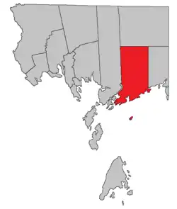 Location within Charlotte County. | |
| Country | |
| Province | |
| County | Charlotte County |
| Erected | 1786 |
| Area | |
| • Land | 363.86 km2 (140.49 sq mi) |
| Population (2016)[1] | |
| • Total | 2,170 |
| • Density | 6.0/km2 (16/sq mi) |
| • Pop 2011-2016 | |
| • Dwellings | 996 |
| Time zone | UTC-4 (AST) |
| • Summer (DST) | UTC-3 (ADT) |
The Census subdivision of the same name includes all of the parish except the village of Blacks Harbour.[1]
Origin of name
The parish was named by Quaker Loyalist settlers of the area for William Penn, early Quaker leader and founder of Pennsylvania.[4]
History
Pennfield was erected in 1786 as one of the county's original parishes;[5] it included most of modern Lepreau Parish and the northern boundary was slightly south of where it is today.[6]
In 1850 the parish was extended north to the county line, annexing unassigned territory.[7]
In 1857 the eastern part of Pennfield was erected as Lepreau Parish.[8]
In 1868 all of the parish north of the southern point of Queens County was included in the Clarendon District, a polling district that also included the northern part of Lepreau Parish.[9]
In 1869 the northern part of Pennfield was included in the newly erected Clarendon Parish.[10]
Boundaries
Pennfield Parish is bounded on the north by a line running true west from the southernmost corner of Queens County; on the east by a line running true north from the mouth of the Pocologan River; on the west by the prolongation north and south of the western line of grants straddling Lake Utopia, then south along a line running through the Letang River and Letang Harbour; and on the south by the Bay of Fundy. The parish also includes any islands with two miles (3.2 kilometres) of the shore and The Wolves, a group of islands more than five miles (eight kilometres) offshore.[2]
Municipality
The village of Blacks Harbour sits at the southwestern corner of the parish's mainland.[11]
Local service districts
Both LSDs assess for the basic LSD services of fire protection, police services, land use planning, emergency measures, and dog control.[12]
Pennfield Parish
The local service district of the parish of Pennfield originally included all of the parish outside Blacks Harbour.
The LSD was established in 1970 to assess for fire protection.[13] First aid and ambulance services were added in 1979.[14]
Today the LSD additionally assesses for community & recreation services.[12] The taxing authority is 512.00 Pennfield.
Beaver Harbour
Beaver Harbour comprises an area on the western side of Beaver Harbour, including the eastern part of the old town plat and running north to the junction of Mountain Road and Waite's Lane.[15] The community of Beaver Harbour outgrew the boundaries of the LSD by 2013.[16]
The LSD was established in 1971 to add street lighting and community services.[17] First aid and ambulance services were added in 1979.[18]
Today Beaver Harbour additionally assesses street lighting and community & recreation services.[12] The taxing authority is 524.00 Beaver Harbour.
Beaver Harbour is the only LSD in Charlotte County with street lighting.
Communities
Communities at least within the parish[19][20][21][22] Bold indicates a municipality.
|
|
|
Bodies of water
Bodies of water at least partly in the parish;[19][20][21][22] italics indicates a deprecated name.[lower-alpha 1]
|
|
|
|
Islands
Islands in the parish;[19][20][21][22] italics indicates a deprecated name.[lower-alpha 1]
|
|
Conservation areas
Parks, historic sites, and related entities in the parish.[19][23][24]
- Lepreau River Wildlife Management Area
- New River Protected Natural Area
- Pocologan Protected Natural Area
- Utopia Wildlife Refuge
Demographics
Population
| Canada census – Pennfield Parish, New Brunswick community profile | |||
|---|---|---|---|
| 2016 | 2011 | 2006 | |
| Population: | 2,170 (-2.2% from 2011) | 2,218 (-4.5% from 2006) | 2,322 (-3.9% from 2001) |
| Land area: | 363.86 km2 (140.49 sq mi) | 363.88 km2 (140.49 sq mi) | 363.88 km2 (140.49 sq mi) |
| Population density: | 6.0/km2 (16/sq mi) | 6.1/km2 (16/sq mi) | 6.4/km2 (17/sq mi) |
| Median age: | 46.7 (M: 46.5, F: 47.0) | 44.3 (M: 44.1, F: 44.4) | 41.8 (M: 42.2, F: 41.4) |
| Total private dwellings: | 996 | 1,099 | 1,120 |
| Median household income: | $60,992 | $58,972 | $42,996 |
| References: 2016[25] 2011[26] 2006[27] earlier[28] | |||
|
|
| |||||||||||||||||||||||||||
| [29][30][1] | |||||||||||||||||||||||||||||
Language
| Canada Census Mother Tongue - Pennfield Parish, New Brunswick[29] | ||||||||||||||||||
|---|---|---|---|---|---|---|---|---|---|---|---|---|---|---|---|---|---|---|
| Census | Total | English |
French |
English & French |
Other | |||||||||||||
| Year | Responses | Count | Trend | Pop % | Count | Trend | Pop % | Count | Trend | Pop % | Count | Trend | Pop % | |||||
2011 |
2,195 |
2,045 | 93.17% | 90 | 4.10% | 5 | 0.23% | 55 | 2.50% | |||||||||
2006 |
2,305 |
2,205 | 95.66% | 55 | 2.39% | 0 | 0.00% | 45 | 1.95% | |||||||||
2001 |
2,410 |
2,265 | 93.98% | 115 | 4.77% | 10 | 0.42% | 20 | 0.83% | |||||||||
1996 |
2,240 |
2,145 | n/a | 95.76% | 70 | n/a | 3.12% | 0 | n/a | 0.00% | 25 | n/a | 1.12% | |||||
Access Routes
Highways and numbered routes that run through the parish, including external routes that start or finish at the parish limits:[31]
See also
Notes
- Categorised as Historical rather than Official by the Canadian Geographic Name Service; only those significantly different are noted;
References
- "Census Profile, 2016 Census: Pennfield, Parish [Census subdivision], New Brunswick". Statistics Canada. Retrieved 7 September 2019.
- "Chapter T-3 Territorial Division Act". Government of New Brunswick. Retrieved 14 August 2020.
- "Communities in each of the 12 Regional Service Commissions (RSC) / Les communautés dans chacune des 12 Commissions de services régionaux (CSR)" (PDF), Government of New Brunswick, July 2017, retrieved 1 February 2021
- Ganong, William F. (1896). A Monograph of the Place-Nomenclature of the Province of New Brunswick. Royal Society of Canada. p. 261.
- "26 Geo. III Chapter I. An Act for the better ascertaining and confirming the Boundaries of the several Counties within this Province, and for subdividing them into Towns or Parishes.". Acts of the General Assembly of His Majesty's Province of New-Brunswick, passed in the year 1786. Saint John, New Brunswick: Government of New Brunswick. 1786. pp. 3–12.
- Ganong, William F. (1901). A Monograph of the Evolution of the Boundaries of the Province of New Brunswick. Royal Society of Canada. p. Map No. 35.
- "13 Vic. c. 51 An Act to consolidate all the Laws now in force for the division of the Province into Counties, Towns and Parishes.". Acts of the General Assembly of Her Mjaesty's Province of New Brunswick, Passed in the Year 1850. Fredericton: Government of New Brunswick. 1850. pp. 142–152, 145–149. Book was poorly proofread, resulting in title typo and reuse of page numbers 145–152.
- "20 Vic. c. 9 An Act to erect the eastern part of the Parish of Pennfield, in the County of Charlotte, into a separate Town or Parish.". Acts of the General Assembly of Her Majesty's Province of New Brunswick, Passed in July 1856, and March and July 1857. Fredericton: Government of New Brunswick. 1857. pp. 15–16.
- "31 Vic. c. 51 An Act to establish an additional Polling place in the County of Charlotte.". Acts of the General Assembly of Her Majesty's Province of New Brunswick. Passed in the Month of March 1868. Fredericton: Government of New Brunswick. 1868. p. 84.
- "32 Vic. c. 51 An Act to erect part of the Parishes of Lepreaux and Pennfield, in the County of Charlotte, into a separate Town or Parish.". Acts of the General Assembly of Her Majesty's Province of New Brunswick. Passed in the Month of April 1869. Fredericton: Government of New Brunswick. 1869. pp. 96–97.
- "New Brunswick Regulation 85-6 under the Municipalities Act (O.C. 85-45)". Government of New Brunswick. Retrieved 6 February 2021.
- "2020 Local Government Statistics for New Brunswick" (PDF). Department of Environment and Local Government. p. 55. Retrieved 6 February 2021.
- "Regulation 70–63 under the Municipalities Act (O. C. 70–385)". The Royal Gazette. Fredericton. 128: 343–344. 17 June 1970.
- "Regulation 79-39 under the Municipalities Act (O. C. 79-169)". The Royal Gazette. Fredericton. 137: 1009–1010. 4 April 1979.
- "New Brunswick Regulation 84-168 under the Municipalities Act (O.C. 84-582)". Government of New Brunswick. Retrieved 6 February 2021.
- Rayner, Barb (5 March 2013). "Meeting will outline Beaver Harbour boundaries". The Saint Croix Courier. p. A2.
- "Regulation 71–17 under the Municipalities Act (O. C. 71–127)". The Royal Gazette. Fredericton. 129: 154. 3 March 1971.
- "Regulation 79-39 under the Municipalities Act (O. C. 79-169)". The Royal Gazette. Fredericton. 137: 1009–1010. 4 April 1979.
- "untitled spreadsheet of New Brunswick place names". Geographical names in Canada. Natural Resources Canada. Retrieved 20 July 2020.
- "No. 163". Provincial Archives of New Brunswick. Department of Natural Resources and Energy Development. Retrieved 3 October 2020.
- "No. 166". Provincial Archives of New Brunswick. Department of Natural Resources and Energy Development. Retrieved 3 October 2020.
- Official place names of New Brunswick checked against the cadastral maps of the area.
- "NEW BRUNSWICK REGULATION 2003-8 under the Protected Natural Areas Act". Justice and Office of the Attorney General. Government of New Brunswick. Retrieved 3 October 2020.
- "Regulation 94-43 under the Fish and Wildlife Act". Justice and Office of the Attorney General. Province of New Brunswick. Retrieved 27 September 2020.
- "2016 Community Profiles". 2016 Canadian Census. Statistics Canada. 21 February 2017. Retrieved 7 September 2019.
- "2011 Community Profiles". 2011 Canadian Census. Statistics Canada. 5 July 2013. Retrieved 15 March 2014.
- "2006 Community Profiles". 2006 Canadian Census. Statistics Canada. 30 March 2011. Retrieved 15 March 2014.
- "2001 Community Profiles". 2001 Canadian Census. Statistics Canada. 17 February 2012.
- Statistics Canada: 1996, 2001, 2006, 2011 census
- 2011 Statistics Canada Census Profile: Pennfield Parish, New Brunswick
- Atlantic Canada Back Road Atlas ISBN 978-1-55368-618-7 Pages 4, 12
Places adjacent to Pennfield Parish, New Brunswick | |
|---|---|
| Subdivisions | |
|---|---|
| Cities | |
| Counties | |
| |