Phrai Bueng District
Phrai Bueng (Thai: ไพรบึง, pronounced [pʰrāj bɯ̄ŋ]) is a district (amphoe) in the central part of Sisaket Province, northeastern Thailand.
Phrai Bueng
ไพรบึง | |
|---|---|
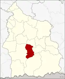 District location in Sisaket Province | |
| Coordinates: 14°44′54″N 104°21′42″E | |
| Country | Thailand |
| Province | Sisaket |
| Seat | Phrai Bueng |
| Area | |
| • Total | 248.8 km2 (96.1 sq mi) |
| Population (2009) | |
| • Total | 47,725 |
| • Density | 191.82/km2 (496.8/sq mi) |
| Time zone | UTC+7 (ICT) |
| Postal code | 33180 |
| Geocode | 3306 |
Geography
Neighboring districts are (from the north clockwise): Phayu, Si Rattana, Khun Han, Khukhan, and Wang Hin.
History
The area of the district was originally part of Khukhan District. On 1 October 1969 tambons Phrai Bueng, Samrong Phlan, Din Daeng, and Prasat Yoe were split off and formed the new minor district (king amphoe) Phrai Bueng.[1] On 22 August 1975 it was upgraded to a full district.[2]
Administration
The district is divided into six sub-districts (tambons), which are further subdivided into 81 villages (mubans). Phrai Bueng is a township (thesaban tambon) which covers parts of tambons Phrai Bueng and Samrong Phlan. There are a further six tambon administrative organizations (TAO).
| No. | Name | Thai name | Villages | Pop. | |
|---|---|---|---|---|---|
| 1. | Phrai Bueng | ไพรบึง | 21 | 16,121 | |
| 2. | Din Daeng | ดินแดง | 9 | 5,108 | |
| 3. | Prasat Yoe | ปราสาทเยอ | 11 | 4,872 | |
| 4. | Samrong Phlan | สำโรงพลัน | 17 | 11,448 | |
| 5. | Suk Sawat | สุขสวัสดิ์ | 12 | 5,634 | |
| 6. | Non Pun | โนนปูน | 11 | 4,393 |
References
- ประกาศกระทรวงมหาดไทย เรื่อง แบ่งท้องที่ตั้งเป็นกิ่งอำเภอ (PDF). Royal Gazette (in Thai). 86 (87 ง): 3021. October 7, 1969.
- พระราชกฤษฎีกาตั้งอำเภอแวงน้อย อำเภอป่าแดด อำเภอเรณูนคร อำเภอคูเมือง อำเภอคุระบุรี อำเภอแม่ลาน้อย อำเภอเสริมงาม อำเภอไพรบึง และอำเภอหนองโดน พ.ศ. ๒๕๑๘ (PDF). Royal Gazette (in Thai). 92 (166 ก special issue): 1–4. August 21, 1975.
External links
Sisaket (capital) | ||
| Districts (amphoe) |  | |
| Related topics | ||
| Neighboring areas |
| |
