Sila Lat District
Sila Lat (Thai: ศิลาลาด) is a district (amphoe) in the northwestern part of Sisaket Province, northeastern Thailand.
Sila Lat
ศิลาลาด | |
|---|---|
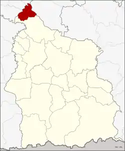 District location in Sisaket Province | |
| Coordinates: 15°28′24″N 104°4′18″E | |
| Country | Thailand |
| Province | Sisaket |
| Seat | Kung |
| Area | |
| • Total | 131.8 km2 (50.9 sq mi) |
| Population (2005) | |
| • Total | 20,857 |
| • Density | 158.2/km2 (410/sq mi) |
| Time zone | UTC+7 (ICT) |
| Postal code | 33160 |
| Geocode | 3322 |
History
The minor district (king amphoe) was established on 1 July 1997, when four tambons were split off from Rasi Salai District.[1]
On 15 May 2007, all 81 minor districts were upgraded to full districts.[2] On 24 August, the upgrade became official.[3]
Geography
Neighboring districts are (from the south clockwise): Rasi Salai of Sisaket Province; Phon Sai, Nong Hi, and Phanom Phrai of Roi Et Province; and Maha Chana Chai of Yasothon Province.
Administration
The district is divided into four sub-districts (tambons), which are further subdivided into 44 villages (mubans). There are no municipal (thesaban) areas; there are four tambon administrative organizations (TAO).
| No. | Name | Thai name | Villages | Pop. | |
|---|---|---|---|---|---|
| 1. | Kung | กุง | 14 | 8,181 | |
| 2. | Khli Kling | คลีกลิ้ง | 11 | 5,439 | |
| 3. | Nong Bua Dong | หนองบัวดง | 9 | 4,530 | |
| 4. | Chot Muang | โจดม่วง | 10 | 2,707 |
References
- ประกาศกระทรวงมหาดไทย เรื่อง แบ่งเขตท้องที่อำเภอราษีไศล จังหวัดศรีสะเกษ ตั้งเป็นกิ่งอำเภอศิลาลาด (PDF). Royal Gazette (in Thai). 114 (Special 51 ง): 18. 25 June 1997.
- แถลงผลการประชุม ครม. ประจำวันที่ 15 พ.ค. 2550 (in Thai). Manager Online.
- พระราชกฤษฎีกาตั้งอำเภอฆ้องชัย...และอำเภอเหล่าเสือโก้ก พ.ศ. ๒๕๕๐ (PDF). Royal Gazette (in Thai). 124 (46 ก): 14–21. 24 August 2007.
External links
Sisaket (capital) | ||
| Districts (amphoe) |  | |
| Related topics | ||
| Neighboring areas |
| |