Pho Si Suwan District
Pho Si Suwan (Thai: โพธิ์ศรีสุวรรณ, pronounced [pʰōː sǐː sù.wān]) is a district (amphoe) in the northwestern part of Sisaket Province, northeastern Thailand.
Pho Si Suwan
โพธิ์ศรีสุวรรณ | |
|---|---|
 Karnkusol Wat Bandod School, a local school | |
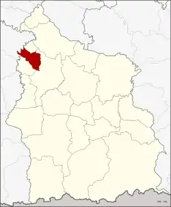 District location in Sisaket Province | |
| Coordinates: 15°13′54″N 104°4′36″E | |
| Country | Thailand |
| Province | Sisaket |
| Seat | Dot |
| Area | |
| • Total | 111.1 km2 (42.9 sq mi) |
| Population (2005) | |
| • Total | 23,519 |
| • Density | 211.7/km2 (548/sq mi) |
| Time zone | UTC+7 (ICT) |
| Postal code | 33120 |
| Geocode | 3321 |
History
The minor district (king amphoe) was established on 30 April 1994, when it was split off from Uthumphon Phisai District.[1]
On 15 May 2007, all 81 minor districts were upgraded to full districts.[2] On 24 August the upgrade became official.[3]
Geography
Neighboring districts are (from the north clockwise) Bueng Bun, Uthumphon Phisai, and Mueang Chan of Sisaket Province, and Rattanaburi of Surin Province.
Administration
The district is divided into five sub-districts (tambons), which are further subdivided into 80 villages (mubans). There are no municipal (thesaban) areas. There are five tambon administrative organizations (TAO).
| No. | Name | Thai name | Villages | Pop. |
|---|---|---|---|---|
| 1. | Dot | โดด | 25 | 7,952 |
| 2. | Siao | เสียว | 17 | 4,455 |
| 3. | Nong Ma | หนองม้า | 12 | 3,519 |
| 4. | Phue Yai | ผือใหญ่ | 14 | 4,568 |
| 5. | I Se | อีเซ | 12 | 3,025 |
References
- ประกาศกระทรวงมหาดไทย เรื่อง แบ่งเขตท้องที่อำเภออุทุมพรพิสัย จังหวัดศรีสะเกษ ตั้งเป็นกิ่งอำเภอโพธิ์ศรีสุวรรณ (PDF). Royal Gazette (in Thai). 111 (42 ง): 30. 26 May 1994.
- แถลงผลการประชุม ครม. ประจำวันที่ 15 พ.ค. 2550 (in Thai). Manager Online.
- พระราชกฤษฎีกาตั้งอำเภอฆ้องชัย...และอำเภอเหล่าเสือโก้ก พ.ศ. ๒๕๕๐ (PDF). Royal Gazette (in Thai). 124 (46 ก): 14–21. 24 August 2007.
External links
Sisaket (capital) | ||
| Districts (amphoe) |  | |
| Related topics | ||
| Neighboring areas |
| |