Pichaqa
Pichaqa (Aymara pichaqa, phichaqa, piqacha a big needle,[2] also spelled Pichaka) is a 4,512-metre-high (14,803 ft) mountain in the Andes of Bolivia. It is situated in the La Paz Department, Pacajes Province, Calacoto Municipality. Pichaqa lies north-east of the Anallajsi volcano.[1][3]
| Pichaqa | |
|---|---|
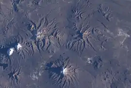 Pichaqa is visible in the upper right part of this satellite image. Sajama volcano is shown in the lower center. | |
| Highest point | |
| Elevation | 4,512 m (14,803 ft) [1] |
| Coordinates | 17°48′35″S 68°51′32″W |
| Geography | |
 Pichaqa Location in Bolivia | |
| Location | Bolivia, La Paz Department |
| Parent range | Andes |
References
- Bolivian IGM map 1:50,000 Estancia Huancarama 5840-IV
- Radio San Gabriel, "Instituto Radiofonico de Promoción Aymara" (IRPA) 1993, Republicado por Instituto de las Lenguas y Literaturas Andinas-Amazónicas (ILLLA-A) 2011, Transcripción del Vocabulario de la Lengua Aymara, P. Ludovico Bertonio 1612 (Spanish-Aymara-Aymara-Spanish dictionary) see: Piqacha, pichaqa and Phichaqa
- "Calacoto". INE, Bolivia. Archived from the original on November 8, 2014. Retrieved November 8, 2014.

This article is issued from Wikipedia. The text is licensed under Creative Commons - Attribution - Sharealike. Additional terms may apply for the media files.