Pointe-des-Cascades, Quebec
Pointe-des-Cascades is a village municipality in Vaudreuil-Soulanges Regional County Municipality in the Montérégie region of Quebec, Canada. It is located on a spit of land where the Saint Lawrence River flows into Lake Saint-Louis. The river has here a significant drop, forming several cascades which give the village its name.[5]
Pointe-des-Cascades | |
|---|---|
 | |
.svg.png.webp) Coat of arms | |
 Location within Vaudreuil-Soulanges RCM | |
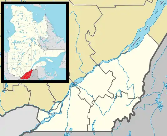
 Pointe-des-Cascades Location in southern Quebec. | |
| Coordinates: 45°20′N 73°58′W[1] | |
| Country | |
| Province | |
| Region | Montérégie |
| RCM | Vaudreuil-Soulanges |
| Constituted | May 1, 1961 |
| Government | |
| • Mayor | Gilles Santerre |
| • Federal riding | Salaberry—Suroît |
| • Prov. riding | Soulanges |
| Area | |
| • Total | 10.00 km2 (3.86 sq mi) |
| • Land | 2.67 km2 (1.03 sq mi) |
| Population (2011)[4] | |
| • Total | 1,340 |
| • Density | 502.2/km2 (1,301/sq mi) |
| • Pop 2006-2011 | |
| • Dwellings | 600 |
| Time zone | UTC−5 (EST) |
| • Summer (DST) | UTC−4 (EDT) |
| Postal code(s) | J0P 1M0 |
| Area code(s) | 450 and 579 |
| Highways | |
| Website | www.pointe- des-cascades.com |
History
Starting in the mid-seventeenth century until 1700, many military expeditions arrived at this place in order to portage around the cascades on the Saint Lawrence River. The first reference to Pointe-des-Cascades appeared in a text of Louis-Armand de Lahontan in 1684 and on a map of Deshayes in 1695, when Pointe des Cascades was included in the Vaudreuil Lordship.[5]
In 1893, the post office opened under the English name Cascades Point (renamed in 1951 to Pointe-des-Cascades). A few years later construction began on the Soulanges Canal and when it was completed in 1899, the village became the eastern, downstream terminus of the canal.[5] In 1958, it closed when it was superseded by the new Beauharnois Canal. The paths along the canal are now used as a regional cycling route.[6]
In 1961, the Village Municipality of Pointe-des-Cascades was formed on the territory of the Parish Municipalities of Saint-Joseph-de-Soulanges and Saint-Michel-de-Vaudreuil.[5]
Demographics
Population
| Canada census – Pointe-des-Cascades, Quebec community profile | |||
|---|---|---|---|
| 2011 | 2006 | ||
| Population: | 1,340 (+28.1% from 2006) | 1,046 (+14.6% from 2001) | |
| Land area: | 2.67 km2 (1.03 sq mi) | 2.67 km2 (1.03 sq mi) | |
| Population density: | 502.2/km2 (1,301/sq mi) | 392.0/km2 (1,015/sq mi) | |
| Median age: | 40.9 (M: 41.1, F: 40.7) | 39.7 (M: 38.7, F: 41.2) | |
| Total private dwellings: | 600 | 446 | |
| Median household income: | $55,754 | $55,741 | |
| References: 2011[7] 2006[8] earlier[9] | |||
|
|
|
Language
| Canada Census mother tongue - Pointe-des-Cascades, Quebec[10] | ||||||||||||||||||
|---|---|---|---|---|---|---|---|---|---|---|---|---|---|---|---|---|---|---|
| Census | Total | French |
English |
French & English |
Other | |||||||||||||
| Year | responses | Count | Trend | Pop % | Count | Trend | Pop % | Count | Trend | Pop % | Count | Trend | Pop % | |||||
2011 |
1,340 |
1,180 | 88.06% | 100 | 7.46% | 25 | 1.87% | 35 | 2.61% | |||||||||
2006 |
1,035 |
985 | 95.17% | 35 | 3.38% | 0 | 0.00% | 15 | 1.45% | |||||||||
2001 |
915 |
870 | 95.08% | 45 | 4.92% | 0 | 0.00% | 0 | 0.00% | |||||||||
1996 |
920 |
890 | n/a | 96.74% | 10 | n/a | 1.09% | 10 | n/a | 1.09% | 10 | n/a | 1.09% | |||||
Schools
Commission Scolaire des Trois-Lacs operates Francophone schools.[11]
Lester B. Pearson School Board operates Anglophone schools. It is zoned to Birchwood Elementary School in Saint-Lazare and St. Patrick Elementary School in Pincourt.[12]
See also
![]() Media related to Pointe-des-Cascades at Wikimedia Commons
Media related to Pointe-des-Cascades at Wikimedia Commons
References
- Reference number 50147 of the Commission de toponymie du Québec (in French)
- "Ministère des Affaires municipales, des Régions et de l'Occupation du territoire: Pointe-des-Cascades". Archived from the original on 2014-02-23. Retrieved 2012-03-11.
- "Parliament of Canada Federal Riding History: VAUDREUIL--SOULANGES (Quebec)". Archived from the original on 2009-06-18. Retrieved 2009-03-22.
- 2011 Statistics Canada Census Profile: Pointe-des-Cascades, Quebec
- "Pointe-des-Cascades (Municipalité de village)" (in French). Commission de toponymie du Québec. Archived from the original on 2016-03-04. Retrieved 2009-02-02.
- "Montérégie Cycling Trails: Soulanges Canal". MontrealPlus.ca. Retrieved 2009-02-02.
- "2011 Community Profiles". 2011 Canadian Census. Statistics Canada. July 5, 2013. Retrieved 2014-02-19.
- "2006 Community Profiles". 2006 Canadian Census. Statistics Canada. March 30, 2011. Retrieved 2014-02-19.
- "2001 Community Profiles". 2001 Canadian Census. Statistics Canada. February 17, 2012.
- Statistics Canada: 1996, 2001, 2006, 2011 census
- "Les écoles et les centres". Commission Scolaire des Trois-Lacs. Retrieved 18 January 2013.
- "School Board Map." Lester B. Pearson School Board. Retrieved on September 28, 2017.