Robles Del Rio, California
Robles Del Rio (also, Robles del Rio)[2] is an unincorporated community in Monterey County, California.[1] It is located west of the Carmel River adjacent to Carmel Valley,[2] at an elevation of 597 feet (182 m).[1]
Robles Del Rio | |
|---|---|
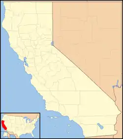 Robles Del Rio Location in California  Robles Del Rio Robles Del Rio (the United States) | |
| Coordinates: 36°28′12″N 121°44′00″W | |
| Country | United States |
| State | California |
| County | Monterey County |
| Elevation | 597 ft (182 m) |
History
The town was laid out by Frank Porter in 1926.[2] Porter bought 600 acres in the southeast corner of the 11,000-acre Rancho Los Laureles Ranch. They named the tract Robles del Rio, “oaks by the river.”[3] The Robles del Rio post office operated from 1941 to 1952, when service was transferred to Carmel Valley.[2]
In 1932, Porter built the Robles Del Rio Lodge that was on 10-acres, included 32 guest rooms, indoor and outdoor dining, pool, spa, tennis courts and horse stables. He sold the lodge on 15 February 1939 to David Prince and William Woods.[4]

Government
At the county level, Robles Del Rio is represented on the Monterey County Board of Supervisors by Supervisor Dave Potter.[5]
In the California State Legislature, Robles Del Rio is in the 17th Senate District, represented by Democrat John Laird, and in the 29th Assembly District, represented by Democrat Mark Stone.[6]
In the United States House of Representatives, Robles Del Rio is in California's 20th congressional district, represented by Democrat Jimmy Panetta[7]
References
- U.S. Geological Survey Geographic Names Information System: Robles Del Rio, California
- Durham, David L. (1998). California's Geographic Names: A Gazetteer of Historic and Modern Names of the State. Clovis, Calif.: Word Dancer Press. p. 946. ISBN 1-884995-14-4.
- Fink, Augusta (2000). Monterey County - The Dramatic Story of Its Past. Western Tanager Press/Valley Publishers. San Francisco. p. 201. Retrieved 2020-12-30.
- "Robles Lodge Is Purchased". The Californian. Salinas, California. 18 Feb 1939. p. 10. Retrieved 2020-12-30 – via Newspapers.com.
- "Monterey County Supervisorial District 5 Map (North District 5)" (PDF). County of Monterey. Archived from the original (PDF) on 1 July 2012. Retrieved 21 September 2012.
- "Statewide Database". UC Regents. Retrieved February 11, 2015.
- "California's 20th Congressional District - Representatives & District Map". Civic Impulse, LLC. Retrieved September 24, 2014.
Municipalities and communities of Monterey County, California, United States | ||
|---|---|---|
| Cities | 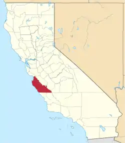 Monterey County map | |
| CDPs | ||
| Unincorporated communities |
| |
| Ghost towns | ||
| Footnotes | ‡This populated place also has portions in an adjacent county | |
| ||