Grovedale, Alberta
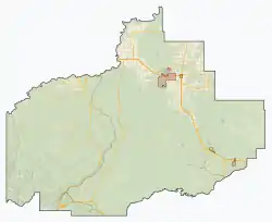
Grovedale is a hamlet in northern Alberta, Canada within the Municipal District of Greenview No. 16.[1] It is located on Highway 666 south of Grande Prairie. It is just south of the Wapiti River valley, amidst farmland and ranchland at the northern limits of the boreal forests and aspen parkland in the foothills of the Canadian Rockies.
Grovedale | |
|---|---|
 Location in M.D. of Greenview  Location in Alberta | |
| Coordinates: 55.0278°N 118.8594°W | |
| Country | Canada |
| Province | Alberta |
| Planning region | Upper Peace |
| Municipal district | Greenview |
| Government | |
| • Type | Unincorporated |
| • Governing body | Municipal District of Greenview No. 16 Council |
| Time zone | UTC-7 (MST) |

Building the bridge over the Wapiti River
History
- 1928: William and Mary Gabler settle in Grovedale.
- 1934: Ferry service commences by donations. T.E. Cooke owned and operated the ferry. A ferryman's house was built on the bank and occupied by Otto Sorely from 1934 to 1945. He was paid with food and supplies from the people who used the ferry, as there was no government wage.[2]
- 1939: Post office and general store open. Farmers start growing alfalfa in their fields.
- 1945: First school opened with a class of 14 children.
- 1954: O'Brien Provincial Park was created and named after Dr. L.J. O'Brien, Grovedale's first forest ranger in 1932.[2]
- 1958: Electrical lines reach Grovedale.
- 1958: Bridge crossing the Wapiti River opens. Ribbon cutting was held on 28 November 1958. Lumber companies had erected bridges in the past, but each spring they were swept away. Proponents of the bridge promoted the importance of it in the development a short truck-route link with Vancouver and the United States.[3]
- 1963: Another school comes to Grovedale, from a small community 9 kilometres south of Grovedale.
- 1960: A new two room school was built on the present site.
- 1967: The two room school was enlarged and renamed Penson Elementary School.[2]
- 1970s: Natural gas lines reach Grovedale.
- 1975: Grovedale Community Centre was built.
- 1976: Landry Heights subdivision was approved.[2]
Climate
| Climate data for Grovedale, Alberta | |||||||||||||
|---|---|---|---|---|---|---|---|---|---|---|---|---|---|
| Month | Jan | Feb | Mar | Apr | May | Jun | Jul | Aug | Sep | Oct | Nov | Dec | Year |
| Record high °C (°F) | 17.0 (62.6) |
17.0 (62.6) |
20.0 (68.0) |
28.5 (83.3) |
31.5 (88.7) |
32.3 (90.1) |
36.0 (96.8) |
34.5 (94.1) |
30.5 (86.9) |
28.0 (82.4) |
17.5 (63.5) |
15.0 (59.0) |
36.0 (96.8) |
| Average high °C (°F) | −6.5 (20.3) |
−2.6 (27.3) |
2.8 (37.0) |
11.0 (51.8) |
17.2 (63.0) |
20.6 (69.1) |
23.0 (73.4) |
22.2 (72.0) |
16.9 (62.4) |
10.5 (50.9) |
−0.3 (31.5) |
−4.6 (23.7) |
9.2 (48.6) |
| Daily mean °C (°F) | −12.8 (9.0) |
−9.5 (14.9) |
−4.1 (24.6) |
3.9 (39.0) |
9.7 (49.5) |
13.6 (56.5) |
15.7 (60.3) |
14.5 (58.1) |
9.8 (49.6) |
4.0 (39.2) |
−5.8 (21.6) |
−10.8 (12.6) |
2.4 (36.3) |
| Average low °C (°F) | −19.1 (−2.4) |
−16.4 (2.5) |
−11.0 (12.2) |
−3.2 (26.2) |
2.3 (36.1) |
6.4 (43.5) |
8.4 (47.1) |
6.8 (44.2) |
2.6 (36.7) |
−2.6 (27.3) |
−11.3 (11.7) |
−17 (1) |
−4.5 (23.9) |
| Record low °C (°F) | −49.0 (−56.2) |
−48 (−54) |
−48.5 (−55.3) |
−29.0 (−20.2) |
−10.0 (14.0) |
−3.0 (26.6) |
−3.0 (26.6) |
−4.5 (23.9) |
−11.5 (11.3) |
−35.5 (−31.9) |
−37.5 (−35.5) |
−45.0 (−49.0) |
−49.0 (−56.2) |
| Average precipitation mm (inches) | 36.3 (1.43) |
22.2 (0.87) |
23.8 (0.94) |
24.9 (0.98) |
42.9 (1.69) |
68.1 (2.68) |
76.1 (3.00) |
56.5 (2.22) |
46.2 (1.82) |
27.9 (1.10) |
31.2 (1.23) |
22.2 (0.87) |
478.2 (18.83) |
| Average rainfall mm (inches) | 1.7 (0.07) |
1.0 (0.04) |
1.8 (0.07) |
13.7 (0.54) |
39.4 (1.55) |
68.1 (2.68) |
76.1 (3.00) |
56.5 (2.22) |
45.2 (1.78) |
15.4 (0.61) |
5.1 (0.20) |
0.7 (0.03) |
324.7 (12.78) |
| Average snowfall cm (inches) | 35.0 (13.8) |
22.0 (8.7) |
22.0 (8.7) |
11.0 (4.3) |
4.0 (1.6) |
0.0 (0.0) |
0.0 (0.0) |
0.0 (0.0) |
1.0 (0.4) |
13.0 (5.1) |
26.0 (10.2) |
22.0 (8.7) |
156.0 (61.4) |
| Source: Environment Canada[4] | |||||||||||||
References
- Alberta Municipal Affairs (1 April 2010). "Specialized and Rural Municipalities and Their Communities" (PDF). Archived from the original (PDF) on 29 February 2012. Retrieved 24 June 2010.
- "Telling Our Stories". 2 (4). South Peace Regional Archives Society. 1 September 2011. Cite journal requires
|journal=(help) - "??". The Herald-Tribune. Bowes Publishers Limited. 28 November 1958.
- "Grovedale, Alberta". Canadian Climate Normals 1981–2010 (in English and French). Environment Canada. Retrieved 13 August 2014.
Places adjacent to Grovedale, Alberta | |
|---|---|
| Cities | |
|---|---|
| Towns | |
| Villages | |
| Hamlets | |
| Municipal districts | |
| Improvement districts | |
| Indian reserves | |
| Provincial parks | |
| Other topics | |
This article is issued from Wikipedia. The text is licensed under Creative Commons - Attribution - Sharealike. Additional terms may apply for the media files.