Saddle Hills County
Saddle Hills County is a municipal district situated in the central portion of the Peace Country in northwest Alberta, Canada. Located approximately 450 km (280 mi) northwest of Edmonton and 90 km (56 mi) north of Grande Prairie, its municipal office is located approximately 25 km (16 mi) west of the Town of Spirit River at the intersection of Highway 49 and Highway 725.
Saddle Hills County | |
|---|---|
Municipal district | |
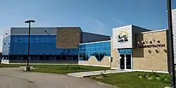 Administration building | |
 | |
| Motto(s): The Wilderness is our Back Yard | |
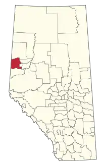 Location within Alberta | |
| Coordinates: 55°46′55″N 118°50′2″W | |
| Country | |
| Province | |
| Region | Northern Alberta |
| Census division | No. 19 |
| Established | 1945 |
| Incorporated | 1995 (Municipal district) |
| 1999 (County) | |
| Government | |
| • Reeve | Alvin Hubert |
| • Governing body | Saddle Hills County Council |
| • Office location | west of Spirit River |
| Area (2016)[2] | |
| • Land | 5,838.15 km2 (2,254.12 sq mi) |
| Population (2016)[2] | |
| • Total | 2,225 |
| • Density | 0.4/km2 (1/sq mi) |
| Time zone | UTC-7 (MST) |
| Website | saddlehills.ab.ca |
Demographics
In the 2016 Census of Population conducted by Statistics Canada, Saddle Hills County recorded a population of 2,225 living in 838 of its 978 total private dwellings, a -2.8% change from its 2011 population of 2,288. With a land area of 5,838.15 km2 (2,254.12 sq mi), it had a population density of 0.4/km2 (1.0/sq mi) in 2016.[2]
In the 2011 Census, Saddle Hills County had a population of 2,288 living in 878 of its 973 total dwellings, a -6.9% change from its 2006 population of 2,458. With a land area of 5,836.92 km2 (2,253.65 sq mi), it had a population density of 0.4/km2 (1.0/sq mi) in 2011.[3]
The population of Saddle Hills County according to its 2008 municipal census was 2,478.[4]
Economy
Saddle Hills County is situated in the Central Peace Region of northwestern Alberta along the southern banks of the Peace River. The County has a diverse agricultural community and deposits of natural gas and oil.
The oil and gas industry continues to play an important role in the region and helps to create a progressive and growing economic base.
Saddle Hills County is also home to a diverse agricultural community which produces crops which include: pulses, cereals, canola, legumes as well as bison, elk, goats and sheep. The most common livestock is cattle with an estimated of 26,429 head.
Rail service is available nearby in the Village of Rycroft, the Hamlet of Woking and the City of Dawson Creek.
Two major road corridors (Highway 49 and Highway 2) run through the County offering access to the Northwest Territories, British Columbia as well as Central and Southern Alberta.
Three areas of the County have been targeted for economic growth and have Area Structure Plans (ASPs) which are designed to give landowners, developers and prospective residents a sense of where the County its future potential. [5]
At the November 5th, 2019 Council Meeting, Saddle Hills County Council declared a Municipal Agricultural Disaster. After a wet fall and early snow, many crops remained unharvested. [6] As of October 29, 2019, only 59% of crops had been harvested in the Peace Region [7]
Government
County Council is responsible for establishing municipal service levels, approving the annual budget and local taxation levels. Council has seven members and is headed by a reeve. The reeve, currently Alvin Hubert, is the chief elected officer and is elected from within council. It is the reeve's responsibility to chair all council meetings and speak on behalf of council and the community.
Council provides direction to its administration through its chief administrative officer (CAO). The CAO is responsible for the overall administration of the county and for advising and making recommendations to county council on matters concerning the municipality.
Communities and localities
|
The following urban municipalities are surrounded by Saddle Hills County:[8]
The following hamlets are located within Saddle Hills County:[8]
|
The following localities are located within Saddle Hills County:[9]
|
Images
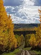 The beautiful Saddle Hills in autumn
 Moonshine Lake offers year round fishing
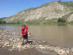 Canada's Mighty Peace River runs through Saddle Hills County
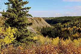 Autumn makes the hills and valley of Saddle Hills COunty stand out
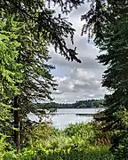 Moonshine Lake is one of the jewels of Saddle Hills County
 The Rim Rocks are a unique rock formation near Bay Tree is Saddle Hills County
References
- "Municipal Officials Search". Alberta Municipal Affairs. September 22, 2017. Retrieved September 25, 2017.
- "Population and dwelling counts, for Canada, provinces and territories, and census subdivisions (municipalities), 2016 and 2011 censuses – 100% data (Alberta)". Statistics Canada. February 8, 2017. Retrieved February 8, 2017.
- "Population and dwelling counts, for Canada, provinces and territories, and census subdivisions (municipalities), 2011 and 2006 censuses (Alberta)". Statistics Canada. February 8, 2012. Retrieved February 8, 2012.
- "Alberta 2009 Official Population List" (PDF). Alberta Municipal Affairs. September 15, 2009. Retrieved September 12, 2010.
- https://townfolio.co/ab/saddle-hills-county/overview
- https://www.saddlehills.ab.ca/en/news/council-declares-municipal-agricultural-disaster.aspx
- https://open.alberta.ca/dataset/af95ff5b-f8cc-4fd9-9bd6-e2642816028e/resource/60c9a4cf-fb77-4024-962a-cc3c2e2aa95d/download/af-crop-report-2019-10-29.pdf
- "Specialized and Rural Municipalities and Their Communities" (PDF). Alberta Municipal Affairs. 2012-03-01. Retrieved 2012-08-12.
- "Standard Geographical Classification (SGC) 2006, Economic Regions: 4819059 - Saddle Hills County, geographical codes and localities, 2006". Statistics Canada. 2010-03-05. Retrieved 2012-08-12.
External links
Places adjacent to Saddle Hills County | |
|---|---|