Silla Pata
Silla Pata (Aymara silla cane of maize, pata step,[2] "maize cane step") is a 5,442-metre-high (17,854 ft) mountain in the Cordillera Real in the Andes of Bolivia. It is located in the La Paz Department, Murillo Province, Palca Municipality. Silla Pata lies in the southern part of the Illimani massif. It is situated south-east of the highest point of the massif and Layqa Qullu and south-west of Link'u Link'u.[1][3]
| Silla Pata | |
|---|---|
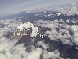 The Illimani massif as seen from the south with Silla Pata (lower center, left, snowless) | |
| Highest point | |
| Elevation | 5,442 m (17,854 ft) [1] |
| Coordinates | 16°40′36″S 67°45′37″W |
| Geography | |
 Silla Pata Location within Bolivia | |
| Location | Bolivia, La Paz Department, Murillo Province |
| Parent range | Andes, Cordillera Real |
References
- Bolivian IGM map 1:50,000 Cohoni 6043-IV
- Radio San Gabriel, "Instituto Radiofonico de Promoción Aymara" (IRPA) 1993, Republicado por Instituto de las Lenguas y Literaturas Andinas-Amazónicas (ILLLA-A) 2011, Transcripción del Vocabulario de la Lengua Aymara, P. Ludovico Bertonio 1612 (Spanish-Aymara-Aymara-Spanish dictionary)
- "Palca". INE, Bolivia. Retrieved November 4, 2014. (unnamed)

This article is issued from Wikipedia. The text is licensed under Creative Commons - Attribution - Sharealike. Additional terms may apply for the media files.