Silver Creek Township, Stephenson County, Illinois
Silver Creek Township is a township in Stephenson County, Illinois. As of the 2010 census, its population was 696 and it contained 332 housing units.[2][3]
Silver Creek Township | |
|---|---|
Township | |
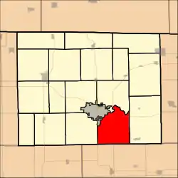 Location in Stephenson County | |
| Coordinates: 42°14′48″N 89°34′01″W | |
| Country | United States |
| State | Illinois |
| County | Stephenson |
| Government | |
| • Supervisor | Lee Runte |
| Area | |
| • Total | 35 sq mi (90 km2) |
| • Land | 34.98 sq mi (90.6 km2) |
| • Water | 0.02 sq mi (0.05 km2) 0.06% |
| Elevation | 823 ft (251 m) |
| Population (2010) | |
| • Estimate (2016)[1] | 666 |
| • Density | 19.9/sq mi (7.7/km2) |
| Time zone | UTC-6 (CST) |
| • Summer (DST) | UTC-5 (CDT) |
| FIPS code | 17-177-69953 |
Geography
Silver Creek is Townships 26 and 27 (part) North, Range 8 East of the Fourth Principal Meridian.
Silver Creek Township is located at 42°14′48″N 89°34′01″W at an elevation of 823 feet (251 meters). According to the 2010 census, the township has a total area of 35 square miles (91 km2), of which 34.98 square miles (90.6 km2) (or 99.94%) is land and 0.02 square miles (0.052 km2) (or 0.06%) is water.[2] Silver Creek Township borders the city of Freeport, the county seat of Stephenson County, to the northwest.[4]
History
Thomas Craine first settled Silver Creek Township in August 1835.[5]
Mills
Brown's Mill was built four miles east of Freeport on the Pecatonica River by Caleb W. Brown in 1857. The stone grist mill closed in 1903 and was converted to a power plant by A.J. Goddard in 1908. For a short time it generated power for the street car system in Freeport. After a fire in 1950 partially destroyed the building it was rebuilt and converted to a residence. It was still standing on Brown's Mill Road in 1970, but has since been demolished.[6]
Demographics
| Historical population | |||
|---|---|---|---|
| Census | Pop. | %± | |
| 2016 (est.) | 666 | [1] | |
| U.S. Decennial Census[7] | |||
As of the census of 2000,[3] there were 739 people, 293 households, and 219 families in Silver Creek Township.
References
- "Population and Housing Unit Estimates". Retrieved June 9, 2017.
- "Population, Housing Units, Area, and Density: 2010 - County -- County Subdivision and Place -- 2010 Census Summary File 1". United States Census. Archived from the original on 2020-02-12. Retrieved 2013-05-28.
- "U.S. Census website". United States Census Bureau. Retrieved 2008-01-31.
- Stephenson County, Illinois General Highway Map (PDF) (Map). Illinois Department of Transportation. 2009. Retrieved 2010-09-04.
- Fulwider, Addison L. (1910). History of Stephenson County, Illinois: Volume 1. p. 391.
- History of Stephenson County 1970. Freeport, Illinois: County of Stephenson, 1972. p. 196, illus.
- "Census of Population and Housing". Census.gov. Retrieved June 4, 2016.
External links
Places adjacent to Silver Creek Township, Stephenson County, Illinois | |
|---|---|
Municipalities and communities of Stephenson County, Illinois, United States | ||
|---|---|---|
| City | Map of Illinois highlighting Stephenson County | |
| Town | ||
| Villages | ||
| CDP | ||
| Townships | ||
| Unincorporated communities | ||
| Footnotes | ‡This populated place also has portions in an adjacent county or counties | |
| ||