Grayson County, Virginia
Grayson County is a county located in the southwestern part of the Commonwealth of Virginia. As of the 2010 census, the population was 15,533.[2] Its county seat is Independence.[3] Mount Rogers, the state's highest peak at 5,729 feet (1,746 m), is in Grayson County.
Grayson County | |
|---|---|
 Present-day Grayson County Courthouse | |
 Seal | |
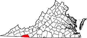 Location within the U.S. state of Virginia | |
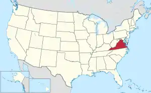 Virginia's location within the U.S. | |
| Coordinates: 36°39′N 81°14′W | |
| Country | |
| State | |
| Founded | 1793 |
| Named for | William Grayson |
| Seat | Independence |
| Largest town | Independence |
| Area | |
| • Total | 446 sq mi (1,160 km2) |
| • Land | 442 sq mi (1,140 km2) |
| • Water | 3.8 sq mi (10 km2) 0.8% |
| Population (2010) | |
| • Total | 15,533 |
| • Estimate (2018)[1] | 15,631 |
| • Density | 35/sq mi (13/km2) |
| Time zone | UTC−5 (Eastern) |
| • Summer (DST) | UTC−4 (EDT) |
| Congressional district | 9th |
| Website | www |
History
Grayson County was founded in 1793 from part of Wythe County. It was named for William Grayson,[4] delegate to the Continental Congress from 1784 to 1787 and one of the first two U.S. Senators from Virginia. The first courthouse was built in Greensville, later called Oldtown, constructed in 1794 and rebuilt beginning in 1832. In 1842, the Virginia General Assembly authorized the division of Grayson County, the northeastern portion becoming Carroll County.
During the American Civil War, little fighting occurred within Grayson County. However, the "Grayson Dare Devils" (Company F, 4th Regiment of the Stonewall Brigade) were recruited from the Elk Creek Valley of Grayson County shortly after Virginia seceded, and sustained significant losses as the First Battle of Manassas. The Grayson Cavalry was Company C of the 8th Virginia Cavalry, which served until the war's end.[5] Company D of the 50th Virginia Infantry was recruited in the Mouth of Wilson Community and they were known as the "Wilson Rifles."
The county seat since shortly before the American Civil War has been Independence, Virginia, since the former county seat had been centrally located until Carroll County split off (and Oldtown now is a district within Grayson county).[6] The Old Grayson County Courthouse and Clerk's Office renovated circa 1834 still exists, but is now located near what since 1953 is the independent city of Galax, Virginia. Even by 1890 the nearest railroad to Grayson county was nine miles from the county line, a Norfolk and Western Railway stop called "Rural Retreat." Textile and then furniture factories arrived in Galax (which was planned as a town near the old village of Blair on a plateau beginning in 1903, and renamed after a plant harvested from the surrounding mountains). Also the New River was dammed at Fries to power a cotton mill, which also led to more direct service by the Norfolk and Western to Troutdale (which later faltered). Whitetop City and Fairwood also virtually disappeared during the Great Depression.[7]
In 1997, Elk Creek was the site of the murder by burning and beheading of Garnett P. "G.P." Johnson, a black man.[8][9]
Geography
According to the U.S. Census Bureau, the county has a total area of 446 square miles (1,160 km2), of which 442 square miles (1,140 km2) is land and 3.8 square miles (9.8 km2) (0.8%) is water.[10] The southernmost point in Virginia lies in Grayson County.
Adjacent counties
|
|
National protected areas
- Blue Ridge Parkway (part)
- Jefferson National Forest (part)
- Mount Rogers National Recreation Area (part)
Demographics
| Historical population | |||
|---|---|---|---|
| Census | Pop. | %± | |
| 1800 | 3,912 | — | |
| 1810 | 4,941 | 26.3% | |
| 1820 | 5,598 | 13.3% | |
| 1830 | 7,675 | 37.1% | |
| 1840 | 9,087 | 18.4% | |
| 1850 | 6,677 | −26.5% | |
| 1860 | 8,252 | 23.6% | |
| 1870 | 9,587 | 16.2% | |
| 1880 | 13,068 | 36.3% | |
| 1890 | 14,394 | 10.1% | |
| 1900 | 16,853 | 17.1% | |
| 1910 | 19,856 | 17.8% | |
| 1920 | 19,816 | −0.2% | |
| 1930 | 20,017 | 1.0% | |
| 1940 | 21,916 | 9.5% | |
| 1950 | 21,379 | −2.5% | |
| 1960 | 17,930 | −16.1% | |
| 1970 | 15,439 | −13.9% | |
| 1980 | 16,579 | 7.4% | |
| 1990 | 16,278 | −1.8% | |
| 2000 | 17,917 | 10.1% | |
| 2010 | 15,533 | −13.3% | |
| 2018 (est.) | 15,631 | [1] | 0.6% |
| U.S. Decennial Census[11] 1790-1960[12] 1900-1990[13] 1990-2000[14] 2010-2013[2] | |||
As of the census[15] of 2000, there were 17,917 people, 7,259 households, and 5,088 families residing in the county. The population density was 40 people per square mile (16/km2). There were 9,123 housing units at an average density of 21 per square mile (8/km2). The racial makeup of the county was 91.70% White, 6.79% Black or African American, 0.12% Native American, 0.07% Asian, 0.03% Pacific Islander, 0.70% from other races, and 0.60% from two or more races. 1.55% of the population were Hispanic or Latino of any race.
There were 7,259 households, out of which 26.40% had children under the living with them, 57.60% were married couples living together, 8.50% had a female householder with no husband present, and 29.90% were non-families. 26.80% of all households were made up of individuals, and 12.90% had someone living alone who was 65 years of age or older. The average household size was 2.31 and the average family size was 2.77.
In the county, the population was spread out, with 19.50% under the age of 18, 7.60% from 18 to 24, 29.80% from 25 to 44, 26.20% from 45 to 64, and 16.90% who were 65 years of age or older. The median age was 40 years. For every 100 females there were 107.70 males. For every 100 females age 18 and over, there were 109.70 males.

The median income for a household in the county was $28,676, and the median income for a family was $35,076. Males had a median income of $24,126 versus $17,856 for females. The per capita income for the county was $16,768. About 10.00% of families and 13.60% of the population were below the poverty line, including 18.80% of those under age 18 and 16.30% of those age 65 or over.
Economy
Grayson is economically isolated, without an Interstate Highway and surrounded by mountains. It struggled to attract and retain business; a situation made much worse beginning in 2009 with the recession. Losses of jobs in the furniture and textile sectors resulted in an unemployment rate of 14.6%. As part of the reformation of county government beginning in 2009, the new but idle River North Correctional Center was activated by the state brought in several hundred jobs. County government efforts were successful in retaining Core Fitness' Nautilus facility as the largest employer in the county and integrating local businesses as part of their supply chain. Independence Lumber suffered significant losses in a fire in November 2012 which forced it to relocate operations to North Carolina. Efforts by the county led to the company rebuilding and reopening its facility in 2014 with 125 jobs. By 2014 a focus on job creation brought additional business operations and 300 more jobs to the county and resulted in an unemployment rate of only 6.9%.[16] By April 2019, the unemployment rate had plummeted to just 2.6%.[17]
Government
In 2009, the county, in dire financial condition from mismanagement and the failing economy, hired Jonathan Sweet as County Administrator. The county debt was $18.3 million and operational expenses were being paid by added borrowing. By 2015 the county had reversed its fiscal direction, revitalized the business climate, and begun to regain the confidence of its citizens. The county fund balance was 35% of its operating expenses and government operations were financially stable with reduced debt.[16]
Board of Supervisors
- At-Large District: John Fant(I)
- Elk Creek District: Brenda R. Sutherland (D)
- Oldtown District: Kenneth Ray Belton (R)
- Providence District: Mike Hash (R)
- Wilson District: Tom Revels (R)
Constitutional officers
| Office | Person | Political party |
|---|---|---|
| Clerk of the Circuit Court ‡ | Susan M. Herrington | (R) |
| Commissioner of the Revenue | Larry D. Bolt | (R) |
| Commonwealth's Attorney ‡ | Brandon R. Boyles | (R) |
| Sheriff ‡ | Richard A. Vaughan | (I) |
| Treasurer | R. Pete Hall, Jr. | (R) |
- ‡Positions shared with Galax City.
Legislative representation
Grayson is represented by Republican C.W. "Bill" Carrico in the Virginia Senate, Republican Israel D. O'Quinn in the Virginia House of Delegates, and Republican H. Morgan Griffith in the U.S. House of Representatives.
| Year | Republican | Democratic | Third parties |
|---|---|---|---|
| 2020 | 80.3% 6,529 | 18.9% 1,535 | 0.8% 67 |
| 2016 | 76.8% 5,592 | 19.3% 1,407 | 3.9% 286 |
| 2012 | 67.4% 4,801 | 29.0% 2,068 | 3.5% 252 |
| 2008 | 62.9% 4,540 | 34.4% 2,480 | 2.8% 200 |
| 2004 | 65.2% 4,655 | 34.1% 2,430 | 0.7% 52 |
| 2000 | 61.8% 4,236 | 36.0% 2,467 | 2.2% 149 |
| 1996 | 46.9% 3,004 | 41.6% 2,661 | 11.5% 738 |
| 1992 | 48.7% 3,378 | 37.7% 2,615 | 13.6% 946 |
| 1988 | 61.5% 3,968 | 37.8% 2,441 | 0.7% 42 |
| 1984 | 65.4% 4,508 | 33.7% 2,319 | 0.9% 63 |
| 1980 | 53.4% 3,494 | 43.9% 2,875 | 2.7% 178 |
| 1976 | 48.3% 3,021 | 50.3% 3,146 | 1.3% 84 |
| 1972 | 67.5% 3,565 | 30.3% 1,603 | 2.2% 115 |
| 1968 | 54.1% 3,563 | 29.2% 1,926 | 16.7% 1,098 |
| 1964 | 48.9% 3,105 | 51.0% 3,238 | 0.1% 9 |
| 1960 | 58.7% 3,893 | 41.3% 2,738 | 0.1% 7 |
| 1956 | 62.2% 4,039 | 37.4% 2,426 | 0.5% 31 |
| 1952 | 61.8% 4,449 | 38.0% 2,734 | 0.3% 18 |
| 1948 | 55.9% 3,669 | 41.7% 2,741 | 2.4% 158 |
| 1944 | 55.8% 3,298 | 44.1% 2,607 | 0.2% 9 |
| 1940 | 50.8% 2,806 | 48.9% 2,703 | 0.3% 17 |
| 1936 | 52.6% 3,343 | 47.3% 3,005 | 0.1% 4 |
| 1932 | 41.0% 1,624 | 58.3% 2,306 | 0.7% 28 |
| 1928 | 61.4% 2,728 | 38.6% 1,713 | |
| 1924 | 46.9% 1,442 | 52.4% 1,611 | 0.8% 23 |
| 1920 | 54.7% 2,153 | 45.3% 1,781 | |
| 1916 | 56.2% 1,244 | 43.7% 967 | 0.2% 4 |
| 1912 | 42.3% 832 | 42.8% 842 | 14.9% 292 |
Culture
Located in the Appalachian region of the United States, Grayson County has long been famous for its traditional, or "old-time" music and musicians. Although the entire Appalachian region is known for its music, the region around Mount Airy, North Carolina and Galax, Virginia is one of the areas where this music has remained strongest, even among young people. The Old Fiddler's Convention, one of the most prominent traditional music contests in the United States, has been held annually in Galax since 1935. Grayson County is also the home of other fiddlers' conventions and old time and bluegrass festivals such as the Grayson County Fiddlers Convention, Fries Fiddlers Convention, and the Wayne C. Henderson Guitar Festival. The Whitetop Mountain Band, The New Ballards Branch Bogtrotters, The Wolfe Brothers String Band, and the Konnarock Critters are among many of the best known old time bands of the area.
Communities
Towns
Unincorporated communities
- Baywood
- Carsonville
- Comers Rock
- Elk Creek
- Fairview
- Flat Ridge
- Grant
- Mouth of Wilson
- Rugby
- Volney
Notable residents
- John Calhoun Dickenson (1815-1890), planter and politician
- Henry Whitter (1892–1941) – early country musician
- Wade Ward (1892–1971) – old-time country music banjo player and fiddler
- Estil C. Ball (1913–1978) – singer-songwriter, fingerstyle guitarist, and country, gospel and folk musician
- Wayne Henderson (luthier) – guitar maker and fingerstyle guitar player
- Kenneth Y. Tomlinson former editor of the Reader's Digest
- Robert Kyle Poole former Virginia state Delegate representing Wythe County
See also
References
- "Population and Housing Unit Estimates". Retrieved July 14, 2019.
- "State & County QuickFacts". United States Census Bureau. Archived from the original on June 7, 2011. Retrieved January 2, 2014.
- "Find a County". National Association of Counties. Archived from the original on 2011-05-31. Retrieved 2011-06-07.
- Gannett, Henry (1905). The Origin of Certain Place Names in the United States. Govt. Print. Off. pp. 142.
- The wartime correspondence of Earl Carson Andis is published in Fields and Hughes, Grayson County: A History in Words and Pictures (Grayson County Historical Society, 1976) pp. 99-133
- For some explanation of what had been a decade-long controversy over the county seat relocation, see the NRIS for the old courthouse, section 8 p. 6 available at http://www.dhr.virginia.gov/registers/Counties/Grayson/038-0004_Old_Grayson_County_Courthouse_1997_Final_Nomination.pdf
- Fields and Hughes, p. 10
- https://webcache.googleusercontent.com/search?q=cache:qDoNsRF_gScJ:https://www.washingtonpost.com/archive/local/1998/11/03/murder-trial-begins-in-va-beheading-case/029bbaf8-b0f4-4027-b5a9-1bda178e5f15/+&cd=1&hl=en&ct=clnk&gl=us&client=opera-gx
- https://greensboro.com/virginia-man-gets-life-in-beheading-the-justice-department-may-now-investigate-the-killing-as/article_5f6dc5db-5506-54b4-bbe0-2a3c04e77594.html
- "US Gazetteer files: 2010, 2000, and 1990". United States Census Bureau. 2011-02-12. Retrieved 2011-04-23.
- "U.S. Decennial Census". United States Census Bureau. Retrieved January 2, 2014.
- "Historical Census Browser". University of Virginia Library. Retrieved January 2, 2014.
- "Population of Counties by Decennial Census: 1900 to 1990". United States Census Bureau. Retrieved January 2, 2014.
- "Census 2000 PHC-T-4. Ranking Tables for Counties: 1990 and 2000" (PDF). United States Census Bureau. Retrieved January 2, 2014.
- "U.S. Census website". United States Census Bureau. Retrieved 2011-05-14.
- Prall, Derek (July 2015). "Home is where the heart is". American City & County. 130 (7): 16–23.
- Local Area Unemployment Statistics Map, Bureau of Labor Statistics
- Leip, David. "Dave Leip's Atlas of U.S. Presidential Elections". uselectionatlas.org. Retrieved 2020-12-09.
External links
| Wikimedia Commons has media related to Grayson County, Virginia. |
Places adjacent to Grayson County, Virginia | ||||||||||
|---|---|---|---|---|---|---|---|---|---|---|
| ||||||||||
Municipalities and communities of Grayson County, Virginia, United States | ||
|---|---|---|
| Towns | Map of Virginia highlighting Grayson County | |
| Unincorporated communities | ||
| ||
| Authority control |
|---|