28th Street station (BMT Broadway Line)
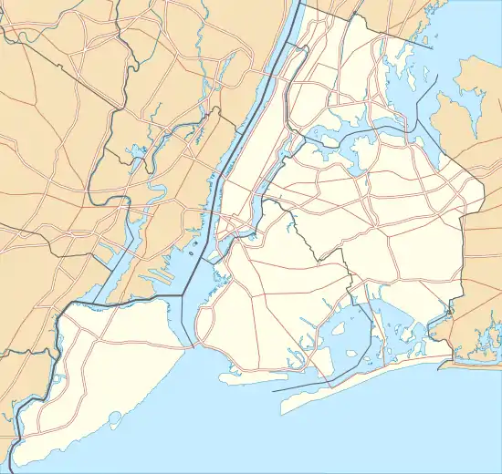
28th Street is a local station on the BMT Broadway Line of the New York City Subway, located at 28th Street and Broadway in Manhattan. It is served by the R train at all times except late nights, the W train on weekdays, the N train during late nights and weekends and the Q train during late nights.
28 Street | ||||||||||||||||||||||||||||||||||||||||||||||||||||||||||||||||||||
|---|---|---|---|---|---|---|---|---|---|---|---|---|---|---|---|---|---|---|---|---|---|---|---|---|---|---|---|---|---|---|---|---|---|---|---|---|---|---|---|---|---|---|---|---|---|---|---|---|---|---|---|---|---|---|---|---|---|---|---|---|---|---|---|---|---|---|---|---|
 | ||||||||||||||||||||||||||||||||||||||||||||||||||||||||||||||||||||
| Station statistics | ||||||||||||||||||||||||||||||||||||||||||||||||||||||||||||||||||||
| Address | West 28th Street & Broadway New York, NY 10001 | |||||||||||||||||||||||||||||||||||||||||||||||||||||||||||||||||||
| Borough | Manhattan | |||||||||||||||||||||||||||||||||||||||||||||||||||||||||||||||||||
| Locale | Midtown Manhattan, NoMad | |||||||||||||||||||||||||||||||||||||||||||||||||||||||||||||||||||
| Coordinates | 40.745241°N 73.988757°W | |||||||||||||||||||||||||||||||||||||||||||||||||||||||||||||||||||
| Division | B (BMT) | |||||||||||||||||||||||||||||||||||||||||||||||||||||||||||||||||||
| Line | BMT Broadway Line | |||||||||||||||||||||||||||||||||||||||||||||||||||||||||||||||||||
| Services | N Q R W | |||||||||||||||||||||||||||||||||||||||||||||||||||||||||||||||||||
| Structure | Underground | |||||||||||||||||||||||||||||||||||||||||||||||||||||||||||||||||||
| Platforms | 2 side platforms | |||||||||||||||||||||||||||||||||||||||||||||||||||||||||||||||||||
| Tracks | 4 | |||||||||||||||||||||||||||||||||||||||||||||||||||||||||||||||||||
| Other information | ||||||||||||||||||||||||||||||||||||||||||||||||||||||||||||||||||||
| Opened | January 5, 1918[1] | |||||||||||||||||||||||||||||||||||||||||||||||||||||||||||||||||||
| Station code | 013[2] | |||||||||||||||||||||||||||||||||||||||||||||||||||||||||||||||||||
| Opposite- direction transfer | No | |||||||||||||||||||||||||||||||||||||||||||||||||||||||||||||||||||
| Traffic | ||||||||||||||||||||||||||||||||||||||||||||||||||||||||||||||||||||
| 2019 | 4,018,310[3] | |||||||||||||||||||||||||||||||||||||||||||||||||||||||||||||||||||
| Rank | 122 out of 424[3] | |||||||||||||||||||||||||||||||||||||||||||||||||||||||||||||||||||
| Station succession | ||||||||||||||||||||||||||||||||||||||||||||||||||||||||||||||||||||
| Next north | 34th Street–Herald Square: N | |||||||||||||||||||||||||||||||||||||||||||||||||||||||||||||||||||
| Next south | 23rd Street: N | |||||||||||||||||||||||||||||||||||||||||||||||||||||||||||||||||||
| ||||||||||||||||||||||||||||||||||||||||||||||||||||||||||||||||||||
| ||||||||||||||||||||||||||||||||||||||||||||||||||||||||||||||||||||
| ||||||||||||||||||||||||||||||||||||||||||||||||||||||||||||||||||||
| ||||||||||||||||||||||||||||||||||||||||||||||||||||||||||||||||||||


History
This station opened on January 5, 1918, as the BMT Broadway Line was extended north from 14th Street–Union Square to Times Square–42nd Street and south to Rector Street. Service at this station was provided by local service running between Times Square and Rector Street.[1] Service was extended one station to Whitehall Street–South Ferry on September 20, 1918.[4][5] On August 1, 1920, the Montague Street Tunnel opened, extending local service from Lower Manhattan to DeKalb Avenue in Downtown Brooklyn by traveling under the East River.[6][7]
On August 6, 1927, bombs exploded at the 28th Street station and at the 28th Street station on the Lexington Avenue Line. The perpetrator of the bombings is unknown; they were initially blamed on Galleanists, as Sacco and Vanzetti had been denied appeal three days prior, though police later believed they were unrelated.[8][9][10]
Station layout
| G | Street level | Exit/entrance |
| P Platform level |
Side platform | |
| Northbound local | ← ← ← ← | |
| Northbound express | ← | |
| Southbound express | | |
| Southbound local | | |
| Side platform | ||
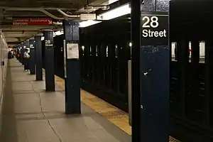
This underground station has four tracks and two side platforms. Both platforms are columnless and have their original BRT-style mosaics and station name tablets reading "28TH STREET" in Times New Roman font.
This station was renovated in 2001 by New York City Transit. It sealed off and removed any evidence of a crossunder outside fare control while false curtain walls were installed at the north ends of each platform, shortening them by 10 to 15 feet, though the Brooklyn-bound platform is longer than the Queens-bound one. Tiles from a previous renovation in the 1970s were removed, restoring the station's original trim line and name tablets.
The 2012 artwork at this station is City Dwellers (for Costas and Maro) by Mark Hadjipateras. It is composed of glass mosaics inspired by the Toy Center and the surrounding areas of the Garment and Flower District.[11]

Exits
Both platforms have one same-level fare control area at the center. Each one has a turnstile bank, token booth, and two street stairs. The ones on the northbound platform go up to either eastern corner of 28th Street and Broadway while the ones on the southbound platform go up to either western corner. There are no crossovers or crossunders to allow a free transfer between directions.[12]
There are closed exits from each platform to all corners of 29th Street and Broadway. The exits to the northern corners are currently used as emergency exits and are blocked by hatches on street level, while the exits to the southern corners were sealed on street level.
References
- "Open New Subway to Times Square" (PDF). The New York Times. January 6, 1918. p. 3. Retrieved November 5, 2016.
- "Station Developers' Information". Metropolitan Transportation Authority. Retrieved June 13, 2017.
- "Facts and Figures: Annual Subway Ridership 2014–2019". Metropolitan Transportation Authority. 2020. Retrieved May 26, 2020.
- District, New York (State) Public Service Commission First (January 1, 1919). Report of the Public Service Commission for the First District of the State of New York. J.B. Lyon Company.
- Legislative Documents. J.B. Lyon Company. January 1, 1920.
- "New B.R.T. lines open" (PDF). The New York Times. August 2, 1920. p. 17. Retrieved November 5, 2016.
- "Broadway - Fifty-Ninth Street Extension of B.R.T. Subway, Opened to Queensboro Plaza, L.I. City" (PDF). The New York Times. August 1, 1920. p. R-92. Retrieved August 31, 2020.
- Joughin, Louis; Morgan, Edmund M. The Legacy of Sacco and Vanzetti. Princeton University Press. p. 273. ISBN 9781400868650 – via Google Books.
- Carroll, Michael P. (Winter 2020). "The Forgotten Story of the Bombings of the Italian Church of Saints Peter and Paul in San Francisco". Italian American Review. 10 (1): 36. doi:10.5406/italamerrevi.10.1.0019.
- "Probe of Bombings Turns to Boston". Boston Globe. August 9, 1927. p. 8 – via Newspapers.com
 .
. - "28th Street - Mark Hadjipateras - City Dwellers (for Costas and Maro), 2002". web.mta.info. Metropolitan Transportation Authority. Archived from the original on September 9, 2020. Retrieved September 9, 2020.
- "MTA Neighborhood Maps: Pennsylvania Station / Times Square" (PDF). mta.info. Metropolitan Transportation Authority. 2015. Retrieved December 11, 2015.
External links
| Wikimedia Commons has media related to 28th Street (BMT Broadway Line). |
- nycsubway.org – BMT Broadway Subway: 28th Street
- Station Reporter — N Train
- Station Reporter — R Train
- MTA's Arts For Transit — 28th Street (BMT Broadway Line)
- 28th Street entrance from Google Maps Street View
- Platforms from Google Maps Street View