Apartadó
Apartadó (Spanish pronunciation: [apaɾtaˈðo]) is a town and municipality in the Antioquia Department, Colombia. Apartadó means river of plantains in the local Indian language. The town is located near the Atlantic Ocean in the Gulf of Urabá, the economy is based in bananas, plantain, corn, cassava, cocoa, wood and livestock. The mean temperature is 30 degrees Celsius and the relative humidity is above 80% all year round. Apartadó is divided in 48 neighborhoods, and here is the best high school of the region of Urabá Antioquia. Today, the government is stimulating industrialization because it is near the Caribbean Sea and to the center of the country. Inhabitants: 200,931 in 2019.[1]
Apartadó | |
|---|---|
 | |
 Flag  Coat of arms | |
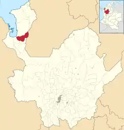 Location of the municipality and town of Apartadó in the Antioquia Department of Colombia | |
 Apartadó Location in Colombia | |
| Coordinates: 7°53′N 76°38′W | |
| Country | |
| Department | |
| Subregion | Urabá |
| Founded | 1907 |
| Government | |
| • Mayor | Gonzalo Giraldo Aguirre |
| Area | |
| • Total | 607 km2 (234 sq mi) |
| Elevation | 30 m (100 ft) |
| Population (2019 est.[1]) | |
| • Total | 200,931 |
| • Density | 330/km2 (860/sq mi) |
| Demonym(s) | Apartadoseños |
| Time zone | UTC-5 (Colombia Standard Time) |
| Area code(s) | 57 + 4 |
| Climate | Af |
| Website | Official website (in Spanish) |
Climate
Apartadó has a tropical rainforest climate (Af) with heavy rainfall year-round.
| Climate data for Apartadó | |||||||||||||
|---|---|---|---|---|---|---|---|---|---|---|---|---|---|
| Month | Jan | Feb | Mar | Apr | May | Jun | Jul | Aug | Sep | Oct | Nov | Dec | Year |
| Average high °C (°F) | 30.2 (86.4) |
30.1 (86.2) |
30.5 (86.9) |
30.7 (87.3) |
29.3 (84.7) |
29.8 (85.6) |
30.0 (86.0) |
30.1 (86.2) |
29.7 (85.5) |
29.4 (84.9) |
29.3 (84.7) |
29.6 (85.3) |
29.9 (85.8) |
| Daily mean °C (°F) | 26.7 (80.1) |
26.8 (80.2) |
27.0 (80.6) |
27.1 (80.8) |
26.3 (79.3) |
26.5 (79.7) |
26.7 (80.1) |
26.7 (80.1) |
26.7 (80.1) |
26.5 (79.7) |
26.5 (79.7) |
26.5 (79.7) |
26.7 (80.0) |
| Average low °C (°F) | 23.2 (73.8) |
23.6 (74.5) |
23.6 (74.5) |
23.5 (74.3) |
23.3 (73.9) |
23.3 (73.9) |
23.4 (74.1) |
23.3 (73.9) |
23.7 (74.7) |
23.7 (74.7) |
23.8 (74.8) |
23.4 (74.1) |
23.5 (74.3) |
| Average rainfall mm (inches) | 94.7 (3.73) |
81.7 (3.22) |
98.8 (3.89) |
254.2 (10.01) |
330.7 (13.02) |
285.3 (11.23) |
255.0 (10.04) |
251.8 (9.91) |
283.7 (11.17) |
310.0 (12.20) |
291.1 (11.46) |
207.3 (8.16) |
2,744.3 (108.04) |
| Average rainy days | 9 | 9 | 10 | 18 | 22 | 22 | 22 | 22 | 22 | 21 | 19 | 15 | 211 |
| Average relative humidity (%) | 86 | 84 | 84 | 86 | 88 | 88 | 88 | 88 | 87 | 87 | 87 | 88 | 87 |
| Mean monthly sunshine hours | 161.2 | 138.3 | 124.0 | 108.0 | 120.9 | 96.0 | 130.2 | 133.3 | 120.0 | 136.4 | 138.0 | 139.5 | 1,545.8 |
| Mean daily sunshine hours | 5.2 | 4.9 | 4.0 | 3.6 | 3.9 | 3.2 | 4.2 | 4.3 | 4.0 | 4.4 | 4.6 | 4.5 | 4.2 |
| Source: IDEAM[2] | |||||||||||||
Transportation
The city is served by Antonio Roldán Betancourt Airport, with service on three commercial airlines.
References
- "Resultados y proyecciones (2005-2020) del censo 2005". Retrieved 1 July 2019.
- "Data". www.ideam.gov.co. Retrieved 2020-08-25.
Capital: Medellín | |||||||||||||||||||
| Regions and municipalities |
| ||||||||||||||||||
| Related topics | |||||||||||||||||||