Nariño, Antioquia
Nariño is a town and municipality in the Colombian department of Antioquia. Part of the subregion of Eastern Antioquia.
Nariño | |
|---|---|
Municipality and town | |
 Flag .svg.png.webp) Seal | |
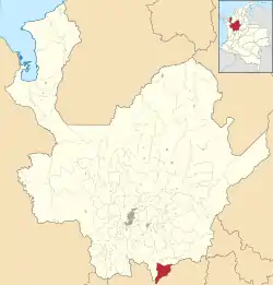 Location of the municipality and town of Nariño in the Antioquia Department of Colombia | |
| Coordinates: 5°36′33″N 75°10′35″W | |
| Country | |
| Department | |
| Subregion | Eastern |
| Area | |
| • Total | 313 km2 (121 sq mi) |
| Population (Census 2018[1]) | |
| • Total | 8,603 |
| • Density | 27/km2 (71/sq mi) |
| Time zone | UTC-5 (Colombia Standard Time) |
Climate
Nariño has a cool tropical rainforest climate (Af) due to altitude with heavy to very heavy rainfall year-round.
| Climate data for Nariño | |||||||||||||
|---|---|---|---|---|---|---|---|---|---|---|---|---|---|
| Month | Jan | Feb | Mar | Apr | May | Jun | Jul | Aug | Sep | Oct | Nov | Dec | Year |
| Average high °C (°F) | 23.2 (73.8) |
23.7 (74.7) |
23.9 (75.0) |
23.0 (73.4) |
23.2 (73.8) |
23.4 (74.1) |
23.9 (75.0) |
23.7 (74.7) |
23.4 (74.1) |
22.6 (72.7) |
22.3 (72.1) |
22.6 (72.7) |
23.2 (73.8) |
| Daily mean °C (°F) | 18.6 (65.5) |
19.0 (66.2) |
19.3 (66.7) |
18.9 (66.0) |
19.2 (66.6) |
19.0 (66.2) |
19.1 (66.4) |
19.0 (66.2) |
18.7 (65.7) |
18.4 (65.1) |
18.2 (64.8) |
18.4 (65.1) |
18.8 (65.9) |
| Average low °C (°F) | 14.1 (57.4) |
14.4 (57.9) |
14.8 (58.6) |
14.8 (58.6) |
15.2 (59.4) |
14.7 (58.5) |
14.3 (57.7) |
14.3 (57.7) |
14.1 (57.4) |
14.2 (57.6) |
14.2 (57.6) |
14.2 (57.6) |
14.4 (58.0) |
| Average rainfall mm (inches) | 201 (7.9) |
241 (9.5) |
304 (12.0) |
433 (17.0) |
453 (17.8) |
258 (10.2) |
189 (7.4) |
246 (9.7) |
355 (14.0) |
468 (18.4) |
335 (13.2) |
282 (11.1) |
3,765 (148.2) |
| Source: Climate-Data.org[2] | |||||||||||||
References
- "Censo Nacional de Población y Vivienda 2018" (in Spanish). DANE. Retrieved 25 April 2020.
- "Climate: Nariño". Climate-Data.org. Retrieved September 3, 2020.
Capital: Medellín | |||||||||||||||||||
| Regions and municipalities |
| ||||||||||||||||||
| Related topics | |||||||||||||||||||
This article is issued from Wikipedia. The text is licensed under Creative Commons - Attribution - Sharealike. Additional terms may apply for the media files.