Mutatá
Mutatá is a municipality in the Colombian department of Antioquia.
Mutatá | |
|---|---|
Municipality and town | |
 | |
.svg.png.webp) Flag | |
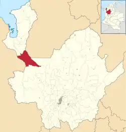 Location of the municipality and town of Mutatá in the Antioquia Department of Colombia | |
 Mutatá Location in Colombia | |
| Coordinates: 7°14′39″N 76°26′9″W | |
| Country | |
| Department | |
| Subregion | Urabá |
| Population (Census 2018[1]) | |
| • Total | 12,607 |
| Time zone | UTC-5 (Colombia Standard Time) |
Climate
Mutatá has a tropical rainforest climate (Af) with very heavy rainfall year round.
| Climate data for Mutatá | |||||||||||||
|---|---|---|---|---|---|---|---|---|---|---|---|---|---|
| Month | Jan | Feb | Mar | Apr | May | Jun | Jul | Aug | Sep | Oct | Nov | Dec | Year |
| Average high °C (°F) | 29.9 (85.8) |
30.4 (86.7) |
30.2 (86.4) |
30.7 (87.3) |
30.6 (87.1) |
30.5 (86.9) |
30.1 (86.2) |
30.4 (86.7) |
30.1 (86.2) |
29.9 (85.8) |
30.0 (86.0) |
30.4 (86.7) |
30.3 (86.5) |
| Daily mean °C (°F) | 26.0 (78.8) |
26.2 (79.2) |
26.2 (79.2) |
26.3 (79.3) |
26.4 (79.5) |
26.2 (79.2) |
25.9 (78.6) |
25.9 (78.6) |
25.9 (78.6) |
25.9 (78.6) |
25.7 (78.3) |
25.8 (78.4) |
26.0 (78.9) |
| Average low °C (°F) | 22.1 (71.8) |
22.0 (71.6) |
22.2 (72.0) |
21.9 (71.4) |
21.7 (71.1) |
21.9 (71.4) |
21.7 (71.1) |
21.4 (70.5) |
21.7 (71.1) |
21.3 (70.3) |
21.4 (70.5) |
21.2 (70.2) |
21.7 (71.1) |
| Average rainfall mm (inches) | 185.5 (7.30) |
138.2 (5.44) |
157.3 (6.19) |
365.9 (14.41) |
629.9 (24.80) |
575.3 (22.65) |
496.0 (19.53) |
549.6 (21.64) |
590.4 (23.24) |
680.7 (26.80) |
642.8 (25.31) |
372.8 (14.68) |
5,384.4 (211.99) |
| Average rainy days | 11 | 10 | 12 | 19 | 25 | 24 | 24 | 26 | 25 | 25 | 24 | 18 | 243 |
| Average relative humidity (%) | 87 | 87 | 86 | 88 | 88 | 88 | 88 | 88 | 88 | 88 | 89 | 88 | 88 |
| Mean monthly sunshine hours | 120.9 | 104.5 | 96.1 | 81.0 | 83.7 | 75.0 | 83.7 | 80.6 | 78.0 | 93.0 | 87.0 | 96.1 | 1,079.6 |
| Mean daily sunshine hours | 3.9 | 3.7 | 3.1 | 2.7 | 2.7 | 2.5 | 2.7 | 2.6 | 2.6 | 3.0 | 2.9 | 3.1 | 3.0 |
| Source: [2] | |||||||||||||
References
Capital: Medellín | |||||||||||||||||||
| Regions and municipalities |
| ||||||||||||||||||
| Related topics | |||||||||||||||||||
This article is issued from Wikipedia. The text is licensed under Creative Commons - Attribution - Sharealike. Additional terms may apply for the media files.