Betania, Antioquia
Betania (pronounced: Bai-TAHN-ee-uh) is a town and municipality in the Colombian department of Antioquia. Part of the subregion of Southwestern Antioquia. It exists 33 mi/53 km SW of Medellín. Main industries include coffee, sugarcane, cacao, and livestock.
Betania | |
|---|---|
Municipality and town | |
 | |
 Flag .svg.png.webp) Seal | |
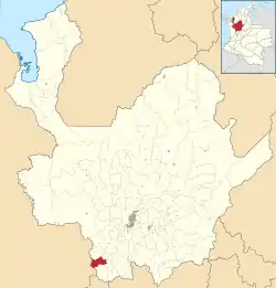 Location of the municipality and town of Betania in the Antioquia Department of Colombia | |
 Betania Location in Colombia | |
| Coordinates: 5°45′N 75°58′W | |
| Country | |
| Department | |
| Subregion | Southwestern |
| Area | |
| • Total | 168 km2 (65 sq mi) |
| Population (2015) | |
| • Total | 9,286 |
| Time zone | UTC-5 (Colombia Standard Time) |
Climate
Chigorodó has a tropical rainforest climate (Af) with heavy to very heavy rainfall year-round.
| Climate data for Chigorodó | |||||||||||||
|---|---|---|---|---|---|---|---|---|---|---|---|---|---|
| Month | Jan | Feb | Mar | Apr | May | Jun | Jul | Aug | Sep | Oct | Nov | Dec | Year |
| Average high °C (°F) | 26.5 (79.7) |
27.0 (80.6) |
27.2 (81.0) |
27.0 (80.6) |
26.3 (79.3) |
26.3 (79.3) |
26.8 (80.2) |
26.5 (79.7) |
26.0 (78.8) |
25.8 (78.4) |
25.4 (77.7) |
25.8 (78.4) |
26.4 (79.5) |
| Daily mean °C (°F) | 20.7 (69.3) |
21.1 (70.0) |
21.4 (70.5) |
21.4 (70.5) |
21.1 (70.0) |
21.0 (69.8) |
21.1 (70.0) |
20.9 (69.6) |
20.5 (68.9) |
20.6 (69.1) |
20.3 (68.5) |
20.4 (68.7) |
20.9 (69.6) |
| Average low °C (°F) | 15.0 (59.0) |
15.3 (59.5) |
15.7 (60.3) |
15.9 (60.6) |
16.0 (60.8) |
15.7 (60.3) |
15.4 (59.7) |
15.3 (59.5) |
15.1 (59.2) |
15.4 (59.7) |
15.3 (59.5) |
15.1 (59.2) |
15.4 (59.8) |
| Average rainfall mm (inches) | 124.5 (4.90) |
148.2 (5.83) |
198.2 (7.80) |
291.8 (11.49) |
318.2 (12.53) |
227.1 (8.94) |
219.3 (8.63) |
234.7 (9.24) |
265.4 (10.45) |
307.2 (12.09) |
240.9 (9.48) |
161.8 (6.37) |
2,737.3 (107.75) |
| Average rainy days | 12 | 13 | 16 | 20 | 23 | 18 | 18 | 18 | 20 | 23 | 20 | 15 | 216 |
| Source 1: IDEAM[1] | |||||||||||||
| Source 2: Climate-Data.org[2] | |||||||||||||
See also
References
- "Data". www.ideam.gov.co. Retrieved 2020-09-03.
- "Climate: Betania". Climate-Data.org. Retrieved September 3, 2020.
Capital: Medellín | |||||||||||||||||||
| Regions and municipalities |
| ||||||||||||||||||
| Related topics | |||||||||||||||||||
This article is issued from Wikipedia. The text is licensed under Creative Commons - Attribution - Sharealike. Additional terms may apply for the media files.
