Achi, Arizona
Achi was a populated place on the Tohono Oʼodham Reservation, in Pima County.[2] It has an estimated elevation of 1,759 feet (536 m) above sea level. As of 2019, there appears to no longer be any residents or buildings at this location and can be classified as a ghost. The site is approximately a mile northeast of the CDP limits of Santa Rosa.
Achi, Arizona | |
|---|---|
Ghost town | |
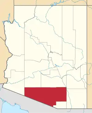
 Achi, Arizona Location of Achi in Arizona | |
| Coordinates: 32°20′40″N 112°00′53″W | |
| Country | United States |
| State | Arizona |
| County | Pima |
| Elevation | 1,759 ft (536 m) |
| Time zone | UTC-7 (Mountain (MST)) |
| • Summer (DST) | UTC-7 (MST) |
| Area code(s) | 520 |
| FIPS code | 04-00135 |
| GNIS feature ID | 24292 |
References
- "Feature Detail Report for: Achi". Geographic Names Information System. United States Geological Survey.
- "Achi (in Pima County, AZ) Populated Place Profile". AZ Hometown Locator. Retrieved December 10, 2015.
This article is issued from Wikipedia. The text is licensed under Creative Commons - Attribution - Sharealike. Additional terms may apply for the media files.