Makgum Havoka, Arizona
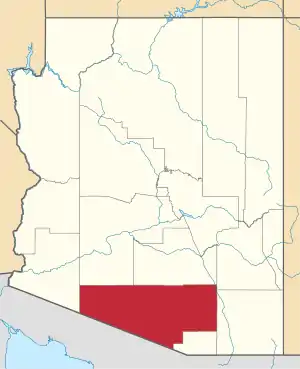
Makgum Havoka, also known as Makumivooka, is a populated place situated on the San Xavier Indian Reservation in Pima County, Arizona.[2] It has an estimated elevation of 1,863 feet (568 m) above sea level. Makum is an O'odham word for black-striped caterpillar, which the O'odham boiled and ate, while havoka is the O'odham word for pond, so the name translates as "caterpillar pond".[1] In 1939 the Bureau of Indian Affairs petitioned the USGS to officially decide between Makumivooka and Makgum Havoka. On April 10, 1941, the Board on Geographic Names issued their decision, officially naming the village Makgum Havoka.[3]
Makgum Havoka, Arizona | |
|---|---|
 Makgum Havoka Location within the state of Arizona  Makgum Havoka Makgum Havoka (the United States) | |
| Coordinates: 32°16′29″N 111°57′39″W | |
| Country | United States |
| State | Arizona |
| County | Pima |
| Elevation | 1,863 ft (890 m) |
| Time zone | UTC-7 (Mountain (MST)) |
| • Summer (DST) | UTC-7 (MST) |
| Area code(s) | 520 |
| FIPS code | 04-33420 |
| GNIS feature ID | 24504 |
References
- "Feature Detail Report for: Makgum Havoka". Geographic Names Information System. United States Geological Survey.
- "Makgum Havoka (in Pima County, AZ) Populated Place Profile". AZ Hometown Locator. Retrieved December 21, 2016.
- Decision details may be found on the USGS link, where the "view decision card" is available.
This article is issued from Wikipedia. The text is licensed under Creative Commons - Attribution - Sharealike. Additional terms may apply for the media files.