Kuakatch, Arizona
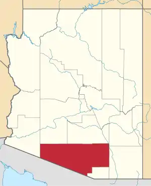
Kuakatch is a populated place situated in Pima County, Arizona.[2] It has an estimated elevation of 2,142 feet (653 m) above sea level. Historically, it has also been known as Kookatsh, Pozo de Federico, and Walls Well. The last variation was derived from Frederick Wall, who dug a well just south of the Tohono O'odham village in the late 1800s. The name was officially designated as Kuakatch by a Board on Geographic Names decision in 1941.[1] Kuakatch is derived from the Tohono O'odham phrase, ku:kaj, meaning "its end", referring to the nearby mountain, thus Kuakatch means "end of the mountain".[3]
Kuakatch, Arizona | |
|---|---|
 Kuakatch Location within the state of Arizona  Kuakatch Kuakatch (the United States) | |
| Coordinates: 32°08′15″N 112°39′47″W | |
| Country | United States |
| State | Arizona |
| County | Pima |
| Elevation | 2,142 ft (653 m) |
| Time zone | UTC-7 (Mountain (MST)) |
| • Summer (DST) | UTC-7 (MST) |
| Area code(s) | 520 |
| FIPS code | 04-38980 |
| GNIS feature ID | 6776 |
References
- "Feature Detail Report for: Kuakatch". Geographic Names Information System. United States Geological Survey.
- "Kuakatch (in Pima County, AZ) Populated Place Profile". AZ Hometown Locator. Retrieved December 5, 2016.
- Bright, William (2013). Native American Placenames of the Southwest: A Handbook for Travelers. Norman, Oklahoma: University of Oklahoma Press. p. 53. ISBN 978-0806189147.
This article is issued from Wikipedia. The text is licensed under Creative Commons - Attribution - Sharealike. Additional terms may apply for the media files.