Chiawuli Tak, Arizona
Chiawuli Tak is both a census-designated place (CDP) as well as a populated place in Pima County, Arizona, United States. Chiawuli Tak means "the barrel cactus sits" in the O'odham language. It is also unofficially known as Geowic, Jeowic, or Tjeavolitak.[4][5] The population was 78 at the 2010 census.
Chiawuli Tak, Arizona | |
|---|---|
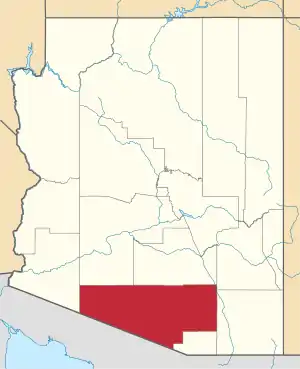
 Chiawuli Tak, Arizona Location within the state of Arizona  Chiawuli Tak, Arizona Chiawuli Tak, Arizona (the United States) | |
| Coordinates: 31°56′27″N 111°46′35″W | |
| Country | United States |
| State | Arizona |
| County | Pima |
| Area | |
| • Total | 2.44 sq mi (6.31 km2) |
| • Land | 2.44 sq mi (6.31 km2) |
| • Water | 0.00 sq mi (0.00 km2) |
| Elevation | 2,634 ft (803 m) |
| Population (2010) | |
| • Total | 236,123 |
| • Estimate (2016)[3] | N/A |
| Time zone | UTC-7 (MST) |
| FIPS code | 04-12560 |
| GNIS feature ID | 2582753 |
Geography
Charco is located at 31°56′27″N 111°46′35″W (31.940955, −111.776472). According to the United States Geological Survey, the CDP has a total area of 0.93 square miles (2.4 km2), all of it land.[2][4]
Demographics
| Historical population | |||
|---|---|---|---|
| Census | Pop. | %± | |
| U.S. Decennial Census[6] | |||
As of the 2010 census, there were 78 people living in the CDP: 40 male and 38 female. 34 were 19 years old or younger, 17 were ages 20–34, 13 were between the ages of 35 and 49, 8 were between 50 and 64, and the remaining 6 were aged 65 and above. The median age was 25.5 years.
The racial makeup of the CDP was 100% Native American. 2.6% of the population were Hispanic or Latino of any race.
There were 19 households in the CDP, 18 family households (94.7%) and 1 non-family household (5.3%), with an average household size of 4.11. Of the family households, there were 4 married couples living together, 4 single fathers, and 10 single mothers. The single non-family household consisted of 1 female.
The CDP contained 21 housing units, of which 19 were occupied and 2 were vacant.[7]
References
- "2016 U.S. Gazetteer Files". United States Census Bureau. Retrieved July 18, 2017.
- "Feature Detail Report for: Chiawuli Tak Census Designated Place". Geographic Names Information System. United States Geological Survey.
- "Population and Housing Unit Estimates". Retrieved June 9, 2017.
- "Chiawuli Tak, Arizona – Basic Facts". AZ Hometown Locator. Retrieved November 1, 2016.
- "Feature Detail Report for: Chiawuli Tak". Geographic Names Information System. United States Geological Survey.
- "Census of Population and Housing". Census.gov. Retrieved June 4, 2016.
- "American FactFinder: Chiawuli Tak CDP, Arizona". United States Census Bureau. Archived from the original on February 13, 2020. Retrieved November 1, 2016.