Avra Valley, Arizona
Avra Valley (O'odham: Ko:jĭ Pi Bak) is a census-designated place (CDP) in Pima County, Arizona, United States. The population was 6,050 at the 2010 census, up from 5,038 in 2000.
Avra Valley, Arizona | |
|---|---|
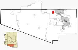 Location in Pima County and the state of Arizona | |
| Coordinates: 32°25′7″N 111°19′41″W | |
| Country | United States |
| State | Arizona |
| County | Pima |
| Area | |
| • Total | 22.19 sq mi (57.47 km2) |
| • Land | 22.19 sq mi (57.47 km2) |
| • Water | 0.00 sq mi (0.00 km2) |
| Elevation | 1,919 ft (585 m) |
| Population (2010) | |
| • Total | 6,050 |
| • Estimate (2016)[2] | N/A |
| Time zone | UTC-7 (MST (no daylight saving time)) |
| FIPS code | 04-04880 |
| GNIS feature ID | 1866979 |
Geography
Avra Valley is located at 32°25′7″N 111°19′41″W (32.418704, -111.328028).[3]
According to the United States Census Bureau, the CDP has a total area of 22.1 square miles (57.2 km2), all of it land.
Climate
Avra Valley has a hot desert climate (Köppen climate classification: BWh).
| Climate data for Avra Valley, Arizona | |||||||||||||
|---|---|---|---|---|---|---|---|---|---|---|---|---|---|
| Month | Jan | Feb | Mar | Apr | May | Jun | Jul | Aug | Sep | Oct | Nov | Dec | Year |
| Record high °F (°C) | 87 (31) |
90 (32) |
97 (36) |
104 (40) |
108 (42) |
115 (46) |
114 (46) |
113 (45) |
109 (43) |
106 (41) |
95 (35) |
88 (31) |
115 (46) |
| Average high °F (°C) | 66 (19) |
69 (21) |
75 (24) |
83 (28) |
92 (33) |
101 (38) |
101 (38) |
99 (37) |
96 (36) |
86 (30) |
75 (24) |
66 (19) |
84 (29) |
| Daily mean °F (°C) | 53 (12) |
56 (13) |
61 (16) |
68 (20) |
77 (25) |
85 (29) |
88 (31) |
86 (30) |
82 (28) |
72 (22) |
61 (16) |
53 (12) |
70 (21) |
| Average low °F (°C) | 39 (4) |
42 (6) |
46 (8) |
53 (12) |
61 (16) |
69 (21) |
74 (23) |
72 (22) |
68 (20) |
57 (14) |
46 (8) |
39 (4) |
56 (13) |
| Record low °F (°C) | 15 (−9) |
19 (−7) |
26 (−3) |
27 (−3) |
42 (6) |
51 (11) |
51 (11) |
46 (8) |
46 (8) |
35 (2) |
26 (−3) |
21 (−6) |
15 (−9) |
| Source: [4] | |||||||||||||
Demographics
| Historical population | |||
|---|---|---|---|
| Census | Pop. | %± | |
| 1990 | 3,403 | — | |
| 2000 | 5,038 | 48.0% | |
| 2010 | 6,050 | 20.1% | |
| U.S. Decennial Census[5] | |||
Avra Valley first appeared on the 1990 U.S. Census as a census-designated place (CDP).
At the 2000 census there were 5,038 people, 1,714 households, and 1,311 families living in the CDP. The population density was 228.3 people per square mile (88.1/km²). There were 1,895 housing units at an average density of 85.9/sq mi (33.2/km²). The racial makeup of the CDP was 84.02% White, 1.81% Black or African American, 1.67% Native American, 0.38% Asian, 0.04% Pacific Islander, 9.65% from other races, and 2.44% from two or more races. 20.72% of the population were Hispanic or Latino of any race.[6] Of the 1,714 households 38.0% had children under the age of 18 living with them, 58.0% were married couples living together, 12.0% had a female householder with no husband present, and 23.5% were non-families. 17.8% of households were one person and 5.7% were one person aged 65 or older. The average household size was 2.94 and the average family size was 3.30.
The age distribution was 31.5% under the age of 18, 7.6% from 18 to 24, 29.3% from 25 to 44, 22.5% from 45 to 64, and 9.2% 65 or older. The median age was 34 years. For every 100 females, there were 104.9 males. For every 100 females age 18 and over, there were 102.3 males.
The median household income was $35,459 and the median family income was $36,981. Males had a median income of $30,643 versus $20,110 for females. The per capita income for the CDP was $13,175. About 9.0% of families and 11.5% of the population were below the poverty line, including 12.8% of those under age 18 and 5.6% of those age 65 or over.
References
- "2016 U.S. Gazetteer Files". United States Census Bureau. Retrieved Jul 18, 2017.
- "Population and Housing Unit Estimates". Retrieved June 9, 2017.
- "US Gazetteer files: 2010, 2000, and 1990". United States Census Bureau. 2011-02-12. Retrieved 2011-04-23.
- "Monthly Average/Record Temperatures". The Weather Channel. Retrieved 6 September 2015.
- "Census of Population and Housing". Census.gov. Retrieved June 4, 2016.
- "U.S. Census website". United States Census Bureau. Retrieved 2008-01-31.