Corona de Tucson, Arizona
Corona de Tucson is a census-designated place (CDP) in Pima County, Arizona, United States. The population was 5,675 at the 2010 census, an increase of 598% from the 2000 population of 813.
Corona de Tucson, Arizona | |
|---|---|
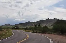 Corona de Tucson and Santa Rita foothills | |
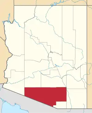
 Location in Pima County and the state of Arizona | |
 Corona de Tucson Location within Arizona  Corona de Tucson Location within the United States | |
| Coordinates: 31°57′28″N 110°46′2″W | |
| Country | |
| State | |
| County | Pima |
| Area | |
| • Total | 6.09 sq mi (15.77 km2) |
| • Land | 6.09 sq mi (15.77 km2) |
| • Water | 0.00 sq mi (0.00 km2) |
| Elevation | 3,281 ft (1,000 m) |
| Population (2010) | |
| • Total | 3,280 |
| • Estimate (2016)[2] | N/A |
| Time zone | UTC-7 (MST (no DST)) |
| ZIP code | 85641 |
| Area code(s) | 520 |
| FIPS code | 04-16030 |
| GNIS feature ID | 0037250 |
Geography
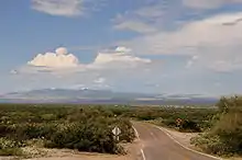
Corona de Tucson is located at 31°57′28″N 110°46′2″W (31.957860, -110.767238),[3] in the foothills of the Santa Rita Mountains, and adjacent to the Coronado National Forest.
According to the United States Census Bureau, the CDP has a total area of 2.6 square miles (6.7 km2), all of it land.
Demographics
| Historical population | |||
|---|---|---|---|
| Census | Pop. | %± | |
| U.S. Decennial Census[4] | |||
As of the census[5] of 2010, there were 5,675 people, 2,165 households, and 280 families in the CDP. The population density was 932.2 people per square mile (122.6/km2). There were 395 housing units at an average density of 154.1/sq mi (59.6/km2). The racial makeup of the CDP was 85.8% White, 5.3% Black or African American, 0.5% Native American, 0.6% Asian, 0% Pacific Islander, 3.2% from other races, and 4.6% from two or more races. 24.9% of the population were Hispanic or Latino of any race.
At the 2000 census Of the 813 households 17.8% had children under the age of 18 living with them, 68.1% were married couples living together, 4.3% had a female householder with no husband present, and 25.3% were non-families. 21.3% of households were one person and 8.5% were one person aged 65 or older. The average household size was 2.16 and the average family size was 2.48.[6] The age distribution was 13.9% under the age of 18, 4.1% from 18 to 24, 19.4% from 25 to 44, 38.6% from 45 to 64, and 24.0% 65 or older. The median age was 51 years. For every 100 females, there were 91.7 males. For every 100 females age 18 and over, there were 91.8 males.
The median household income was 93,542, and the median family income was $61,375. Males had a median income of $49,722 versus $31,250 for females. The per capita income for the CDP was $28,304. None of the families and 1.0% of the population were living below the poverty line, including no under eighteens and none of those over 64.
Education
The entire CDP is served by the Vail Unified School District and the Pima County Joint Technical Education District’s 4th Governing Board District.
Public Safety
Corona de Tucson is patrolled by the 1st Beat of the Pima County Sheriff's Department's Rincon District and fire protection is provided by the Corona de Tucson Fire District.
See also
References
- "2016 U.S. Gazetteer Files". United States Census Bureau. Retrieved Jul 18, 2017.
- "Population and Housing Unit Estimates". Retrieved June 9, 2017.
- "US Gazetteer files: 2010, 2000, and 1990". United States Census Bureau. 2011-02-12. Retrieved 2011-04-23.
- "Census of Population and Housing". Census.gov. Retrieved June 4, 2016.
- Bureau, US Census. "Search Results". The United States Census Bureau. Retrieved 2020-03-30.
- "U.S. Census website". United States Census Bureau. Retrieved 2008-01-31.
External links
- Corona de Tucson profile at City-Data.com
- Corona Foothills Middle School
- Corona De Tucson Fire Department
| Authority control |
|
|---|