Ali Chuk, Arizona
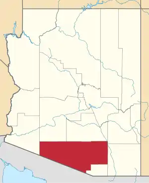
Ali Chuk is a populated place and census designated place in Pima County, Arizona. Its population was 161 as of the 2010 census, and it has a land area of 1.44 square miles.[4] It has an estimated elevation of 1,762 feet (537 m) above sea level. It is located adjacent to the border with Mexico. It is not to be confused with another village on the reservation, Ali Chukson.
Ali Chuk, Arizona | |
|---|---|
Populated place | |
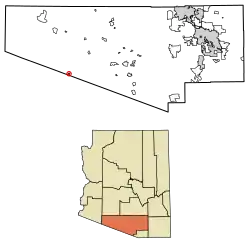 Location of Ali Chuk in Pima County, Arizona. | |
 Ali Chuk, Arizona Location of Ali Chuk in Arizona | |
| Coordinates: 31°49′01″N 112°33′30″W | |
| Country | United States |
| State | Arizona |
| County | Pima |
| Area | |
| • Total | 1.44 sq mi (3.73 km2) |
| • Land | 1.44 sq mi (3.73 km2) |
| • Water | 0.00 sq mi (0.00 km2) |
| Elevation | 1,762 ft (537 m) |
| Population (2010) | |
| • Total | 161 |
| • Estimate (2016)[3] | N/A |
| Time zone | UTC-7 (Mountain (MST)) |
| • Summer (DST) | UTC-7 (MST) |
| Area code(s) | 520 |
| FIPS code | 025-01560 |
| GNIS feature ID | 2582723 |
Demographics
| Historical population | |||
|---|---|---|---|
| Census | Pop. | %± | |
| 2010 | 161 | — | |
| U.S. Decennial Census[5] | |||
Ali Chuk first appeared on the 2010 U.S. Census as a census-designated place (CDP).
References
- "2016 U.S. Gazetteer Files". United States Census Bureau. Retrieved Jul 18, 2017.
- "Feature Detail Report for: Ali Chuk". Geographic Names Information System. United States Geological Survey.
- "Population and Housing Unit Estimates". Retrieved June 9, 2017.
- "Ali Chuk, AZ Profile: Facts, Map & Data". AZ Hometown Locator. Retrieved December 26, 2015.
- "Census of Population and Housing". Census.gov. Retrieved June 4, 2016.
This article is issued from Wikipedia. The text is licensed under Creative Commons - Attribution - Sharealike. Additional terms may apply for the media files.