Sikul Himatk, Arizona
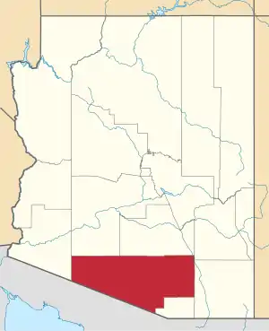
Sikul Himatk is a populated place situated in Pima County, Arizona.[2] Between 1893 and 1912 the location was known as Vaheja. Historically it has also been called Siclehema, Sikulhamakt, Sikulhamatk, and Sikulhimat. It officially became known as Sikul Himatk, which is O'odham meaning "water going around", due to it being situated between two watersheds, in 1941 as a result of a decision by the Board on Geographic Names. It has an estimated elevation of 2,155 feet (657 m) above sea level.[1]
Sikul Himatk, Arizona | |
|---|---|
 Sikul Himatk Location within the state of Arizona  Sikul Himatk Sikul Himatk (the United States) | |
| Coordinates: 32°06′54″N 112°02′08″W | |
| Country | United States |
| State | Arizona |
| County | Pima |
| Elevation | 2,155 ft (657 m) |
| Time zone | UTC-7 (Mountain (MST)) |
| • Summer (DST) | UTC-7 (MST) |
| Area code(s) | 520 |
| FIPS code | 04-66940 |
| GNIS feature ID | 11300 |
References
- "Feature Detail Report for: Sikul Himatk". Geographic Names Information System. United States Geological Survey.
- "Sikul Himatk (in Pima County, AZ) Populated Place Profile". AZ Hometown Locator. Retrieved March 23, 2017.
This article is issued from Wikipedia. The text is licensed under Creative Commons - Attribution - Sharealike. Additional terms may apply for the media files.