Vakamok, Arizona
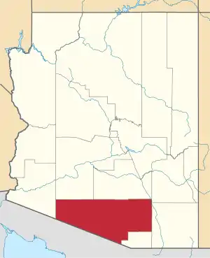
Vakamok is a populated place situated in Pima County, Arizona, right along the international border with Mexico.[2] Historically, it has been known by several names, including Comot, Comoti, and Rusty Shovel. Vakamok is an O'odham word meaning "rusty". The traditional O'odham name for the village was Popolo Vakamakatuk, but the current name was made official as a result of a decision in 1941 by the Board on Geographic Names. It has an estimated elevation of 2,264 feet (690 m) above sea level.[1]
Vakamok, Arizona | |
|---|---|
 Vakamok Location within the state of Arizona  Vakamok Vakamok (the United States) | |
| Coordinates: 31°42′20″N 112°01′51″W | |
| Country | United States |
| State | Arizona |
| County | Pima |
| Elevation | 2,264 ft (690 m) |
| Time zone | UTC-7 (Mountain (MST)) |
| • Summer (DST) | UTC-7 (MST) |
| Area code(s) | 520 |
| FIPS code | 04-78715 |
| GNIS feature ID | 24671 |
References
- "Feature Detail Report for: Vakamok". Geographic Names Information System. United States Geological Survey.
- "Vakamok (in Pima County, AZ) Populated Place Profile". AZ Hometown Locator. Retrieved June 26, 2017.
This article is issued from Wikipedia. The text is licensed under Creative Commons - Attribution - Sharealike. Additional terms may apply for the media files.