Amhara Region
Amhara Region (Ge'ez: ዐምሐራ, Amharic: አማራ) is a regional state in northern Ethiopia, and the homeland of the Amhara people. Previously known as "Region 3", its capital is Bahir Dar. Ethiopia's largest inland body of water, Lake Tana, which is the source of the Blue Nile river, is located within Amhara. The region also contains the Semien Mountains National Park, which includes Ras Dashan, the highest point in Ethiopia. Amhara is bordered by the state of Sudan to the west and northwest, and in other directions by other regions of Ethiopia: Tigray to the north, Afar to the east, Benishangul-Gumuz to the west and southwest, and Oromia to the south.
Amhara Region
አማራ | |
|---|---|
 | |
 Flag  Seal | |
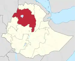 Map of Ethiopia showing Amhara Region | |
| Coordinates: 11°39′39″N 37°57′28″E | |
| Country | Ethiopia |
| Capital | Bahir Dar |
| Government | |
| • President | Agegnehu Teshager |
| Area | |
| • Total | 154,708.96 km2 (59,733.46 sq mi) |
| Area rank | 3 |
| Population (2014) | |
| • Total | 20,018,988[1] |
| • Rank | 2 |
| ISO 3166 code | ET-AM |
| HDI (2017) | 0.443[2] low · 9th |
The government of Amhara is composed of the executive branch, led by the President; the legislative branch, which comprises the State Council; and the judicial branch, which is led by the state Supreme Court.
History
During the Ethiopian Empire, Amhara included several provinces (such as Dembiya, Gojjam, Begemder, Angot, Wollo, Shewa and Lasta), most of which were ruled by native Ras or Negus. The Amhara Region then incorporated most of the former provinces of Begemder, Dembiya, Angot, Bete Amhara (Wollo), Gojjam and Shewa.[3] With the rise of the so-called Solomonic Dynasty in 1270 under Emperor Yekuno Amlak (born in the Maqdalla region) and until the establishment of Gondar as the new imperial capital around 1600, the Debre-Birhan to Mekane-Selassie region was the primary seat of the roving Wolloye-Shewan emperors. This period is most significant in the formation of the medieval Ethiopian state, the spread and consolidation of Ethiopian Orthodox Christianity (following the example set by the Zagwe kings in preserving the Axumite heritage) and propagating to the core provinces (besides Tigray/Eritrea , and Lasta) of Bete Amhara, Gojam, Begemdir, northern Shewa, Gafat, and Damot[4]
The region's recorded history, in fact, goes back to the early second millennium. For example, St. George's Church in the town of Woreilu (whose Tabot is reputed to have been carried by Emperor Menelik at the Battle of Adwa) was established around 1200.
The parish of Mekane Selassie (መካነ ሥላሴ), near Neded and the home of the cathedral by the same name, served as a favourite royal playground. The construction of Mekane Selassie (meaning: the abode of the Trinity) was begun by Emperor Naod (1494-1508) and completed by his son Emperor Lebna Dengel. This was a year before the church (along with a large number of monasteries in the region) was sacked and burned down in 1531 by the invasion led by Ahmad bin Ibrahim. Francisco Alvarez, who had earlier visited the church, confirms that its size was some 150 feet by 150 feet — wholly covered in gold leaf, inlaid with gems, pearls and corals[5]
21st century
After the social movements of 2014-2017, Amhara nationalism developed strongly in the region, with a discourse that includes both issues of power balance between elites and territorial claims. Several local politicians were able to control armed factions.[6]
On 22 June 2019, factions of the security forces of the region attempted a coup d'état against the regional government, during which the President of the Amhara Region, Ambachew Mekonnen, was assassinated.[7] A bodyguard siding with the nationalist factions assassinated General Se'are Mekonnen – the Chief of the General Staff of the Ethiopian National Defense Force – as well as his aide, Major General Gizae Aberra.[7] The Prime Minister's Office accused Brigadier General Asaminew Tsige, head of the Amhara region security forces, of leading the plot,[8] and Tsige was shot dead by police near Bahir Dar on 24 June.[9]
During the war against Tigray that started on 4 November 2020, the Amhara Region actively participated on the side of Prime Minister Abiy Ahmed. On 18 December 2020, looting was reported by EEPA, including 500 dairy cows and hundreds of calves stolen by Amhara forces [10] On 19 December 2020, an EEPA report stated that Sudan had captured Eritrean soldiers dressed in Amhara militia uniforms fighting along the Sudan border alongside Amhara special forces.[11] On 23 November, a reporter of AFP news agency visited the western Tigray town of Humera, and observed that the administration of the conquered parts of Western Tigray was taken over by officials from Amhara Region.[12]
Demographics
_AN0457026.jpg.webp)
Based on the 2007 census conducted by the Central Statistical Agency of Ethiopia (CSA), the Amhara Region has a population of 17,221,976. 8,641,580 were men and 8,580,396 women; urban inhabitants number 2,112,595 or 12.27% of the population. With an estimated area of 154,708.96 km2 (59,733.46 sq mi), this region has an estimated density of 108.2 people per square kilometer. For the entire Region 3, 983,768 households were counted, which results in an average for the Region of 4.3 persons to a household, with urban households having on average 3.3 and rural households 4.5 people.[13] The projected population as of 2017 was 21,134,988.[1]
In the previous census, conducted in 1994, the region's population was reported to be 13,834,297 of whom 6,947,546 were men and 6,886,751 women; urban inhabitants numbered 1,265,315 or 9.15% of the population.
According to the CSA, as of 2004, 28% of the total population had access to safe drinking water, of whom 19.89% were rural inhabitants and 91.8% were urban.[14] Values for other reported common indicators of the standard of living for Amhara as of 2005 include the following: 17.5% of the inhabitants fall into the lowest wealth quintile; adult literacy for men is 54% and for women 25.1%; and the Regional infant mortality rate is 94 infant deaths per 1,000 live births, which is greater than the nationwide average of 77; at least half of these deaths occurred in the infants’ first month of life.[15]
| Year | Pop. | ±% |
|---|---|---|
| 1994 | 13,834,297 | — |
| 2007 | 17,221,976 | +24.5% |
| 2017 | 21,134,988 | +22.7% |
| source:[16] | ||
Ethnic groups
At 91.47% of the local population, the region is predominantly inhabited by people from the Semitic-speaking Amhara ethnic group. Most other residents hail from other Afro-Asiatic language communities, including the Agaw/Awi, Oromo, Agaw/Kamyr and Argobba.
| Ethnic group | 1994 Census | 2007 Census |
|---|---|---|
| Amhara | 91.2% | 91.47% |
| Agaw/Awi | 2.7% | 3.46% |
| Oromo | 3% | 2.62% |
| Agaw/Kamyr | 1% | 1.39% |
| Argobba | - | 0.41% |
| Qemant | 1.2% | 0% |
| Tigrayan | 0.9% | 0.65 |
Religion
| Religion | 1994 Census[17] | 2007 Census[18] |
|---|---|---|
| Orthodox Christians | 81.5% | 82.5% |
| Muslim | 18.1% | 17.2% |
| Protestants | 0.1% | 0.2% |
| Other faiths | – | 0.1% |
The predominant religion of the Amhara for centuries has been Christianity, with the Ethiopian Orthodox Tewahedo Church playing a central role in the culture of the country. According to the 2007 census, 82.5% of the population of the Amhara Region (which is 91.2% Amhara) were Ethiopian Orthodox; 17.2% were Muslim, and 0.2% were Protestant ("P'ent'ay").[19] The Ethiopian Orthodox Church maintains close links with the Coptic Orthodox Church of Alexandria. Easter and Epiphany are the most important celebrations, marked with services, feasting and dancing. There are also many fast days throughout the year, when only vegetables or fish may be eaten.
Marriages are often arranged, with men marrying in their late teens or early twenties.[20] Traditionally, girls were married as young as 14, but in the 20th century, the minimum age was raised to 18. After a church wedding, divorce is frowned upon.[20] Each family hosts a separate wedding feast after the wedding.
Traditionally, upon childbirth, a priest will visit the family to bless the infant. The mother and child remain in the house for 40 days after birth for physical and emotional strength. The infant will be taken to the church for baptism at 40 days (for boys) or 80 days (for girls).[21]
Geography
Water flow

According to the regional government, the Amhara Highlands receive 80% of the total rainfall of Ethiopia and is the most fertile and hospitable region of Ethiopia.[22] The Amhara Region is the location of Lake Tana, the source of the Blue Nile, at Bahir Dar. The flow of the Blue Nile reaches maximum volume in the rainy season (from June to September) when it supplies about two-thirds of the water of the Nile proper. The Blue Nile, along with the Atbara River to the north, which also flows out of the Ethiopian Highlands, caused the annual Nile floods that contributed to the fertility of the Nile Valley. This supported the rise of ancient Egyptian civilization and Egyptian mythology. With the completion in 1970 of the Aswan High Dam in Egypt, the Nile floods ended. Lake Tana has a number of islands, whose numbers vary depending on the level of the lake; it has fallen about 2 metres (6.6 ft) in the last 400 years. According to Manoel de Almeida (a Portuguese missionary in the early 17th century), there were 21 islands, seven to eight of which had monasteries on them "formerly large, but now much diminished."[23] When James Bruce visited the area in the later 18th century, he noted that the locals counted 45 inhabited islands, but wrote he believed that "the number may be about eleven."[23] A mid-twentieth century account identified 37 islands, of which 19 were said to have or have had monasteries or churches on them.[23]

The lake islands were the home of ancient Ethiopian emperors. Treasures of the Ethiopian Church are kept in the isolated island monasteries (including Kebran Gabriel, Ura Kidane Mehret, Narga Selassie, Daga Estifanos, Medhane Alem of Rema, Kota Maryam and Mertola Maryam). The body of Yekuno Amlak is interred in the monastery of St. Stephen on Daga Island; other Emperors whose tombs are on Daga include Dawit I, Zara Yaqob, Za Dengel and Fasilides. Other important islands in Lake Tana include Dek, Mitraha, Gelila Zakarias, Halimun, and Briguida.
In the late 20th century, the scholar Paul B. Henze reported being shown a rock on the island of Tana Qirqos and being told it was where the Virgin Mary had rested during her journey back from Egypt. He was also told that Saint Frumentius, the bishop known for introducing Christianity to Ethiopia, was "allegedly buried on Tana Cherqos."[24]
Economy
Manufacturing
There are several industrial parks (IP) that are in operation or under construction. The Kombolcha IP was built at a cost of $90 million and employs 20,000 people.[25] Arerti IP and Debre Birhan IP are under construction.[26]
Agriculture
.jpg.webp)
The CSA of Ethiopia estimated in 2005 that farmers in Amhara had a total of 9,694,800 head of cattle (representing 25% of Ethiopia's total cattle), 6,390,800 sheep (36.7%), 4,101,770 goats (31.6%), 257,320 horses (17%), 8,900 mules (6%), 1,400,030 asses (55.9%), 14,270 camels (3.12%), 8,442,240 poultry of all species (27.3%), and 919,450 beehives (21.1%).[27]
Landmarks
The Amhara Region contains Ethiopia's largest inland body of water, Lake Tana, which is the source of the Blue Nile river, and the highest point in Ethiopia, Ras Dashan (4,543 m (14,905 ft)) in the Semien Mountains. UNESCO has designated the Semien Mountains National Park as part of a World Heritage Site. The mountains consist of plateaux separated by valleys and pinnacles. Other notable heights include Mounts Biuat (4,437 m (14,557 ft)) and Abba Yared (4,460 m). Most of the Amhara Region is mountainous and is covered with large trees and forest. Amhara region has the most world heritage sites of any region in Ethiopia.
Endemic species of fauna include the gelada baboon, the walia ibex and the Ethiopian wolf (or Simien fox). The wide range of altitudes has given the country a variety of ecologically distinct areas, leading to the evolution of endemic species in ecological isolation.
Government
Executive branch
The executive branch is headed by the President of Amhara. The current president is Temesgen Tiruneh, an ANDM member, elected in 8 March 2019.[28] A Vice President of Amhara succeeds the president in the event of any removal from office, and performs any duties assigned by the president. The current vice president is Alemnew Mekonnen. The other offices in the executive branch cabinet are the Regional Health Bureau (Dr. Abebaw Gebeyehu), Educational Bureau (Yilikal Kefyalew), and 20 other officials.[29]
Judicial branch
There are three levels of the Amhara state judiciary. The lowest level is the court of common pleas: each woreda maintains its own constitutionally mandated court of common pleas, which maintain jurisdiction over all justiciable matters. The intermediate-level court system is the district court system. Four courts of appeals exist, each retaining jurisdiction over appeals from common pleas, municipal, and county courts in an administrative zone. A case heard in this system is decided by a three-judge panel, and each judge is elected.
The highest-ranking court, the Amhara Supreme Court, is Amhara's "court of last resort". A seven-justice panel composes the court, which, by its own discretion, hears appeals from the courts of appeals, and retains original jurisdiction over limited matters. The chief judge is called the President of Amhara Supreme Court (Yeneneh Simegn).[30]
Legislative branch
The State Council, which is the highest administrative body of the state, is made up of 294 members.[31]
National politics
Amhara is represented by 138 representatives in the Federal Democratic Republic of Ethiopia House of Peoples' Representatives.
Administrative zones
Like other Regions in Ethiopia, Amhara is subdivided into administrative zones.
References
- Population Projection of Ethiopia for All Regions At Wereda Level from 2014 – 2017. Federal Democratic Republic of Ethiopia Central Statistical Agency. Archived from the original on 6 June 2018. Retrieved 4 June 2018.
- "Sub-national HDI - Area Database - Global Data Lab". hdi.globaldatalab.org. Retrieved 2018-09-13.
- Blackhurst, Hector (October 1974). "Church and State in Ethiopia, 1270–1527. By Taddesse Tamrat. Oxford: Clarendon Press, 1972. Pp. xv + 327, bibl., ill., maps. £5·50". Africa. 44 (4): 427–428. doi:10.2307/1159069. ISSN 0001-9720.
- Blackhurst, Hector (October 1974). "Church and State in Ethiopia, 1270–1527. By Taddesse Tamrat. Oxford: Clarendon Press, 1972. Pp. xv + 327, bibl., ill., maps. £5·50". Africa. 44 (4): 427–428. doi:10.2307/1159069. ISSN 0001-9720.
- Beckingham, C.F.; Huntingford, G.W.B., eds. (2017-05-15). "The Prester John of the Indies". doi:10.4324/9781315554013. Cite journal requires
|journal=(help) - Labzaé, Mehdi, ed. (2020-11-17). "« Tedjemerwal » : ressorts sociaux, enjeux matériels et significations locales d'une entrée en guerre". Politique africaine.
- "President of the Amhara region killed". Ethiopia Observer. 23 June 2019. Retrieved 24 June 2019.
- Ingber, Sasha (23 June 2019). "Ethiopia Army Chief Killed In Attempted Coup, Government Says". NPR. Retrieved 24 June 2019.
- "Alleged Ethiopian coup mastermind shot dead after 36-hour manhunt". i24 news. 24 June 2019. Retrieved 24 June 2019.
- Situation Report EEPA HORN No. 30 - 19 December Europe External Programme with Africa
- Situation Report EEPA HORN No. 31 - 20 December Europe External Programme with Africa
- "Inside Humera, a town scarred by Ethiopia's war". Reuters. 2020-11-23. Retrieved 2020-11-24.
- Census 2007 Tables: Amhara Region Archived November 14, 2010, at the Wayback Machine, Tables 2.1, 2.5, 3.1, 3.2, 3.4.
- "Households by sources of drinking water, safe water sources" Archived 2009-03-05 at the Wayback Machine CSA Selected Basic Welfare Indicators (accessed 28 January 2009)
- Macro International Inc. "2008. Ethiopia Atlas of Key Demographic and Health Indicators, 2005." (Calverton: Macro International, 2008), pp. 2, 3, 10 (accessed 28 January 2009)
- Amhara Region population statistics
- 1994 Population and Housing Census of Ethiopia: Results for Amhara Region, Vol. 1, part 1 Archived November 15, 2010, at the Wayback Machine, Tables 2.1, 2.9, 2.10, 2.17 (accessed 9 April 2009)
- "Census 2007" Archived 2012-02-14 at the Wayback Machine, first draft, Tables 1, 4, 5, 6.
- "FDRE States: Basic Information – Amhara". Population. Archived from the original on 24 May 2011. Retrieved 26 March 2006.
- "African Marriage ritual". Archived from the original on 2017-05-07. Retrieved 2011-02-09.
- The World and Its Peoples: Africa, North and East, Part 2, Volume 23. Greystone Press. 1967. p. 300. Retrieved 17 February 2017.
- The Amhara National Regional State - Ethiopian Government Portal. 2017. The Amhara National Regional State - Ethiopian Government Portal. [Online] Available at http://www.ethiopia.gov.et/stateamhara Archived 2017-02-02 at the Wayback Machine. [Accessed 30 January 2017].
- C.F. Beckham and G.W.B. Huntingford, Some Records of Ethiopia, 1593-1646, (series 2, no. 107; London: Hakluyt Society, 1954), p. 35 and note.
- Paul B. Henze, Layers of Time: A History of Ethiopia (New York: Palgrave, 2000), p.73
- Asrat, Amare (8 July 2017). "Kombolcha industrial park inaugurated". Fana Broadcasting Company. Archived from the original on 2017-07-14. Retrieved 24 February 2018.
- Lifang, Song (13 July 2017). "Ethiopia plans to have 15 industrial parks by June 2018". Xinhua. Retrieved 24 February 2018.
- "CSA 2005 National Statistics" Archived 2008-11-18 at the Wayback Machine, Tables D.4 - D.7
- Ben, Cahoon. "Ethiopia Administrative Divisions". World Statesman. Retrieved 24 February 2018.
- "Amhara Region Announces Appointment of 22 Cabinet Members". Ethiopian News Agency. 23 November 2016. Archived from the original on 2018-03-05. Retrieved 24 February 2018.
- "MOU Signing ceremony With Federal and Regional Supreme Courts of Ethiopia to Facilitate Support for Clearance of Backlog Files". Justice For All-PF Ethiopia. 14 August 2015. Archived from the original on 5 November 2017. Retrieved 8 July 2017.
- Lansford, Tom (2015). Political Handbook of the World 2015. Washington, D.C., United States: CQ Press. pp. 492. ISBN 1483371557.
External links
| Wikimedia Commons has media related to Amhara Region. |
- FDRE States: Basic Information - Amhara
- Africa Guide: Amhara
- Map of Amhara Region at DPPA of Ethiopia
Zones of the Amhara Region | ||
|---|---|---|
| Current zones | ||
| Special woredas | ||