Auboué
Auboué is a commune in the Meurthe-et-Moselle department in northeastern France.
Auboué | |
|---|---|
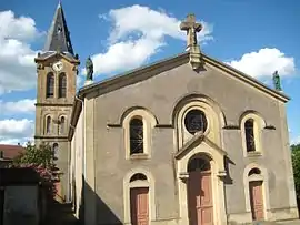 The church in Auboué | |
 Coat of arms | |
Location of Auboué 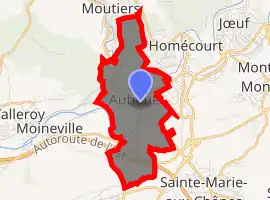
| |
 Auboué  Auboué | |
| Coordinates: 49°12′46″N 5°58′39″E | |
| Country | France |
| Region | Grand Est |
| Department | Meurthe-et-Moselle |
| Arrondissement | Briey |
| Canton | Jarny |
| Intercommunality | Orne Lorraine Confluences |
| Government | |
| • Mayor (2014-2020) | Fabrice Brogi |
| Area 1 | 4.54 km2 (1.75 sq mi) |
| Population (2017-01-01)[1] | 2,514 |
| • Density | 550/km2 (1,400/sq mi) |
| Time zone | UTC+01:00 (CET) |
| • Summer (DST) | UTC+02:00 (CEST) |
| INSEE/Postal code | 54028 /54580 |
| Elevation | 177–266 m (581–873 ft) (avg. 185 m or 607 ft) |
| 1 French Land Register data, which excludes lakes, ponds, glaciers > 1 km2 (0.386 sq mi or 247 acres) and river estuaries. | |
Early years
An 1832 plan of the village of Auboué shows 50-60 houses, sheds, barns and stables on each side of the Orne river. The church of Coinville had been built, but the church of Auboué had not yet been built, although the location had been set aside and is marked on the plan. At the end of the 19th century there were 100 voters, but ten families of farmers and craftsmen ran the village, sitting in the 10-person municipal council. Often a son or son-in-law succeeded his father or father-in-law.[2]
Industrialization
Xavier Rogé of the Société de Pont-à-Mousson began to investigate land around Auboué, and on 1 December 1882 found the upper layers of the iron oxide formation of the Briey Basin. The survey then stopped, since the company undertaking it declared that the iron oxide formation had been completely crossed. Rogé's assistant Camille Cavallier thought there could be lower layers, and obtained permission to continue the survey. In April 1883 a layer 4 metres (13 ft) thick was found, and on 11 August 1884 the Société de Pont-à-Mousson was granted the concession.[3]
The technicians said that it would be very difficult to pass through the overburden above the Auboué ore deposit due to the amount of water it contained. Cavallier decided to proceed anyway, using the freezing method to pass through the 100 metres (330 ft) aquifer layer, although this method had not been used for more than 60 metres (200 ft) in the past. The gamble succeeded.[3] In 1892–93, due to excavation of the first mine, the population started to rise, reaching 662 in 1901.[2] In 1903 Cavallier installed blast furnaces at Auboué. In 1905 he purchased the Moineville concession, which was later merged with the Auboué concession.[3] When the foundry was put into service the population rose to 2,100 in 1906 and 4,388 in 1911.[2]
During World War I (1914–18) Auboué was occupied by the Germans.[4] The blast furnaces were destroyed, and the mine was put out of operation.[3] The population dropped during the war, then slowly started to recover, reaching a maximum of 5,271 in 1931. After the economic recession of 1968–70, the town lost industry and commerce and reverted to becoming a small dormitory community.[2]
Population changes
|
|
|
References
- "Populations légales 2017". INSEE. Retrieved 6 January 2020.
- Viard.
- Camille Cavallier (1854–1926) – Annales.
- Vuillemin 2002.
Sources
- "Camille CAVALLIER (1854–1926)", Annales des Mines (in French), retrieved 2017-08-28
- Viard, Paul, Auboué mon pays (in French), retrieved 2017-08-30
- Vuillemin, Jean (October 2002), "Camille Cavallier", Arts et Métiers Magazine (in French), Fondation des Arts et Métiers, archived from the original on 2017-08-29, retrieved 2017-08-29
| Wikimedia Commons has media related to Auboué. |
| Authority control |
|---|