Moncel-sur-Seille
Moncel-sur-Seille is a commune in the Meurthe-et-Moselle département in north-eastern France.
Moncel-sur-Seille | |
|---|---|
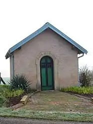 The chapel in Moncel-sur-Seille | |
.svg.png.webp) Coat of arms | |
Location of Moncel-sur-Seille 
| |
 Moncel-sur-Seille  Moncel-sur-Seille | |
| Coordinates: 48°45′57″N 6°25′21″E | |
| Country | France |
| Region | Grand Est |
| Department | Meurthe-et-Moselle |
| Arrondissement | Nancy |
| Canton | Grand Couronné |
| Intercommunality | CC Seille et Grand Couronné |
| Government | |
| • Mayor (2008–2014) | Ennio Bazzara (PR) |
| Area 1 | 12.41 km2 (4.79 sq mi) |
| Population (2017-01-01)[1] | 523 |
| • Density | 42/km2 (110/sq mi) |
| Time zone | UTC+01:00 (CET) |
| • Summer (DST) | UTC+02:00 (CEST) |
| INSEE/Postal code | 54374 /54280 |
| Elevation | 195–283 m (640–928 ft) (avg. 206 m or 676 ft) |
| 1 French Land Register data, which excludes lakes, ponds, glaciers > 1 km2 (0.386 sq mi or 247 acres) and river estuaries. | |
In the past, inhabitants of Moncel were known by their neighbours as culs crottés ("shit arses"), on account of the unusually clingy mud of their village.[2]
References
- "Populations légales 2017". INSEE. Retrieved 6 January 2020.
- Graham Robb, The Discovery of France, p36, Picador (2007), ISBN 978-0-330-42761-6, citing Vital Collet "Sobriquets caractérisant les habitants de villages lorrains" in Le Pays lorrain, Nancy (1908), pp442-449 and Henri-Adolphe Labourasse, "Anciens us, coutumes, légendes, supersititions, préjugés, etc. du département de la Meuse" in Mémoires de la Société des lettres, sciences et art de Bar-le-Duc, 1902, pp3-225
| Wikimedia Commons has media related to Moncel-sur-Seille. |
| Authority control |
|---|
This article is issued from Wikipedia. The text is licensed under Creative Commons - Attribution - Sharealike. Additional terms may apply for the media files.
