Montigny-sur-Chiers
Montigny-sur-Chiers is a commune in the Meurthe-et-Moselle department in north-eastern France.
Montigny-sur-Chiers | |
|---|---|
_mairie.JPG.webp) The town hall in Montigny-sur-Chiers | |
 Coat of arms | |
Location of Montigny-sur-Chiers 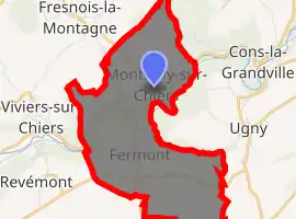
| |
 Montigny-sur-Chiers  Montigny-sur-Chiers | |
| Coordinates: 49°28′49″N 5°40′12″E | |
| Country | France |
| Region | Grand Est |
| Department | Meurthe-et-Moselle |
| Arrondissement | Briey |
| Canton | Mont-Saint-Martin |
| Intercommunality | CC Terre Lorraine du Longuyonnais |
| Government | |
| • Mayor (2008–2014) | Jean-Claude Brinster |
| Area 1 | 9.36 km2 (3.61 sq mi) |
| Population (2017-01-01)[1] | 482 |
| • Density | 51/km2 (130/sq mi) |
| Time zone | UTC+01:00 (CET) |
| • Summer (DST) | UTC+02:00 (CEST) |
| INSEE/Postal code | 54378 /54870 |
| Elevation | 217–351 m (712–1,152 ft) |
| 1 French Land Register data, which excludes lakes, ponds, glaciers > 1 km2 (0.386 sq mi or 247 acres) and river estuaries. | |
References
- "Populations légales 2017". INSEE. Retrieved 6 January 2020.
| Wikimedia Commons has media related to Montigny-sur-Chiers. |
| Authority control |
|
|---|
This article is issued from Wikipedia. The text is licensed under Creative Commons - Attribution - Sharealike. Additional terms may apply for the media files.