Aumelas
Aumelas (Languedocien: Aumelaç) is a commune in the Hérault department in southern France.
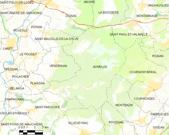
Map
Aumelas | |
|---|---|
 Chapel of Cardonnet | |
.svg.png.webp) Coat of arms | |
Location of Aumelas 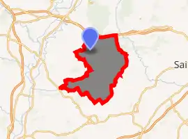
| |
 Aumelas  Aumelas | |
| Coordinates: 43°36′14″N 3°35′57″E | |
| Country | France |
| Region | Occitanie |
| Department | Hérault |
| Arrondissement | Lodève |
| Canton | Gignac |
| Intercommunality | CC Vallée Hérault |
| Government | |
| • Mayor (2014-2020) | Michel Saint-Pierre |
| Area 1 | 58.26 km2 (22.49 sq mi) |
| Population (2017-01-01)[1] | 526 |
| • Density | 9.0/km2 (23/sq mi) |
| Time zone | UTC+01:00 (CET) |
| • Summer (DST) | UTC+02:00 (CEST) |
| INSEE/Postal code | 34016 /34230 |
| Elevation | 64–341 m (210–1,119 ft) (avg. 295 m or 968 ft) |
| 1 French Land Register data, which excludes lakes, ponds, glaciers > 1 km2 (0.386 sq mi or 247 acres) and river estuaries. | |
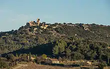
The castle from West.
Population
| Year | Pop. | ±% |
|---|---|---|
| 1962 | 210 | — |
| 1968 | 225 | +7.1% |
| 1975 | 191 | −15.1% |
| 1982 | 245 | +28.3% |
| 1990 | 332 | +35.5% |
| 1999 | 378 | +13.9% |
| 2008 | 469 | +24.1% |
| 2015 | 519 | +10.7% |
See also
References
- "Populations légales 2017". INSEE. Retrieved 6 January 2020.
| Wikimedia Commons has media related to Aumelas. |
| Authority control |
|
|---|
This article is issued from Wikipedia. The text is licensed under Creative Commons - Attribution - Sharealike. Additional terms may apply for the media files.