Montesquieu, Hérault
Montesquieu (Languedocien: Montesquiu) is a commune in the Hérault department in the Occitanie region in southern France.
Montesquieu | |
|---|---|
.svg.png.webp) Coat of arms | |
Location of Montesquieu 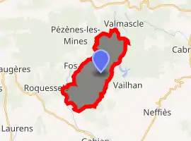
| |
 Montesquieu  Montesquieu | |
| Coordinates: 43°33′45″N 3°16′36″E | |
| Country | France |
| Region | Occitanie |
| Department | Hérault |
| Arrondissement | Béziers |
| Canton | Cazouls-lès-Béziers |
| Intercommunality | CC Les Avant-Monts |
| Government | |
| • Mayor (2008–2014) | Elie Kubica |
| Area 1 | 14.47 km2 (5.59 sq mi) |
| Population | 70 |
| • Density | 4.8/km2 (13/sq mi) |
| Time zone | UTC+01:00 (CET) |
| • Summer (DST) | UTC+02:00 (CEST) |
| INSEE/Postal code | 34168 /34320 |
| Elevation | 140–467 m (459–1,532 ft) (avg. 150 m or 490 ft) |
| 1 French Land Register data, which excludes lakes, ponds, glaciers > 1 km2 (0.386 sq mi or 247 acres) and river estuaries. | |
Geography
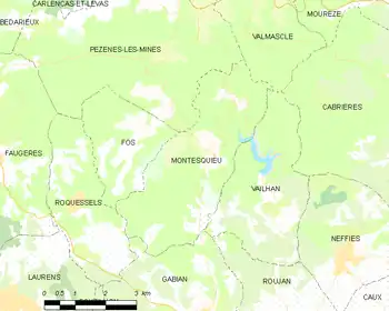
Map
The original village of Montesquieu is in ruins. The commune has a number of hamlets: Mas Rolland, which has the town hall and the old school, Paders, near the valley of the Peyne, Fournols to the north of the commune and Valuzières towards the middle.
Population
| Year | Pop. | ±% |
|---|---|---|
| 1962 | 45 | — |
| 1968 | 53 | +17.8% |
| 1975 | 35 | −34.0% |
| 1982 | 38 | +8.6% |
| 1990 | 47 | +23.7% |
| 1999 | 47 | +0.0% |
| 2008 | 60 | +27.7% |
See also
References
- "Populations légales 2017". INSEE. Retrieved 6 January 2020.
| Wikimedia Commons has media related to Montesquieu (Hérault). |
| Authority control |
|---|
This article is issued from Wikipedia. The text is licensed under Creative Commons - Attribution - Sharealike. Additional terms may apply for the media files.