Villetelle
Villetelle is a commune in the Hérault department in the Occitanie region in southern France.
Villetelle | |
|---|---|
 Square | |
.svg.png.webp) Coat of arms | |
Location of Villetelle 
| |
 Villetelle  Villetelle | |
| Coordinates: 43°44′05″N 4°08′26″E | |
| Country | France |
| Region | Occitanie |
| Department | Hérault |
| Arrondissement | Montpellier |
| Canton | Lunel |
| Government | |
| • Mayor (2014–2020) | Jean-Pierre Navas |
| Area 1 | 5.31 km2 (2.05 sq mi) |
| Population (2017-01-01)[1] | 1,433 |
| • Density | 270/km2 (700/sq mi) |
| Time zone | UTC+01:00 (CET) |
| • Summer (DST) | UTC+02:00 (CEST) |
| INSEE/Postal code | 34340 /34400 |
| Elevation | 10–67 m (33–220 ft) (avg. 37 m or 121 ft) |
| 1 French Land Register data, which excludes lakes, ponds, glaciers > 1 km2 (0.386 sq mi or 247 acres) and river estuaries. | |
Geography
The river Vidourle crosses the commune.
Population
|
|
Pictures
 Saint Géraud church
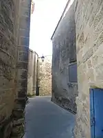 alley behind the church
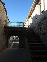 The porch from the church
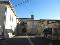 The porch square
 The old forge
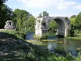
 Vidourle river between Aubais and Villetelle
References
- "Populations légales 2017". INSEE. Retrieved 6 January 2020.
External links
| Wikimedia Commons has media related to Villetelle. |
| Authority control |
|---|
This article is issued from Wikipedia. The text is licensed under Creative Commons - Attribution - Sharealike. Additional terms may apply for the media files.
