Balaguier-d'Olt
Balaguier-d'Olt is a commune in the Aveyron department in the Occitanie region of southern France.
Balaguier-d'Olt | |
|---|---|
Location of Balaguier-d'Olt 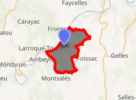
| |
 Balaguier-d'Olt  Balaguier-d'Olt | |
| Coordinates: 44°31′29″N 1°58′23″E | |
| Country | France |
| Region | Occitanie |
| Department | Aveyron |
| Arrondissement | Villefranche-de-Rouergue |
| Canton | Lot et Montbazinois |
| Government | |
| • Mayor (2020–2026) | Yves Ville |
| Area 1 | 10.84 km2 (4.19 sq mi) |
| Population (2017-01-01)[1] | 162 |
| • Density | 15/km2 (39/sq mi) |
| Time zone | UTC+01:00 (CET) |
| • Summer (DST) | UTC+02:00 (CEST) |
| INSEE/Postal code | 12018 /12260 |
| Elevation | 152–378 m (499–1,240 ft) (avg. 150 m or 490 ft) |
| 1 French Land Register data, which excludes lakes, ponds, glaciers > 1 km2 (0.386 sq mi or 247 acres) and river estuaries. | |
The inhabitants of the commune are known as Balaguiérois or Balaguiéroises.[2]
Geography
Balaguier-d'Olt is located some 12 km south-west of Figeac just east of Ambeyrac. The whole north-western border of the commune is the Lot river which is also the departmental boundary between Aveyron and Lot. Access to the commune is by the D86 road from Ambeyrac which follows the river through the village and continues north-east to Capdenac-Gare. The D38 branches off the D86 and crosses the only bridge in the commune across the Lot to Saint-Pierre-Toirac. The D647 branches off the D86 just north of the village and goes south-east to Foissac. Apart from the village there is the hamlet of Vernet-le-Bas in the north of the commune. The commune is mixed forest and farmland.[3]
Geologically the commune is divided into two parts: first the Lot valley which consists of Toarcian marl and secondly the limestone plateau overlooking it.
The Ruisseau de Bournac flows from the north-east and the Ruisseau de Fréjéroque flows from the east both joining in the commune and flowing into the Lot.[3]
Neighbouring communes and villages
Places adjacent to Balaguier-d'Olt | ||||||||||
|---|---|---|---|---|---|---|---|---|---|---|
| ||||||||||
Administration
| From | To | Name | Party | Position |
|---|---|---|---|---|
| 1840 | 1848 | Joseph Daube | ||
| 1848 | 1860 | Pierre Trenty | ||
| 1860 | 1868 | Jean Louis Obscur | ||
| 1868 | 1904 | Félix Vernet | ||
| 2001 | 2008 | Claude Roques | ||
| 2008 | 2020 | Yves Ville |
(Not all data is known)
Demography
In 2017 the commune had 162 inhabitants.
|
| ||||||||||||||||||||||||||||||||||||||||||||||||||||||||||||||||||||||||||||||||||||||||||||||||||||||
| Source: EHESS[5] and INSEE[6] | |||||||||||||||||||||||||||||||||||||||||||||||||||||||||||||||||||||||||||||||||||||||||||||||||||||||
Sites and Monuments
The Romanesque Church of Vernet-le-Bas has a bell tower dating from the 12th century and has Romanesque capitals on three sides. Inside the church the Romanesque Altar (12th century)![]() is still preserved in one of the side chapels. It is carved in sandstone decorations and presents interlacing. It is registered as an historical object.[7]
is still preserved in one of the side chapels. It is carved in sandstone decorations and presents interlacing. It is registered as an historical object.[7]
See also
Bibliography
- Christian-Pierre Bedel (preface Jacques Dournes), Capdenac Los Aures Asprièras, Balaguier, Bolhac, Causse-e-Diege Foissac, Naussac, Salas, Sonnac / Christian-Pierre Bedel e los estatjants del canton de Capdenac, Rodez, Mission departmental culture, coll. "Al Canton", 1996, ill., cov. ill., 28 cm, 240 pp. ISBN 2-907279-23-8, ISSN 1151-8375, BNF No. FRBNF36688708 (in French)
External links
- Balaguier-d'Olt on Lion1906
- Balaguier-d'Olt on Géoportail, National Geographic Institute (IGN) website (in French)
- Balaguyer on the 1750 Cassini Map
References
- "Populations légales 2017". INSEE. Retrieved 6 January 2020.
- Inhabitants of Aveyron (in French)
- Google Maps
- List of Mayors of France (in French)
- Données Cassini, EHESS
- Population en historique depuis 1968, INSEE
- Ministry of Culture, Palissy PM12000015 Altar (in French)
| Wikimedia Commons has media related to Balaguier-d'Olt. |
| Authority control |
|---|