Brandonnet
Brandonnet is a commune in the Aveyron department in southern France.
Brandonnet | |
|---|---|
Location of Brandonnet 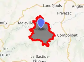
| |
 Brandonnet  Brandonnet | |
| Coordinates: 44°23′19″N 2°08′10″E | |
| Country | France |
| Region | Occitanie |
| Department | Aveyron |
| Arrondissement | Villefranche-de-Rouergue |
| Canton | Villeneuvois et Villefranchois |
| Intercommunality | Plateau de Montbazens |
| Government | |
| • Mayor (2008–2014) | Jean Pierre Blondes |
| Area 1 | 12.22 km2 (4.72 sq mi) |
| Population (2017-01-01)[1] | 319 |
| • Density | 26/km2 (68/sq mi) |
| Time zone | UTC+01:00 (CET) |
| • Summer (DST) | UTC+02:00 (CEST) |
| INSEE/Postal code | 12034 /12350 |
| Elevation | 318–546 m (1,043–1,791 ft) (avg. 400 m or 1,300 ft) |
| 1 French Land Register data, which excludes lakes, ponds, glaciers > 1 km2 (0.386 sq mi or 247 acres) and river estuaries. | |
Population
| Year | Pop. | ±% |
|---|---|---|
| 1962 | 371 | — |
| 1968 | 417 | +12.4% |
| 1975 | 370 | −11.3% |
| 1982 | 360 | −2.7% |
| 1990 | 325 | −9.7% |
| 1999 | 316 | −2.8% |
| 2008 | 306 | −3.2% |
See also
References
- "Populations légales 2017". INSEE. Retrieved 6 January 2020.
| Wikimedia Commons has media related to Brandonnet. |
| Authority control |
|---|
This article is issued from Wikipedia. The text is licensed under Creative Commons - Attribution - Sharealike. Additional terms may apply for the media files.