Lédergues
Lédergues is a commune in the Aveyron department in southern France.
Lédergues | |
|---|---|
 Coat of arms | |
Location of Lédergues 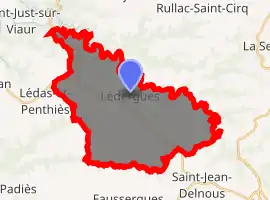
| |
 Lédergues  Lédergues | |
| Coordinates: 44°05′23″N 2°26′30″E | |
| Country | France |
| Region | Occitanie |
| Department | Aveyron |
| Arrondissement | Millau |
| Canton | Monts du Réquistanais |
| Intercommunality | Réquistanais |
| Government | |
| • Mayor (2014–2020) | Patrice Panis (PR) |
| Area 1 | 36.31 km2 (14.02 sq mi) |
| Population (2017-01-01)[1] | 644 |
| • Density | 18/km2 (46/sq mi) |
| Time zone | UTC+01:00 (CET) |
| • Summer (DST) | UTC+02:00 (CEST) |
| INSEE/Postal code | 12127 /12170 |
| Elevation | 331–544 m (1,086–1,785 ft) (avg. 450 m or 1,480 ft) |
| 1 French Land Register data, which excludes lakes, ponds, glaciers > 1 km2 (0.386 sq mi or 247 acres) and river estuaries. | |
Geography
The commune is traversed by the Cérou river.
Population
| Year | Pop. | ±% |
|---|---|---|
| 1962 | 923 | — |
| 1968 | 1,049 | +13.7% |
| 1975 | 960 | −8.5% |
| 1982 | 862 | −10.2% |
| 1990 | 746 | −13.5% |
| 1999 | 740 | −0.8% |
| 2008 | 708 | −4.3% |
See also
References
- "Populations légales 2017". INSEE. Retrieved 6 January 2020.
| Wikimedia Commons has media related to Lédergues. |
This article is issued from Wikipedia. The text is licensed under Creative Commons - Attribution - Sharealike. Additional terms may apply for the media files.
