Laguiole
Laguiole ([lajɔl]; La Guiòla [laˈjɔlɔ] in Languedocien) is a commune in the Aveyron department in southern France.
Laguiole | |
|---|---|
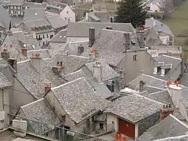 The slate rooftops in Laguiole | |
.svg.png.webp) Coat of arms | |
Location of Laguiole 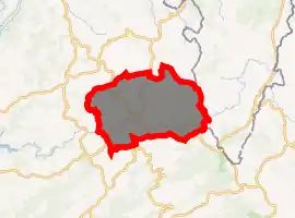
| |
 Laguiole  Laguiole | |
| Coordinates: 44°41′06″N 2°50′53″E | |
| Country | France |
| Region | Occitanie |
| Department | Aveyron |
| Arrondissement | Rodez |
| Canton | Aubrac et Carladez |
| Government | |
| • Mayor (2008–2014) | Vincent Alazard |
| Area 1 | 63.06 km2 (24.35 sq mi) |
| Population (2017-01-01)[1] | 1,242 |
| • Density | 20/km2 (51/sq mi) |
| Time zone | UTC+01:00 (CET) |
| • Summer (DST) | UTC+02:00 (CEST) |
| INSEE/Postal code | 12119 /12210 |
| Elevation | 868–1,342 m (2,848–4,403 ft) (avg. 1,000 m or 3,300 ft) |
| Website | www.laguiole12.fr |
| 1 French Land Register data, which excludes lakes, ponds, glaciers > 1 km2 (0.386 sq mi or 247 acres) and river estuaries. | |
It is known for its Laguiole cheese, which has an Appellation d'Origine Contrôlée (label of guaranteed origin), and as the birthplace of the Laguiole knife. The name of the village comes from la gleisòla, meaning a little church.
Population
| Year | Pop. | ±% |
|---|---|---|
| 1793 | 1,833 | — |
| 1800 | 1,973 | +7.6% |
| 1806 | 1,928 | −2.3% |
| 1821 | 2,177 | +12.9% |
| 1831 | 2,128 | −2.3% |
| 1836 | 2,178 | +2.3% |
| 1841 | 2,174 | −0.2% |
| 1846 | 2,020 | −7.1% |
| 1851 | 2,115 | +4.7% |
| 1856 | 1,934 | −8.6% |
| 1861 | 1,837 | −5.0% |
| 1866 | 1,996 | +8.7% |
| 1872 | 1,989 | −0.4% |
| 1876 | 1,984 | −0.3% |
| 1881 | 1,930 | −2.7% |
| 1886 | 1,914 | −0.8% |
| 1891 | 1,941 | +1.4% |
| 1896 | 1,871 | −3.6% |
| 1901 | 1,890 | +1.0% |
| 1906 | 1,885 | −0.3% |
| 1911 | 1,767 | −6.3% |
| 1921 | 1,576 | −10.8% |
| 1926 | 1,647 | +4.5% |
| 1931 | 1,509 | −8.4% |
| 1936 | 1,612 | +6.8% |
| 1946 | 1,468 | −8.9% |
| 1954 | 1,366 | −6.9% |
| 1962 | 1,262 | −7.6% |
| 1968 | 1,282 | +1.6% |
| 1975 | 1,291 | +0.7% |
| 1982 | 1,231 | −4.6% |
| 1990 | 1,264 | +2.7% |
| 1999 | 1,248 | −1.3% |
| 2008 | 1,269 | +1.7% |
See also
Tourism and accommodations
- Coutellerie Durand
- Coopérative Laitière de Laguiole
- Campsite La Romiguiere
- Vent d'Aubrac
References
- "Populations légales 2017". INSEE. Retrieved 6 January 2020.
| Wikimedia Commons has media related to Laguiole. |
| Authority control |
|
|---|
This article is issued from Wikipedia. The text is licensed under Creative Commons - Attribution - Sharealike. Additional terms may apply for the media files.