La Couvertoirade
La Couvertoirade is a commune in the Aveyron department in southern France.
La Couvertoirade | |
|---|---|
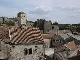 A general view of La Couvertoirade | |
Location of La Couvertoirade 
| |
 La Couvertoirade  La Couvertoirade | |
| Coordinates: 43°54′50″N 3°19′02″E | |
| Country | France |
| Region | Occitanie |
| Department | Aveyron |
| Arrondissement | Millau |
| Canton | Causses-Rougiers |
| Government | |
| • Mayor (2008–2014) | Marie José Laborie |
| Area 1 | 61.91 km2 (23.90 sq mi) |
| Population (2017-01-01)[1] | 188 |
| • Density | 3.0/km2 (7.9/sq mi) |
| Time zone | UTC+01:00 (CET) |
| • Summer (DST) | UTC+02:00 (CEST) |
| INSEE/Postal code | 12082 /12230 |
| Elevation | 640–900 m (2,100–2,950 ft) (avg. 800 m or 2,600 ft) |
| 1 French Land Register data, which excludes lakes, ponds, glaciers > 1 km2 (0.386 sq mi or 247 acres) and river estuaries. | |
Geography
La Couvertoirade is located on the Larzac plateau.
History and sites of interest
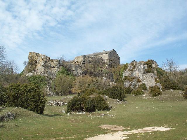
This well-preserved fortified town was owned by the Knights Templar, under orders from the Commandery of Sainte-Eulalie, from the twelfth century. The Templars built the fortress there during the 12th and 13th centuries; its two upper floors have since been removed. Following their dissolution in 1312, the Templars' property in the causses was taken by the Knights of St John of Jerusalem who were responsible for building the curtain wall at La Couvertoirade between 1439 and 1450.
Like other Larzac villages, the population fell rapidly in the 19th century, to as few as 362 by 1880. Today, it is largely inhabited by craftsmen working with enamel, pottery, weaving and similar crafts. It is one of the Les Plus Beaux Villages de France (most beautiful villages of France).
Population
| Year | Pop. | ±% |
|---|---|---|
| 1962 | 98 | — |
| 1968 | 120 | +22.4% |
| 1975 | 107 | −10.8% |
| 1982 | 134 | +25.2% |
| 1990 | 148 | +10.4% |
| 1999 | 153 | +3.4% |
| 2008 | 179 | +17.0% |
See also
References
- "Populations légales 2017". INSEE. Retrieved 6 January 2020.
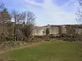 La Couvertoirade walls
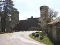 La Couvertoirade walls
External links
| Wikimedia Commons has media related to La Couvertoirade. |
- Tourist office website
- Pictures of the Knights Templar Castle: ,
| Authority control |
|---|